Saint-James (Saint-James)

- former commune in Manche, France
- Country:

- Postal Code: 50240
- Coordinates: 48° 31' 18" N, 1° 19' 35" E


- GPS tracks (wikiloc): [Link]
- Area: 17.96 sq km
- Population: 2833
- Web site: http://www.mairie-saintjames.com
- Wikidata storage: Wikidata: Q478259
- Wikipedia Commons Category: [Link]
- Freebase ID: [/m/03nxbxx]
- Freebase ID: [/m/03nxbxx]
- GeoNames ID: Alt: [2979401]
- GeoNames ID: Alt: [2979401]
- BnF ID: [15262460w]
- BnF ID: [15262460w]
- INSEE municipality code: 50487
- INSEE municipality code: 50487
- US National Archives Identifier: 10047174
- US National Archives Identifier: 10047174
Shares border with regions:


La Croix-Avranchin
- former commune in Manche, France
- Country:
- Postal Code: 50240
- Coordinates: 48° 32' 46" N, 1° 23' 0" E
- GPS tracks (wikiloc): [Link]
- Area: 10.79 sq km
- Population: 452


Montjoie-Saint-Martin
- commune in Manche, France
- Country:
- Postal Code: 50240
- Coordinates: 48° 31' 56" N, 1° 17' 28" E
- GPS tracks (wikiloc): [Link]
- Area: 7.49 sq km
- Population: 252


Saint-Senier-de-Beuvron
- commune in Manche, France
- Country:
- Postal Code: 50240
- Coordinates: 48° 34' 32" N, 1° 18' 37" E
- GPS tracks (wikiloc): [Link]
- Area: 11.21 sq km
- Population: 360


Villiers-le-Pré
- former commune in Manche, France
- Country:
- Postal Code: 50240
- Coordinates: 48° 32' 32" N, 1° 23' 57" E
- GPS tracks (wikiloc): [Link]
- Area: 7.94 sq km
- Population: 190

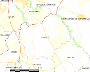
Le Ferré
- commune in Ille-et-Vilaine, France
- Country:
- Postal Code: 35420
- Coordinates: 48° 29' 33" N, 1° 17' 38" E
- GPS tracks (wikiloc): [Link]
- Area: 16.92 sq km
- Population: 689
- Web site: [Link]


Carnet
- former commune in Manche, France
- Country:
- Postal Code: 50240
- Coordinates: 48° 30' 36" N, 1° 21' 26" E
- GPS tracks (wikiloc): [Link]
- Area: 10.18 sq km
- Population: 494