Saint-Jores (Saint-Jores)

- former commune in Manche, France
- Country:

- Postal Code: 50250
- Coordinates: 49° 18' 11" N, 1° 25' 18" E


- GPS tracks (wikiloc): [Link]
- Area: 12.73 sq km
- Population: 363
- Wikipedia en: wiki(en)
- Wikipedia: wiki(fr)
- Wikidata storage: Wikidata: Q1062206
- Wikipedia Commons Category: [Link]
- Freebase ID: [/m/03x_zl1]
- Freebase ID: [/m/03x_zl1]
- GeoNames ID: Alt: [6435606]
- GeoNames ID: Alt: [6435606]
- BnF ID: [152624706]
- BnF ID: [152624706]
- INSEE municipality code: 50497
- INSEE municipality code: 50497
Shares border with regions:


Auvers
- commune in Manche, France
- Country:
- Postal Code: 50500
- Coordinates: 49° 17' 46" N, 1° 19' 27" E
- GPS tracks (wikiloc): [Link]
- Area: 18.76 sq km
- Population: 674


Prétot-Sainte-Suzanne
- former commune in Manche, France
- Country:
- Postal Code: 50250
- Coordinates: 49° 19' 29" N, 1° 26' 14" E
- GPS tracks (wikiloc): [Link]
- Area: 11.64 sq km
- Population: 295


Coigny
- former commune in Manche, France
- Country:
- Postal Code: 50250
- Coordinates: 49° 19' 23" N, 1° 23' 2" E
- GPS tracks (wikiloc): [Link]
- Area: 4.5 sq km
- Population: 163


Gorges
- commune in Manche, France
- Country:
- Postal Code: 50190
- Coordinates: 49° 15' 23" N, 1° 24' 24" E
- GPS tracks (wikiloc): [Link]
- Area: 22.67 sq km
- Population: 347

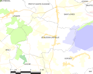
Le Plessis-Lastelle
- commune in Manche, France
- Country:
- Postal Code: 50250
- Coordinates: 49° 16' 52" N, 1° 25' 35" E
- GPS tracks (wikiloc): [Link]
- AboveSeaLevel: 36 м m
- Area: 14.99 sq km
- Population: 242


Baupte
- commune in Manche, France
- Country:
- Postal Code: 50500
- Coordinates: 49° 18' 29" N, 1° 21' 41" E
- GPS tracks (wikiloc): [Link]
- Area: 2.29 sq km
- Population: 432