Saint-Julien-Beychevelle (Saint-Julien-Beychevelle)

- commune in Gironde, France
- Country:

- Postal Code: 33250
- Coordinates: 45° 9' 53" N, 0° 44' 26" E


- GPS tracks (wikiloc): [Link]
- AboveSeaLevel: 16 м m
- Area: 16.3 sq km
- Population: 609
- Web site: http://www.saint-julien-beychevelle-site-officiel.fr
- Wikipedia en: wiki(en)
- Wikipedia: wiki(fr)
- Wikidata storage: Wikidata: Q467113
- Wikipedia Commons Category: [Link]
- Freebase ID: [/m/042_9c]
- GeoNames ID: Alt: [6616567]
- SIREN number: [213304231]
- BnF ID: [15256472n]
- VIAF ID: Alt: [124390851]
- INSEE municipality code: 33423
Shares border with regions:


Saint-Androny
- commune in Gironde, France
- Country:
- Postal Code: 33390
- Coordinates: 45° 11' 23" N, 0° 38' 59" E
- GPS tracks (wikiloc): [Link]
- Area: 11.65 sq km
- Population: 553
- Web site: [Link]

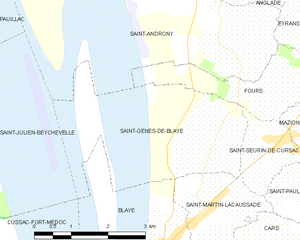
Saint-Genès-de-Blaye
- commune in Gironde, France
- Country:
- Postal Code: 33390
- Coordinates: 45° 9' 43" N, 0° 38' 29" E
- GPS tracks (wikiloc): [Link]
- Area: 7.41 sq km
- Population: 484


Saint-Laurent-Médoc
- commune in Gironde, France
- Country:
- Postal Code: 33112
- Coordinates: 45° 9' 1" N, 0° 49' 19" E
- GPS tracks (wikiloc): [Link]
- AboveSeaLevel: 9 м m
- Area: 136.55 sq km
- Population: 4569
- Web site: [Link]


Pauillac
- commune in Gironde, France
- Country:
- Postal Code: 33250
- Coordinates: 45° 11' 47" N, 0° 44' 55" E
- GPS tracks (wikiloc): [Link]
- Area: 22.74 sq km
- Population: 4861
- Web site: [Link]

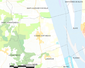
Cussac-Fort-Médoc
- commune in Gironde, France
- Country:
- Postal Code: 33460
- Coordinates: 45° 6' 51" N, 0° 43' 51" E
- GPS tracks (wikiloc): [Link]
- AboveSeaLevel: 19 м m
- Area: 18.01 sq km
- Population: 2133
- Web site: [Link]