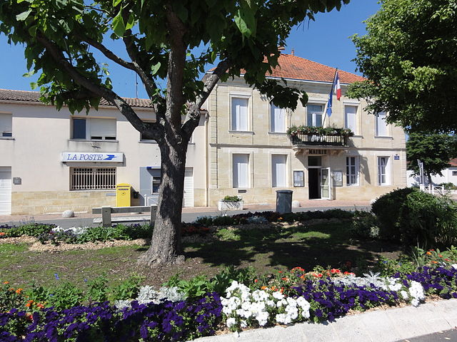
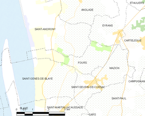
Saint-Androny (Saint-Androny)

- commune in Gironde, France
- Country:

- Postal Code: 33390
- Coordinates: 45° 11' 23" N, 0° 38' 59" E


- GPS tracks (wikiloc): [Link]
- Area: 11.65 sq km
- Population: 553
- Web site: http://saintandrony.free.fr
- Wikipedia en: wiki(en)
- Wikipedia: wiki(fr)
- Wikidata storage: Wikidata: Q1005168
- Wikipedia Commons Category: [Link]
- Freebase ID: [/m/03ns0r9]
- GeoNames ID: Alt: [6432366]
- SIREN number: [213303704]
- BnF ID: [152564196]
- INSEE municipality code: 33370
Shares border with regions:

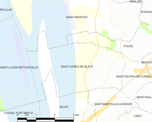
Saint-Genès-de-Blaye
- commune in Gironde, France
- Country:
- Postal Code: 33390
- Coordinates: 45° 9' 43" N, 0° 38' 29" E
- GPS tracks (wikiloc): [Link]
- Area: 7.41 sq km
- Population: 484

Braud-et-Saint-Louis
- commune in Gironde, France
- Country:
- Postal Code: 33820
- Coordinates: 45° 14' 52" N, 0° 37' 31" E
- GPS tracks (wikiloc): [Link]
- Area: 49.24 sq km
- Population: 1531
- Web site: [Link]


Anglade
- commune in Gironde, France
- Country:
- Postal Code: 33390
- Coordinates: 45° 12' 40" N, 0° 38' 13" E
- GPS tracks (wikiloc): [Link]
- Area: 13.82 sq km
- Population: 940


Pauillac
- commune in Gironde, France
- Country:
- Postal Code: 33250
- Coordinates: 45° 11' 47" N, 0° 44' 55" E
- GPS tracks (wikiloc): [Link]
- Area: 22.74 sq km
- Population: 4861
- Web site: [Link]


Saint-Julien-Beychevelle
- commune in Gironde, France
- Country:
- Postal Code: 33250
- Coordinates: 45° 9' 53" N, 0° 44' 26" E
- GPS tracks (wikiloc): [Link]
- AboveSeaLevel: 16 м m
- Area: 16.3 sq km
- Population: 609
- Web site: [Link]


Eyrans
- commune in Gironde, France
- Country:
- Postal Code: 33390
- Coordinates: 45° 11' 18" N, 0° 36' 59" E
- GPS tracks (wikiloc): [Link]
- Area: 4.28 sq km
- Population: 748
- Web site: [Link]

Fours
- commune in Gironde, France
- Country:
- Postal Code: 33390
- Coordinates: 45° 10' 25" N, 0° 37' 45" E
- GPS tracks (wikiloc): [Link]
- Area: 4.64 sq km
- Population: 315