Saint-Just-en-Chaussée (Saint-Just-en-Chaussée)

- commune in Oise, France
- Country:

- Postal Code: 60130
- Coordinates: 49° 30' 22" N, 2° 25' 51" E


- GPS tracks (wikiloc): [Link]
- Area: 14.66 sq km
- Population: 5972
- Web site: http://www.mairie-saintjustenchaussee.fr
- Wikipedia en: wiki(en)
- Wikipedia: wiki(fr)
- Wikidata storage: Wikidata: Q389077
- Wikipedia Commons Category: [Link]
- Freebase ID: [/m/02q3b5g]
- SIREN number: [216005744]
- BnF ID: [15267815c]
- VIAF ID: Alt: [157254589]
- Library of Congress authority ID: Alt: [n93062879]
- INSEE municipality code: 60581
Shares border with regions:

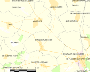
Catillon-Fumechon
- commune in Oise, France
- Country:
- Postal Code: 60130
- Coordinates: 49° 31' 2" N, 2° 22' 12" E
- GPS tracks (wikiloc): [Link]
- AboveSeaLevel: 129 м m
- Area: 13.31 sq km
- Population: 516
- Web site: [Link]


Le Plessier-sur-Saint-Just
- commune in Oise, France
- Country:
- Postal Code: 60130
- Coordinates: 49° 30' 40" N, 2° 27' 14" E
- GPS tracks (wikiloc): [Link]
- Area: 7.63 sq km
- Population: 510


Quinquempoix
- commune in Oise, France
- Country:
- Postal Code: 60130
- Coordinates: 49° 33' 5" N, 2° 25' 35" E
- GPS tracks (wikiloc): [Link]
- Area: 5.86 sq km
- Population: 321

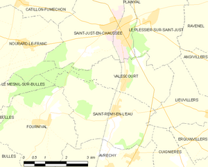
Valescourt
- commune in Oise, France
- Country:
- Postal Code: 60130
- Coordinates: 49° 29' 2" N, 2° 26' 10" E
- GPS tracks (wikiloc): [Link]
- Area: 6.87 sq km
- Population: 284

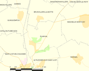
Plainval
- commune in Oise, France
- Country:
- Postal Code: 60130
- Coordinates: 49° 31' 45" N, 2° 26' 26" E
- GPS tracks (wikiloc): [Link]
- Area: 9.19 sq km
- Population: 400
- Web site: [Link]

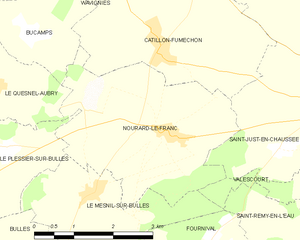
Nourard-le-Franc
- commune in Oise, France
- Country:
- Postal Code: 60130
- Coordinates: 49° 29' 55" N, 2° 22' 26" E
- GPS tracks (wikiloc): [Link]
- Area: 11.48 sq km
- Population: 349