Saint-Léger-Bridereix (Saint-Léger-Bridereix)

- commune in Creuse, France
- Country:

- Postal Code: 23300
- Coordinates: 46° 17' 11" N, 1° 35' 16" E


- GPS tracks (wikiloc): [Link]
- Area: 8.1 sq km
- Population: 204
- Wikipedia en: wiki(en)
- Wikipedia: wiki(fr)
- Wikidata storage: Wikidata: Q1016346
- Wikipedia Commons Category: [Link]
- Freebase ID: [/m/03mfkm3]
- Freebase ID: [/m/03mfkm3]
- GeoNames ID: Alt: [6429283]
- GeoNames ID: Alt: [6429283]
- SIREN number: [212320709]
- SIREN number: [212320709]
- BnF ID: [152515941]
- BnF ID: [152515941]
- INSEE municipality code: 23207
- INSEE municipality code: 23207
Shares border with regions:


Noth
- commune in Creuse, France
- Country:
- Postal Code: 23300
- Coordinates: 46° 14' 5" N, 1° 35' 9" E
- GPS tracks (wikiloc): [Link]
- Area: 22.89 sq km
- Population: 515


Naillat
- commune in Creuse, France
- Country:
- Postal Code: 23800
- Coordinates: 46° 15' 52" N, 1° 38' 14" E
- GPS tracks (wikiloc): [Link]
- Area: 36.23 sq km
- Population: 668


Saint-Germain-Beaupré
- commune in Creuse, France
- Country:
- Postal Code: 23160
- Coordinates: 46° 18' 28" N, 1° 32' 42" E
- GPS tracks (wikiloc): [Link]
- Area: 17.06 sq km
- Population: 440


Saint-Agnant-de-Versillat
- commune in Creuse, France
- Country:
- Postal Code: 23300
- Coordinates: 46° 16' 44" N, 1° 30' 40" E
- GPS tracks (wikiloc): [Link]
- Area: 50.46 sq km
- Population: 1104

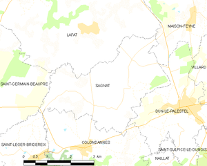
Sagnat
- commune in Creuse, France
- Country:
- Postal Code: 23800
- Coordinates: 46° 18' 15" N, 1° 37' 42" E
- GPS tracks (wikiloc): [Link]
- Area: 11.81 sq km
- Population: 196


Colondannes
- commune in Creuse, France
- Country:
- Postal Code: 23800
- Coordinates: 46° 17' 21" N, 1° 36' 41" E
- GPS tracks (wikiloc): [Link]
- Area: 10.7 sq km
- Population: 269