
Saint-Lô (Saint-Lô)

- commune in Manche, France
- Country:

- Postal Code: 50000
- Coordinates: 49° 6' 52" N, 1° 5' 30" E


- GPS tracks (wikiloc): [Link]
- AboveSeaLevel: 14 м m
- Area: 23.19 sq km
- Population: 19301
- Web site: http://www.saint-lo.fr
- Wikipedia en: wiki(en)
- Wikipedia: wiki(fr)
- Wikidata storage: Wikidata: Q181704
- Wikipedia Commons Gallery: [Link]
- Wikipedia Commons Category: [Link]
- Freebase ID: [/m/034sgd]
- Freebase ID: [/m/034sgd]
- Freebase ID: [/m/034sgd]
- Freebase ID: [/m/034sgd]
- GeoNames ID: Alt: [2978758]
- GeoNames ID: Alt: [2978758]
- GeoNames ID: Alt: [2978758]
- GeoNames ID: Alt: [2978758]
- SIREN number: [215005026]
- SIREN number: [215005026]
- SIREN number: [215005026]
- SIREN number: [215005026]
- BnF ID: [15262475x]
- BnF ID: [15262475x]
- BnF ID: [15262475x]
- BnF ID: [15262475x]
- VIAF ID: Alt: [132286566]
- VIAF ID: Alt: [132286566]
- VIAF ID: Alt: [132286566]
- VIAF ID: Alt: [132286566]
- GND ID: Alt: [4340309-8]
- GND ID: Alt: [4340309-8]
- GND ID: Alt: [4340309-8]
- GND ID: Alt: [4340309-8]
- archINFORM location ID: [12546]
- archINFORM location ID: [12546]
- archINFORM location ID: [12546]
- archINFORM location ID: [12546]
- Library of Congress authority ID: Alt: [n83145475]
- Library of Congress authority ID: Alt: [n83145475]
- Library of Congress authority ID: Alt: [n83145475]
- Library of Congress authority ID: Alt: [n83145475]
- MusicBrainz area ID: [473a999d-1c9e-44a6-bc4a-bf703330d54a]
- MusicBrainz area ID: [473a999d-1c9e-44a6-bc4a-bf703330d54a]
- MusicBrainz area ID: [473a999d-1c9e-44a6-bc4a-bf703330d54a]
- MusicBrainz area ID: [473a999d-1c9e-44a6-bc4a-bf703330d54a]
- SUDOC authorities ID: [031064701]
- SUDOC authorities ID: [031064701]
- SUDOC authorities ID: [031064701]
- SUDOC authorities ID: [031064701]
- Encyclopædia Britannica Online ID: [place/Saint-Lo]
- Encyclopædia Britannica Online ID: [place/Saint-Lo]
- Encyclopædia Britannica Online ID: [place/Saint-Lo]
- Encyclopædia Britannica Online ID: [place/Saint-Lo]
- Gran Enciclopèdia Catalana ID: [0057889]
- Gran Enciclopèdia Catalana ID: [0057889]
- Gran Enciclopèdia Catalana ID: [0057889]
- Gran Enciclopèdia Catalana ID: [0057889]
- Encyclopædia Universalis ID: [saint-lo]
- Encyclopædia Universalis ID: [saint-lo]
- Encyclopædia Universalis ID: [saint-lo]
- Encyclopædia Universalis ID: [saint-lo]
- ISNI: Alt: [0000 0001 2160 4012]
- ISNI: Alt: [0000 0001 2160 4012]
- ISNI: Alt: [0000 0001 2160 4012]
- ISNI: Alt: [0000 0001 2160 4012]
- INSEE municipality code: 50502
- INSEE municipality code: 50502
- INSEE municipality code: 50502
- INSEE municipality code: 50502
- US National Archives Identifier: 10045013
- US National Archives Identifier: 10045013
- US National Archives Identifier: 10045013
- US National Archives Identifier: 10045013
Shares border with regions:


Condé-sur-Vire
- former commune in Manche, France
- Country:
- Postal Code: 50890
- Coordinates: 49° 3' 8" N, 1° 2' 14" E
- GPS tracks (wikiloc): [Link]
- Area: 24.85 sq km
- Population: 3382
- Web site: [Link]


Saint-Gilles
- commune in Manche, France
- Country:
- Postal Code: 50180
- Coordinates: 49° 6' 17" N, 1° 10' 32" E
- GPS tracks (wikiloc): [Link]
- Area: 7.84 sq km
- Population: 871


Saint-Georges-Montcocq
- commune in Manche, France
- Country:
- Postal Code: 50000
- Coordinates: 49° 7' 42" N, 1° 5' 38" E
- GPS tracks (wikiloc): [Link]
- AboveSeaLevel: 90 м m
- Area: 8.94 sq km
- Population: 884
- Web site: [Link]


Saint-Ébremond-de-Bonfossé
- former commune in Manche, France
- Country:
- Postal Code: 50750
- Coordinates: 49° 4' 0" N, 1° 8' 58" E
- GPS tracks (wikiloc): [Link]
- Area: 11.9 sq km
- Population: 727


Saint-André-de-l'Épine
- commune in Manche, France
- Country:
- Postal Code: 50680
- Coordinates: 49° 8' 22" N, 1° 0' 39" E
- GPS tracks (wikiloc): [Link]
- Area: 7.24 sq km
- Population: 560
- Web site: [Link]


La Barre-de-Semilly
- commune in Manche, France
- Country:
- Postal Code: 50810
- Coordinates: 49° 6' 41" N, 1° 2' 3" E
- GPS tracks (wikiloc): [Link]
- Area: 7.74 sq km
- Population: 992

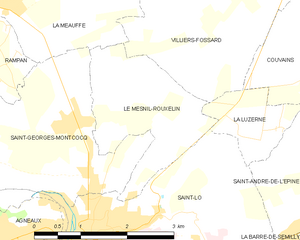
Le Mesnil-Rouxelin
- commune in Manche, France
- Country:
- Postal Code: 50000
- Coordinates: 49° 8' 52" N, 1° 5' 11" E
- GPS tracks (wikiloc): [Link]
- Area: 4.74 sq km
- Population: 518


Agneaux
- commune in Manche, France
- Country:
- Postal Code: 50180
- Coordinates: 49° 7' 0" N, 1° 6' 40" E
- GPS tracks (wikiloc): [Link]
- AboveSeaLevel: 60 м m
- Area: 6.5 sq km
- Population: 4036
- Web site: [Link]

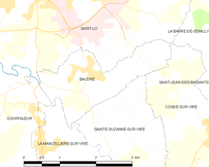
Baudre
- commune in Manche, France
- Country:
- Postal Code: 50000
- Coordinates: 49° 5' 21" N, 1° 4' 23" E
- GPS tracks (wikiloc): [Link]
- Area: 3.81 sq km
- Population: 544
- Web site: [Link]

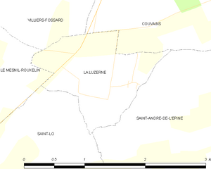
La Luzerne
- commune in Manche, France
- Country:
- Postal Code: 50680
- Coordinates: 49° 8' 20" N, 1° 3' 1" E
- GPS tracks (wikiloc): [Link]
- Area: 1.94 sq km
- Population: 79


Gourfaleur
- former commune in Manche, France
- Country:
- Postal Code: 50750
- Coordinates: 49° 4' 59" N, 1° 6' 44" E
- GPS tracks (wikiloc): [Link]
- Area: 8.45 sq km
- Population: 468