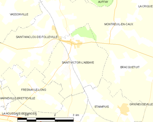
Saint-Maclou-de-Folleville (Saint-Maclou-de-Folleville)

- commune in Seine-Maritime, France
- Country:

- Postal Code: 76890
- Coordinates: 49° 40' 50" N, 1° 6' 24" E


- GPS tracks (wikiloc): [Link]
- Area: 13.21 sq km
- Population: 646
- Web site: http://smfolleville.net/
- Wikipedia en: wiki(en)
- Wikipedia: wiki(fr)
- Wikidata storage: Wikidata: Q1164307
- Wikipedia Commons Category: [Link]
- Freebase ID: [/m/03qg9_3]
- GeoNames ID: Alt: [6443466]
- SIREN number: [217606029]
- BnF ID: [152751871]
- VIAF ID: Alt: [150261644]
- Library of Congress authority ID: Alt: [n96044434]
- INSEE municipality code: 76602
Shares border with regions:


Tôtes
- commune in Seine-Maritime, France
- Country:
- Postal Code: 76890
- Coordinates: 49° 40' 43" N, 1° 2' 49" E
- GPS tracks (wikiloc): [Link]
- Area: 7.61 sq km
- Population: 1588
- Web site: [Link]

Saint-Victor-l'Abbaye
- commune in Seine-Maritime, France
- Country:
- Postal Code: 76890
- Coordinates: 49° 40' 26" N, 1° 7' 13" E
- GPS tracks (wikiloc): [Link]
- Area: 8.43 sq km
- Population: 771
Montreuil-en-Caux
- commune in Seine-Maritime, France
- Country:
- Postal Code: 76850
- Coordinates: 49° 40' 45" N, 1° 8' 55" E
- GPS tracks (wikiloc): [Link]
- Area: 9.4 sq km
- Population: 522
Fresnay-le-Long
- commune in Seine-Maritime, France
- Country:
- Postal Code: 76850
- Coordinates: 49° 38' 55" N, 1° 5' 47" E
- GPS tracks (wikiloc): [Link]
- Area: 5.22 sq km
- Population: 324
Vassonville
- commune in Seine-Maritime, France
- Country:
- Postal Code: 76890
- Coordinates: 49° 41' 41" N, 1° 5' 34" E
- GPS tracks (wikiloc): [Link]
- AboveSeaLevel: 110 м m
- Area: 5.65 sq km
- Population: 443
Saint-Denis-sur-Scie
- commune in Seine-Maritime, France
- Country:
- Postal Code: 76890
- Coordinates: 49° 42' 17" N, 1° 5' 39" E
- GPS tracks (wikiloc): [Link]
- Area: 8.63 sq km
- Population: 666
Varneville-Bretteville
- commune in Seine-Maritime, France
- Country:
- Postal Code: 76890
- Coordinates: 49° 39' 8" N, 1° 2' 43" E
- GPS tracks (wikiloc): [Link]
- Area: 9.22 sq km
- Population: 314