Saint-Malon-sur-Mel (Saint-Malon-sur-Mel)

- commune in Ille-et-Vilaine, France
- Country:

- Postal Code: 35750
- Coordinates: 48° 5' 35" N, 2° 5' 56" E


- GPS tracks (wikiloc): [Link]
- AboveSeaLevel: 96 м m
- Area: 16.07 sq km
- Population: 591
- Web site: http://www.saintmalonsurmel.com
- Wikipedia en: wiki(en)
- Wikipedia: wiki(fr)
- Wikidata storage: Wikidata: Q1070412
- Wikipedia Commons Category: [Link]
- Freebase ID: [/m/03mf0qv]
- Freebase ID: [/m/03mf0qv]
- Freebase ID: [/m/03mf0qv]
- GeoNames ID: Alt: [6616613]
- GeoNames ID: Alt: [6616613]
- GeoNames ID: Alt: [6616613]
- SIREN number: [213502909]
- SIREN number: [213502909]
- SIREN number: [213502909]
- BnF ID: [152572323]
- BnF ID: [152572323]
- BnF ID: [152572323]
- OSM relation ID: [531042]
- OSM relation ID: [531042]
- OSM relation ID: [531042]
- INSEE municipality code: 35290
- INSEE municipality code: 35290
- INSEE municipality code: 35290
Shares border with regions:

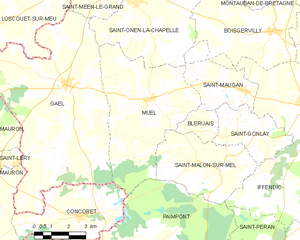
Muel
- commune in Ille-et-Vilaine, France
- Country:
- Postal Code: 35290
- Coordinates: 48° 7' 38" N, 2° 9' 26" E
- GPS tracks (wikiloc): [Link]
- AboveSeaLevel: 67 м m
- Area: 28.9 sq km
- Population: 905
- Web site: [Link]


Paimpont
- commune in Ille-et-Vilaine, France
- Country:
- Postal Code: 35380
- Coordinates: 48° 1' 5" N, 2° 10' 16" E
- GPS tracks (wikiloc): [Link]
- Area: 110.28 sq km
- Population: 1672
- Web site: [Link]

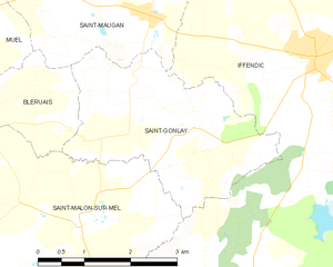
Saint-Gonlay
- commune in Ille-et-Vilaine, France
- Country:
- Postal Code: 35750
- Coordinates: 48° 6' 47" N, 2° 3' 57" E
- GPS tracks (wikiloc): [Link]
- Area: 9.26 sq km
- Population: 341


Bléruais
- commune in Ille-et-Vilaine, France
- Country:
- Postal Code: 35750
- Coordinates: 48° 6' 40" N, 2° 7' 29" E
- GPS tracks (wikiloc): [Link]
- Area: 3.33 sq km
- Population: 111

Iffendic
- commune in Ille-et-Vilaine, France
- Country:
- Postal Code: 35750
- Coordinates: 48° 7' 47" N, 2° 2' 5" E
- GPS tracks (wikiloc): [Link]
- Area: 73.66 sq km
- Population: 4456
- Web site: [Link]