Saint-Mard-de-Réno (Saint-Mard-de-Réno)

- commune in Orne, France
- Country:

- Postal Code: 61400
- Coordinates: 48° 30' 35" N, 0° 38' 1" E


- GPS tracks (wikiloc): [Link]
- Area: 19.13 sq km
- Population: 448
- Web site: http://www.saint-mard-de-reno.fr
- Wikipedia en: wiki(en)
- Wikipedia: wiki(fr)
- Wikidata storage: Wikidata: Q600454
- Wikipedia Commons Category: [Link]
- Freebase ID: [/m/03x_xfb]
- Freebase ID: [/m/03x_xfb]
- SIREN number: [216104182]
- SIREN number: [216104182]
- BnF ID: [152683486]
- BnF ID: [152683486]
- INSEE municipality code: 61418
- INSEE municipality code: 61418
Shares border with regions:

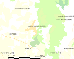
La Chapelle-Montligeon
- commune in Orne, France
- Country:
- Postal Code: 61400
- Coordinates: 48° 29' 1" N, 0° 39' 12" E
- GPS tracks (wikiloc): [Link]
- Area: 8.33 sq km
- Population: 550
- Web site: [Link]


Courgeon
- commune in Orne, France
- Country:
- Postal Code: 61400
- Coordinates: 48° 28' 42" N, 0° 36' 43" E
- GPS tracks (wikiloc): [Link]
- Area: 10.41 sq km
- Population: 373


Loisail
- commune in Orne, France
- Country:
- Postal Code: 61400
- Coordinates: 48° 30' 4" N, 0° 35' 26" E
- GPS tracks (wikiloc): [Link]
- Area: 5.16 sq km
- Population: 128


Saint-Victor-de-Réno
- former commune in Orne, France
- Country:
- Postal Code: 61290
- Coordinates: 48° 30' 10" N, 0° 41' 55" E
- GPS tracks (wikiloc): [Link]
- Area: 12.32 sq km
- Population: 173


Feings
- commune in Orne, France
- Country:
- Postal Code: 61400
- Coordinates: 48° 32' 45" N, 0° 38' 1" E
- GPS tracks (wikiloc): [Link]
- Area: 20.24 sq km
- Population: 207
Villiers-sous-Mortagne
- commune in Orne, France
- Country:
- Postal Code: 61400
- Coordinates: 48° 32' 19" N, 0° 35' 35" E
- GPS tracks (wikiloc): [Link]
- Area: 13.04 sq km
- Population: 298