Saint-Mars-Vieux-Maisons (Saint-Mars-Vieux-Maisons)

- commune in Seine-et-Marne, France
- Country:

- Postal Code: 77320
- Coordinates: 48° 44' 31" N, 3° 19' 10" E


- GPS tracks (wikiloc): [Link]
- Area: 19.02 sq km
- Population: 282
- Wikipedia en: wiki(en)
- Wikipedia: wiki(fr)
- Wikidata storage: Wikidata: Q1458785
- Wikipedia Commons Category: [Link]
- Freebase ID: [/m/02rrv4g]
- Freebase ID: [/m/02rrv4g]
- GeoNames ID: Alt: [6617686]
- GeoNames ID: Alt: [6617686]
- SIREN number: [217704212]
- SIREN number: [217704212]
- BnF ID: [15275760n]
- BnF ID: [15275760n]
- PACTOLS thesaurus ID: [pcrtHffxOG2sqj]
- PACTOLS thesaurus ID: [pcrtHffxOG2sqj]
- INSEE municipality code: 77421
- INSEE municipality code: 77421
Shares border with regions:


Cerneux
- commune in Seine-et-Marne, France
- Country:
- Postal Code: 77320
- Coordinates: 48° 41' 37" N, 3° 20' 39" E
- GPS tracks (wikiloc): [Link]
- Area: 22.1 sq km
- Population: 318


Leudon-en-Brie
- commune in Seine-et-Marne, France
- Country:
- Postal Code: 77320
- Coordinates: 48° 44' 0" N, 3° 16' 12" E
- GPS tracks (wikiloc): [Link]
- Area: 4.24 sq km
- Population: 164


Courtacon
- commune in Seine-et-Marne, France
- Country:
- Postal Code: 77560
- Coordinates: 48° 41' 44" N, 3° 17' 28" E
- GPS tracks (wikiloc): [Link]
- Area: 11.88 sq km
- Population: 258
- Web site: [Link]


Chartronges
- commune in Seine-et-Marne, France
- Country:
- Postal Code: 77320
- Coordinates: 48° 44' 47" N, 3° 16' 8" E
- GPS tracks (wikiloc): [Link]
- Area: 8.2 sq km
- Population: 299


Saint-Martin-des-Champs
- commune in Seine-et-Marne, France
- Country:
- Postal Code: 77320
- Coordinates: 48° 46' 41" N, 3° 20' 5" E
- GPS tracks (wikiloc): [Link]
- Area: 10.42 sq km
- Population: 674
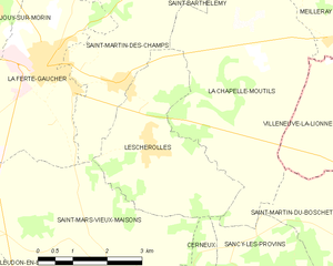
Lescherolles
- commune in Seine-et-Marne, France
- Country:
- Postal Code: 77320
- Coordinates: 48° 45' 43" N, 3° 20' 44" E
- GPS tracks (wikiloc): [Link]
- Area: 11.01 sq km
- Population: 484

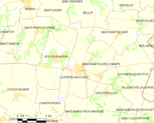
La Ferté-Gaucher
- commune in Seine-et-Marne, France
- Country:
- Postal Code: 77320
- Coordinates: 48° 46' 57" N, 3° 18' 19" E
- GPS tracks (wikiloc): [Link]
- Area: 17.32 sq km
- Population: 4802
- Web site: [Link]