Saint-Micaud (Saint-Micaud)

- commune in Saône-et-Loire, France
- Country:

- Postal Code: 71460
- Coordinates: 46° 41' 29" N, 4° 32' 48" E


- GPS tracks (wikiloc): [Link]
- Area: 20.91 sq km
- Population: 274
- Wikipedia en: wiki(en)
- Wikipedia: wiki(fr)
- Wikidata storage: Wikidata: Q745773
- Wikipedia Commons Category: [Link]
- Wikipedia Commons Maps Category: [Link]
- Freebase ID: [/m/03qh3xy]
- GeoNames ID: Alt: [6442454]
- SIREN number: [217104652]
- BnF ID: [152734354]
- INSEE municipality code: 71465
Shares border with regions:


Marigny
- commune in Saône-et-Loire, France
- Country:
- Postal Code: 71300
- Coordinates: 46° 40' 44" N, 4° 27' 34" E
- GPS tracks (wikiloc): [Link]
- Area: 22.3 sq km
- Population: 151


Saint-Laurent-d'Andenay
- commune in Saône-et-Loire, France
- Country:
- Postal Code: 71210
- Coordinates: 46° 44' 16" N, 4° 30' 51" E
- GPS tracks (wikiloc): [Link]
- Area: 11.49 sq km
- Population: 1028


Saint-Martin-d'Auxy
- commune in Saône-et-Loire, France
- Country:
- Postal Code: 71390
- Coordinates: 46° 43' 17" N, 4° 33' 12" E
- GPS tracks (wikiloc): [Link]
- Area: 7.32 sq km
- Population: 97
- Web site: [Link]


Le Puley
- commune in Saône-et-Loire, France
- Country:
- Postal Code: 71460
- Coordinates: 46° 40' 42" N, 4° 33' 49" E
- GPS tracks (wikiloc): [Link]
- Area: 5.3 sq km
- Population: 95

Genouilly
- commune in Saône-et-Loire, France
- Country:
- Postal Code: 71460
- Coordinates: 46° 39' 5" N, 4° 34' 25" E
- GPS tracks (wikiloc): [Link]
- Area: 10.88 sq km
- Population: 429


Mont-Saint-Vincent
- commune in Saône-et-Loire, France
- Country:
- Postal Code: 71300
- Coordinates: 46° 37' 50" N, 4° 28' 41" E
- GPS tracks (wikiloc): [Link]
- Area: 13.6 sq km
- Population: 334


Saint-Privé, Saône-et-Loire
- commune in Saône-et-Loire, France
- Country:
- Postal Code: 71390
- Coordinates: 46° 41' 29" N, 4° 34' 13" E
- GPS tracks (wikiloc): [Link]
- AboveSeaLevel: 300 м m
- Area: 5.21 sq km
- Population: 65

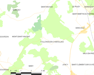
Collonge-en-Charollais
- commune in Saône-et-Loire, France
- Country:
- Postal Code: 71460
- Coordinates: 46° 38' 26" N, 4° 31' 54" E
- GPS tracks (wikiloc): [Link]
- Area: 12.17 sq km
- Population: 140

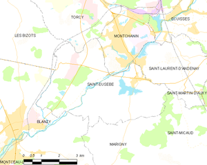
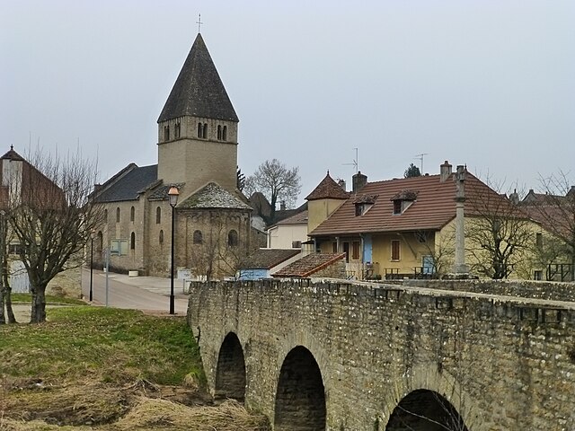
Saint-Eusèbe, Saône-et-Loire
- commune in Saône-et-Loire, France
- Country:
- Postal Code: 71210
- Coordinates: 46° 43' 32" N, 4° 28' 53" E
- GPS tracks (wikiloc): [Link]
- Area: 21.21 sq km
- Population: 1180