Saint-Michel-de-Montaigne (Saint-Michel-de-Montaigne)

- commune in Dordogne, France
- Country:

- Postal Code: 24230
- Coordinates: 44° 52' 27" N, 0° 1' 48" E


- GPS tracks (wikiloc): [Link]
- Area: 9.1 sq km
- Population: 345
- Wikipedia en: wiki(en)
- Wikipedia: wiki(fr)
- Wikidata storage: Wikidata: Q178442
- Wikipedia Commons Category: [Link]
- Freebase ID: [/m/03mg9hh]
- Freebase ID: [/m/03mg9hh]
- GeoNames ID: Alt: [2977985]
- GeoNames ID: Alt: [2977985]
- SIREN number: [212404669]
- SIREN number: [212404669]
- BnF ID: [152521093]
- BnF ID: [152521093]
- VIAF ID: Alt: [248280274]
- VIAF ID: Alt: [248280274]
- GND ID: Alt: [4596660-6]
- GND ID: Alt: [4596660-6]
- Library of Congress authority ID: Alt: [no2012143228]
- Library of Congress authority ID: Alt: [no2012143228]
- MusicBrainz area ID: [3deb655d-d0cb-4fcf-b157-e4b869fbe955]
- MusicBrainz area ID: [3deb655d-d0cb-4fcf-b157-e4b869fbe955]
- INSEE municipality code: 24466
- INSEE municipality code: 24466
Shares border with regions:


Gardegan-et-Tourtirac
- commune in Gironde, France
- Country:
- Postal Code: 33350
- Coordinates: 44° 54' 1" N, 0° 1' 18" E
- GPS tracks (wikiloc): [Link]
- Area: 9.58 sq km
- Population: 288


Les Salles-de-Castillon
- commune in Gironde, France
- Country:
- Postal Code: 33350
- Coordinates: 44° 54' 44" N, 0° 0' 4" E
- GPS tracks (wikiloc): [Link]
- AboveSeaLevel: 82 м m
- Area: 10.81 sq km
- Population: 382


Belvès-de-Castillon
- commune in Gironde, France
- Country:
- Postal Code: 33350
- Coordinates: 44° 52' 42" N, 0° 1' 52" E
- GPS tracks (wikiloc): [Link]
- Area: 6.61 sq km
- Population: 337
- Web site: [Link]

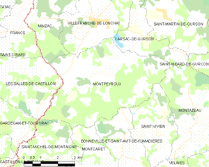
Montpeyroux
- commune in Dordogne, France
- Country:
- Postal Code: 24610
- Coordinates: 44° 55' 12" N, 0° 3' 25" E
- GPS tracks (wikiloc): [Link]
- Area: 23.37 sq km
- Population: 447
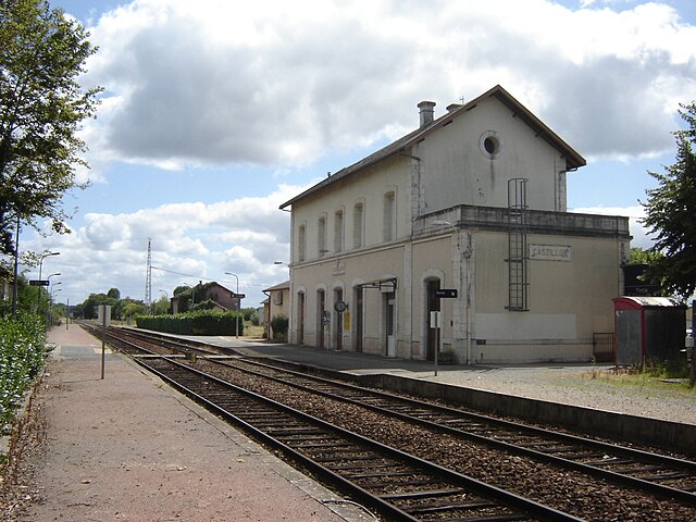
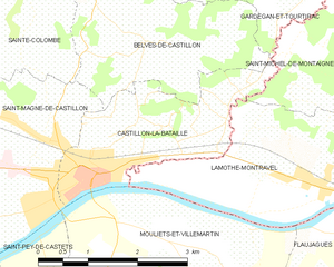
Castillon-la-Bataille
- commune in Gironde, France
- Country:
- Postal Code: 33350
- Coordinates: 44° 51' 12" N, 0° 2' 40" E
- GPS tracks (wikiloc): [Link]
- Area: 5.68 sq km
- Population: 3070