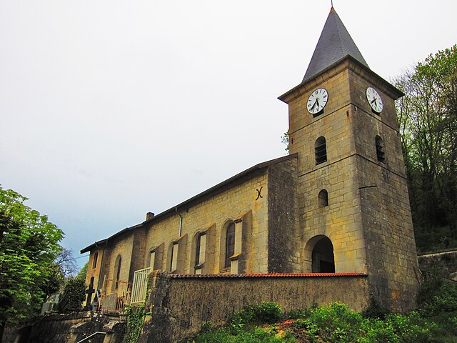
Saint-Mihiel (Saint-Mihiel)

- commune in Meuse, France
- Country:

- Postal Code: 55300
- Coordinates: 48° 53' 22" N, 5° 32' 24" E


- GPS tracks (wikiloc): [Link]
- AboveSeaLevel: 228 м m
- Area: 33 sq km
- Population: 4186
- Web site: http://www.saintmihiel.fr
- Wikipedia en: wiki(en)
- Wikipedia: wiki(fr)
- Wikidata storage: Wikidata: Q194932
- Wikipedia Commons Category: [Link]
- Freebase ID: [/m/04q04v]
- GeoNames ID: Alt: [2977948]
- SIREN number: [215504630]
- BnF ID: [152651289]
- VIAF ID: Alt: [155992285]
- GND ID: Alt: [4118258-3]
- Library of Congress authority ID: Alt: [n84178632]
- PACTOLS thesaurus ID: [pcrtURP2nlXApK]
- Encyclopædia Britannica Online ID: [place/Saint-Mihiel]
- INSEE municipality code: 55463
- US National Archives Identifier: 10045102
Shares border with regions:

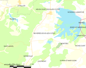
Buxières-sous-les-Côtes
- commune in Meuse, France
- Country:
- Postal Code: 55300
- Coordinates: 48° 54' 57" N, 5° 40' 19" E
- GPS tracks (wikiloc): [Link]
- Area: 26.72 sq km
- Population: 283
- Web site: [Link]

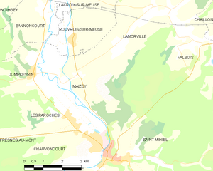
Maizey
- commune in Meuse, France
- Country:
- Postal Code: 55300
- Coordinates: 48° 55' 29" N, 5° 30' 42" E
- GPS tracks (wikiloc): [Link]
- Area: 14.91 sq km
- Population: 167

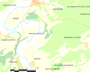
Han-sur-Meuse
- commune in Meuse, France
- Country:
- Postal Code: 55300
- Coordinates: 48° 51' 58" N, 5° 32' 20" E
- GPS tracks (wikiloc): [Link]
- Area: 17.22 sq km
- Population: 283
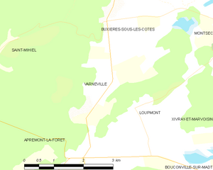
Varnéville
- commune in Meuse, France
- Country:
- Postal Code: 55300
- Coordinates: 48° 52' 18" N, 5° 39' 19" E
- GPS tracks (wikiloc): [Link]
- Area: 6.44 sq km
- Population: 54


Bislée
- commune in Meuse, France
- Country:
- Postal Code: 55300
- Coordinates: 48° 52' 8" N, 5° 29' 40" E
- GPS tracks (wikiloc): [Link]
- Area: 4.96 sq km
- Population: 61
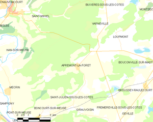
Apremont-la-Forêt
- commune in Meuse, France
- Country:
- Postal Code: 55300
- Coordinates: 48° 51' 19" N, 5° 38' 21" E
- GPS tracks (wikiloc): [Link]
- Area: 32.89 sq km
- Population: 396
Chauvoncourt
- commune in Meuse, France
- Country:
- Postal Code: 55300
- Coordinates: 48° 54' 4" N, 5° 31' 25" E
- GPS tracks (wikiloc): [Link]
- Area: 10.04 sq km
- Population: 455


Valbois
- commune in Meuse, France
- Country:
- Postal Code: 55300
- Coordinates: 48° 56' 0" N, 5° 37' 1" E
- GPS tracks (wikiloc): [Link]
- AboveSeaLevel: 260 м m
- Area: 17.09 sq km
- Population: 88
- Web site: [Link]