Saint-Pé-d'Ardet (Saint-Pé-d'Ardet)


- commune in Haute-Garonne, France
- Country:

- Postal Code: 31510
- Coordinates: 42° 59' 5" N, 0° 40' 15" E


- GPS tracks (wikiloc): [Link]
- Area: 3.47 sq km
- Population: 138
- Web site: http://www.mairie-saintpedardet31.fr
- Wikipedia en: wiki(en)
- Wikipedia: wiki(fr)
- Wikidata storage: Wikidata: Q835578
- Wikipedia Commons Category: [Link]
- Freebase ID: [/m/03nq2y7]
- GeoNames ID: Alt: [6431823]
- SIREN number: [213105091]
- BnF ID: [152555046]
- PACTOLS thesaurus ID: [pcrtnXTtP90n0r]
- INSEE municipality code: 31509
Shares border with regions:

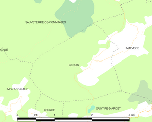
Génos
- commune in Haute-Garonne, France
- Country:
- Postal Code: 31510
- Coordinates: 43° 0' 2" N, 0° 40' 25" E
- GPS tracks (wikiloc): [Link]
- Area: 3.47 sq km
- Population: 78


Antichan-de-Frontignes
- commune in Haute-Garonne, France
- Country:
- Postal Code: 31510
- Coordinates: 42° 58' 23" N, 0° 39' 56" E
- GPS tracks (wikiloc): [Link]
- Area: 4.27 sq km
- Population: 98
Cazaunous
- commune in Haute-Garonne, France
- Country:
- Postal Code: 31160
- Coordinates: 42° 59' 9" N, 0° 44' 2" E
- GPS tracks (wikiloc): [Link]
- Area: 4.66 sq km
- Population: 73
Malvezie
- commune in Haute-Garonne, France
- Country:
- Postal Code: 31510
- Coordinates: 43° 0' 20" N, 0° 41' 15" E
- GPS tracks (wikiloc): [Link]
- Area: 8.52 sq km
- Population: 123
Moncaup
- commune in Haute-Garonne, France
- Country:
- Postal Code: 31160
- Coordinates: 42° 58' 40" N, 0° 42' 23" E
- GPS tracks (wikiloc): [Link]
- Area: 7.14 sq km
- Population: 37


Lourde
- commune in Haute-Garonne, France
- Country:
- Postal Code: 31510
- Coordinates: 42° 59' 3" N, 0° 39' 39" E
- GPS tracks (wikiloc): [Link]
- Area: 1.24 sq km
- Population: 91