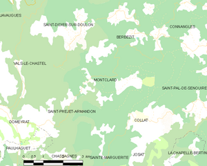
Saint-Pal-de-Senouire (Saint-Pal-de-Senouire)

- commune in Haute-Loire, France
- Country:

- Postal Code: 43160
- Coordinates: 45° 15' 33" N, 3° 39' 3" E


- GPS tracks (wikiloc): [Link]
- Area: 18.35 sq km
- Population: 109
- Web site: http://www.saint-pal-de-senouire.fr
- Wikipedia en: wiki(en)
- Wikipedia: wiki(fr)
- Wikidata storage: Wikidata: Q275891
- Wikipedia Commons Category: [Link]
- Freebase ID: [/m/03ntpbz]
- GeoNames ID: Alt: [6434436]
- SIREN number: [214302143]
- BnF ID: [15260118s]
- INSEE municipality code: 43214
Shares border with regions:
La Chapelle-Bertin
- commune in Haute-Loire, France
- Country:
- Postal Code: 43270
- Coordinates: 45° 13' 8" N, 3° 38' 56" E
- GPS tracks (wikiloc): [Link]
- Area: 11.29 sq km
- Population: 53
Monlet
- commune in Haute-Loire, France
- Country:
- Postal Code: 43270
- Coordinates: 45° 13' 10" N, 3° 42' 52" E
- GPS tracks (wikiloc): [Link]
- Area: 35.7 sq km
- Population: 399

Montclard
- commune in Haute-Loire, France
- Country:
- Postal Code: 43230
- Coordinates: 45° 15' 47" N, 3° 35' 28" E
- GPS tracks (wikiloc): [Link]
- Area: 9.58 sq km
- Population: 57

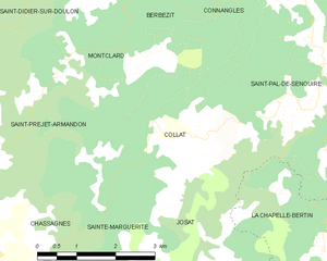
Collat
- commune in Haute-Loire, France
- Country:
- Postal Code: 43230
- Coordinates: 45° 14' 37" N, 3° 36' 41" E
- GPS tracks (wikiloc): [Link]
- Area: 10.22 sq km
- Population: 85


Sembadel
- commune in Haute-Loire, France
- Country:
- Postal Code: 43160
- Coordinates: 45° 16' 29" N, 3° 41' 12" E
- GPS tracks (wikiloc): [Link]
- Area: 18.59 sq km
- Population: 231


Connangles
- commune in Haute-Loire, France
- Country:
- Postal Code: 43160
- Coordinates: 45° 17' 56" N, 3° 38' 50" E
- GPS tracks (wikiloc): [Link]
- Area: 21.89 sq km
- Population: 148