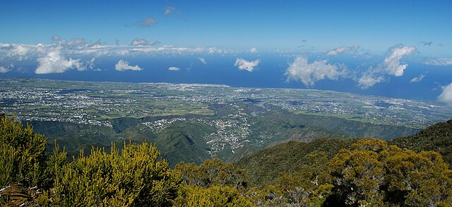
Saint-Pierre (Saint-Pierre)
- commune in La Réunion, France
- Country:

- Postal Code: 97410
- Coordinates: 21° 20' 31" S, 55° 28' 40" W


- GPS tracks (wikiloc): [Link]
- Area: 95.99 sq km
- Population: 84063
- Web site: http://www.ville-saintpierre.fr
- Wikipedia en: wiki(en)
- Wikipedia: wiki(fr)
- Wikidata storage: Wikidata: Q249884
- Wikipedia Commons Category: [Link]
- Freebase ID: [/m/08sgw4]
- Freebase ID: [/m/08sgw4]
- Freebase ID: [/m/08sgw4]
- Freebase ID: [/m/08sgw4]
- SIREN number: [219740164]
- SIREN number: [219740164]
- SIREN number: [219740164]
- SIREN number: [219740164]
- BnF ID: [12128230f]
- BnF ID: [12128230f]
- BnF ID: [12128230f]
- BnF ID: [12128230f]
- VIAF ID: Alt: [128697059]
- VIAF ID: Alt: [128697059]
- VIAF ID: Alt: [128697059]
- VIAF ID: Alt: [128697059]
- OSM relation ID: [315484]
- OSM relation ID: [315484]
- OSM relation ID: [315484]
- OSM relation ID: [315484]
- Library of Congress authority ID: Alt: [n77004877]
- Library of Congress authority ID: Alt: [n77004877]
- Library of Congress authority ID: Alt: [n77004877]
- Library of Congress authority ID: Alt: [n77004877]
- MusicBrainz area ID: [7e238321-129f-40db-a673-8a5bc58fc8fa]
- MusicBrainz area ID: [7e238321-129f-40db-a673-8a5bc58fc8fa]
- MusicBrainz area ID: [7e238321-129f-40db-a673-8a5bc58fc8fa]
- MusicBrainz area ID: [7e238321-129f-40db-a673-8a5bc58fc8fa]
- SUDOC authorities ID: [029718198]
- SUDOC authorities ID: [029718198]
- SUDOC authorities ID: [029718198]
- SUDOC authorities ID: [029718198]
- Facebook Places ID: [111849825501378]
- Facebook Places ID: [111849825501378]
- Facebook Places ID: [111849825501378]
- Facebook Places ID: [111849825501378]
- INSEE municipality code: 97416
- INSEE municipality code: 97416
- INSEE municipality code: 97416
- INSEE municipality code: 97416
Shares border with regions:


Entre-Deux
- commune in La Réunion, France
- Country:

- Postal Code: 97414
- Coordinates: 21° 14' 56" S, 55° 28' 13" W


- GPS tracks (wikiloc): [Link]
- Area: 66.83 sq km
- Population: 6781
- Web site: [Link]

Petite-Île
- commune in La Réunion, France
- Country:

- Postal Code: 97429
- Coordinates: 21° 21' 21" S, 55° 33' 57" W


- GPS tracks (wikiloc): [Link]
- Area: 33.93 sq km
- Population: 12143
- Web site: [Link]

Le Tampon
- commune in La Réunion, France
- Country:

- Postal Code: 97430
- Coordinates: 21° 16' 41" S, 55° 30' 55" W


- GPS tracks (wikiloc): [Link]
- Area: 165.43 sq km
- Population: 76310
- Web site: [Link]

Saint-Louis
- commune in La Réunion, France
- Country:

- Postal Code: 97450
- Coordinates: 21° 17' 12" S, 55° 24' 33" W


- GPS tracks (wikiloc): [Link]
- Area: 98.9 sq km
- Population: 53524
- Web site: [Link]

Saint-Joseph
- commune in La Réunion, France
- Country:

- Postal Code: 97480
- Coordinates: 21° 22' 43" S, 55° 37' 9" W


- GPS tracks (wikiloc): [Link]
- AboveSeaLevel: 0 м m
- Area: 178.5 sq km
- Population: 37608
- Web site: [Link]
