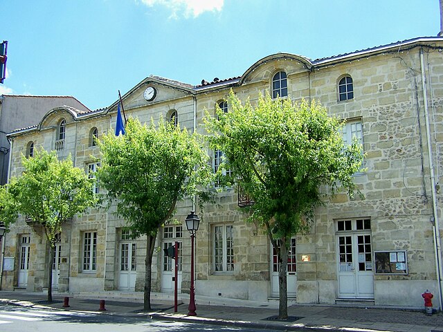
Saint-Selve (Saint-Selve)

- commune in Gironde, France
- Country:

- Postal Code: 33650
- Coordinates: 44° 40' 14" N, 0° 28' 49" E


- GPS tracks (wikiloc): [Link]
- Area: 17.74 sq km
- Population: 2775
- Web site: http://www.mairie-saintselve.fr
- Wikipedia en: wiki(en)
- Wikipedia: wiki(fr)
- Wikidata storage: Wikidata: Q501978
- Wikipedia Commons Category: [Link]
- Freebase ID: [/m/03ns1_q]
- GeoNames ID: Alt: [6432446]
- SIREN number: [213304744]
- BnF ID: [152565211]
- INSEE municipality code: 33474
Shares border with regions:


Ayguemorte-les-Graves
- commune in Gironde, France
- Country:
- Postal Code: 33640
- Coordinates: 44° 42' 36" N, 0° 28' 55" E
- GPS tracks (wikiloc): [Link]
- Area: 6.33 sq km
- Population: 1216
- Web site: [Link]


Beautiran
- commune in Gironde, France
- Country:
- Postal Code: 33640
- Coordinates: 44° 42' 13" N, 0° 27' 8" E
- GPS tracks (wikiloc): [Link]
- Area: 6.35 sq km
- Population: 2178
- Web site: [Link]

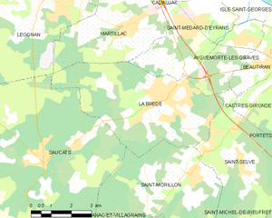
La Brède
- commune in Gironde, France
- Country:
- Postal Code: 33650
- Coordinates: 44° 40' 53" N, 0° 31' 43" E
- GPS tracks (wikiloc): [Link]
- AboveSeaLevel: 26 м m
- Area: 23.28 sq km
- Population: 4109
- Web site: [Link]

Castres-Gironde
- commune in Gironde, France
- Country:
- Postal Code: 33640
- Coordinates: 44° 41' 47" N, 0° 26' 41" E
- GPS tracks (wikiloc): [Link]
- Area: 6.97 sq km
- Population: 2299
- Web site: [Link]


Saint-Michel-de-Rieufret
- commune in Gironde, France
- Country:
- Postal Code: 33720
- Coordinates: 44° 37' 18" N, 0° 25' 55" E
- GPS tracks (wikiloc): [Link]
- Area: 18.94 sq km
- Population: 702
- Web site: [Link]


Portets
- commune in Gironde, France
- Country:
- Postal Code: 33640
- Coordinates: 44° 41' 49" N, 0° 25' 27" E
- GPS tracks (wikiloc): [Link]
- Area: 15.49 sq km
- Population: 2650
- Web site: [Link]


Saint-Morillon
- commune in Gironde, France
- Country:
- Postal Code: 33650
- Coordinates: 44° 38' 59" N, 0° 30' 10" E
- GPS tracks (wikiloc): [Link]
- Area: 20.4 sq km
- Population: 1636
- Web site: [Link]