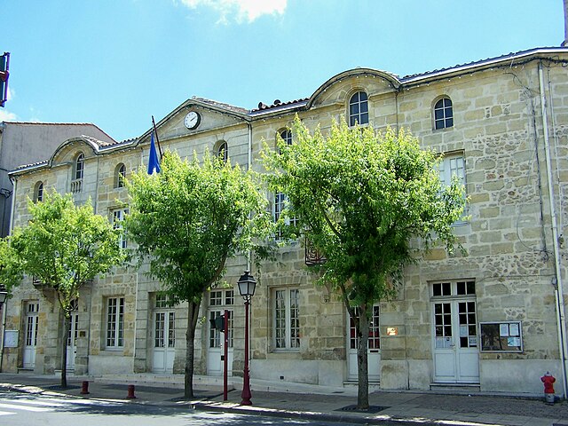
Beautiran (Beautiran)

- commune in Gironde, France
- Country:

- Postal Code: 33640
- Coordinates: 44° 42' 13" N, 0° 27' 8" E


- GPS tracks (wikiloc): [Link]
- Area: 6.35 sq km
- Population: 2178
- Web site: http://www.mairie-beautiran.fr
- Wikipedia en: wiki(en)
- Wikipedia: wiki(fr)
- Wikidata storage: Wikidata: Q238469
- Wikipedia Commons Category: [Link]
- Freebase ID: [/m/03nrx18]
- GeoNames ID: Alt: [6448401]
- SIREN number: [213300379]
- BnF ID: [15256091t]
- VIAF ID: Alt: [245707737]
- GND ID: Alt: [4209583-9]
- PACTOLS thesaurus ID: [pcrtadrz47HRae]
- INSEE municipality code: 33037
Shares border with regions:


Isle-Saint-Georges
- commune in Gironde, France
- Country:
- Postal Code: 33640
- Coordinates: 44° 43' 29" N, 0° 28' 26" E
- GPS tracks (wikiloc): [Link]
- Area: 4.35 sq km
- Population: 538
- Web site: [Link]


Ayguemorte-les-Graves
- commune in Gironde, France
- Country:
- Postal Code: 33640
- Coordinates: 44° 42' 36" N, 0° 28' 55" E
- GPS tracks (wikiloc): [Link]
- Area: 6.33 sq km
- Population: 1216
- Web site: [Link]


Baurech
- commune in Gironde, France
- Country:
- Postal Code: 33880
- Coordinates: 44° 43' 31" N, 0° 26' 23" E
- GPS tracks (wikiloc): [Link]
- Area: 7.68 sq km
- Population: 816

Castres-Gironde
- commune in Gironde, France
- Country:
- Postal Code: 33640
- Coordinates: 44° 41' 47" N, 0° 26' 41" E
- GPS tracks (wikiloc): [Link]
- Area: 6.97 sq km
- Population: 2299
- Web site: [Link]


Tabanac
- commune in Gironde, France
- Country:
- Postal Code: 33550
- Coordinates: 44° 43' 14" N, 0° 24' 20" E
- GPS tracks (wikiloc): [Link]
- Area: 8 sq km
- Population: 1073
- Web site: [Link]

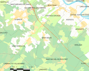
Saint-Selve
- commune in Gironde, France
- Country:
- Postal Code: 33650
- Coordinates: 44° 40' 14" N, 0° 28' 49" E
- GPS tracks (wikiloc): [Link]
- Area: 17.74 sq km
- Population: 2775
- Web site: [Link]