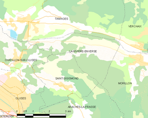
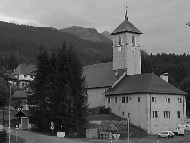
Saint-Sigismond (Saint-Sigismond)

- commune in Haute-Savoie, France
 Hiking in Saint-Sigismond
Saint-Sigismond, located in the Haute-Savoie region of the French Alps, offers a delightful experience for hikers and nature enthusiasts. This area is characterized by its stunning mountainous landscapes, lush greenery, and a variety of trails suitable for different skill levels. Here are some key points about hiking in Saint-Sigismond:
Trails
-
Variety of Trails: The region features numerous hiking trails ranging from easy walks to more challenging routes. Beginners can find gentle paths, while experienced hikers can tackle steeper inclines and more rugged terrain.
-
Scenic Routes: Many trails provide breathtaking views of the surrounding mountains, valleys, and sometimes even alpine lakes. The landscapes change with the seasons, adding to the beauty from vibrant wildflowers in spring to autumn foliage.
-
Local Highlights: Consider trails that lead to nearby attractions such as the Arve Valley or the peaks of the Mont Blanc massif which are visible from many vantage points in the area.
Preparation and Safety
-
Gear Up: Wear appropriate hiking boots and clothing suitable for variable weather conditions, as mountain weather can change rapidly. Always carry a map or a GPS device.
-
Water and Snacks: Ensure you bring enough water and snacks, especially for longer hikes. There might not be facilities along the trails.
-
Weather Awareness: Check the local weather forecast before heading out, as some trails can become hazardous in bad weather.
Accessibility
-
Transportation: Saint-Sigismond can be accessed by car, and there are usually parking areas available near trailheads. Local public transport options may also be available from larger nearby towns.
-
Guided Tours: For those unfamiliar with the area or hiking in general, guided tours led by local experts could be a fantastic way to explore the trails while learning about the environment and history of the region.
Cultural and Natural Attractions
-
Flora and Fauna: The high-altitude meadows and forests are home to diverse plant species and wildlife, making it a great location for nature lovers and photographers.
-
Local Culture: After a day of hiking, take time to explore the local culture, perhaps trying out regional cuisine in one of the cozy restaurants or taking part in local events.
Whether you're seeking solitude in nature or an adventure with friends and family, hiking in Saint-Sigismond provides a wonderful opportunity to appreciate the beauty of the Alps. Just make sure to plan appropriately, respect nature, and enjoy your time outdoors!
- Country:

- Postal Code: 74300
- Coordinates: 46° 4' 20" N, 6° 36' 52" E


- GPS tracks (wikiloc): [Link]
- Area: 7.92 sq km
- Population: 595
- Web site: http://saint-sigismond.fr
- Wikipedia en: wiki(en)
- Wikipedia: wiki(fr)
- Wikidata storage: Wikidata: Q845365
- Wikipedia Commons Category: [Link]
- Freebase ID: [/m/03ntxm7]
- GeoNames ID: Alt: [6617614]
- SIREN number: [217402528]
- BnF ID: [152745062]
- INSEE municipality code: 74252
Shares border with regions:

La Rivière-Enverse
- commune in Haute-Savoie, France
Hiking in La Rivière-Enverse
La Rivière-Enverse is a picturesque village located in the Haute-Savoie region of France, offering stunning scenery and a range of hiking opportunities. Nestled in the French Alps, this area boasts a mix of lush valleys, dramatic peaks, and tranquil rivers. Here’s what you need to know about hiking in and around La Rivière-Enverse:...
- Country:
- Postal Code: 74440
- Coordinates: 46° 5' 34" N, 6° 38' 11" E
- GPS tracks (wikiloc): [Link]
- Area: 7.98 sq km
- Population: 457

Arâches-la-Frasse
- commune in Haute-Savoie, France
Hiking in Arâches-la-Frasse
Arâches-la-Frasse is a charming commune located in the Haute-Savoie region of the French Alps. It is known for its stunning landscapes and proximity to the Grand Massif ski area, which also offers numerous hiking opportunities during the warmer months....
- Country:
- Postal Code: 74300
- Coordinates: 46° 2' 36" N, 6° 37' 53" E
- GPS tracks (wikiloc): [Link]
- Area: 37.69 sq km
- Population: 1928


Cluses
- commune in Haute-Savoie, France
Hiking in Cluses
Cluses, located in the Haute-Savoie region of France, is a beautiful destination for hiking enthusiasts. Nestled in the heart of the Alps, it offers a variety of trails that cater to different skill levels and preferences. Here’s what you can expect when hiking in and around Cluses:...
- Country:
- Postal Code: 74300
- Coordinates: 46° 3' 37" N, 6° 34' 43" E
- GPS tracks (wikiloc): [Link]
- Area: 10.46 sq km
- Population: 17538
- Web site: [Link]


Châtillon-sur-Cluses
- commune in Haute-Savoie, France
Hiking in Châtillon-sur-Cluses
Châtillon-sur-Cluses is a picturesque village in the Haute-Savoie region of France, nestled in the Alps. It provides a beautiful backdrop for hiking enthusiasts, offering a variety of trails that cater to different levels of experience. Here are some details about hiking in and around Châtillon-sur-Cluses:...
- Country:
- Postal Code: 74300
- Coordinates: 46° 5' 14" N, 6° 34' 57" E
- GPS tracks (wikiloc): [Link]
- Area: 9.18 sq km
- Population: 1258