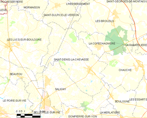
Saint-Sulpice-le-Verdon (Saint-Sulpice-le-Verdon)

- former commune in Vendée, France
- Country:

- Postal Code: 85260
- Coordinates: 46° 53' 36" N, 1° 25' 15" E


- GPS tracks (wikiloc): [Link]
- Area: 14.07 sq km
- Population: 1036
- Web site: http://www.saintsulpiceleverdon.fr
- Wikipedia en: wiki(en)
- Wikipedia: wiki(fr)
- Wikidata storage: Wikidata: Q1412213
- Wikipedia Commons Category: [Link]
- Freebase ID: [/m/03qhlqx]
- GeoNames ID: Alt: [2976839]
- BnF ID: [15278392w]
- Library of Congress authority ID: Alt: [no2013082164]
- INSEE municipality code: 85272
Shares border with regions:


L'Herbergement
- commune in Vendée, France
- Country:
- Postal Code: 85260
- Coordinates: 46° 54' 33" N, 1° 22' 37" E
- GPS tracks (wikiloc): [Link]
- Area: 16.75 sq km
- Population: 3119
- Web site: [Link]


Les Brouzils
- commune in Vendée, France
- Country:
- Postal Code: 85260
- Coordinates: 46° 53' 13" N, 1° 19' 18" E
- GPS tracks (wikiloc): [Link]
- Area: 41.25 sq km
- Population: 2779
- Web site: [Link]


Mormaison
- former commune in Vendée, France
- Country:
- Postal Code: 85260
- Coordinates: 46° 54' 25" N, 1° 27' 0" E
- GPS tracks (wikiloc): [Link]
- AboveSeaLevel: 55 м m
- Area: 15.44 sq km
- Population: 1122


Les Lucs-sur-Boulogne
- commune in Vendée, France
- Country:
- Postal Code: 85170
- Coordinates: 46° 50' 38" N, 1° 29' 37" E
- GPS tracks (wikiloc): [Link]
- Area: 53.15 sq km
- Population: 3392
- Web site: [Link]

Saint-Denis-la-Chevasse
- commune in Vendée, France
- Country:
- Postal Code: 85170
- Coordinates: 46° 49' 19" N, 1° 21' 31" E
- GPS tracks (wikiloc): [Link]
- Area: 39.47 sq km
- Population: 2278
- Web site: [Link]