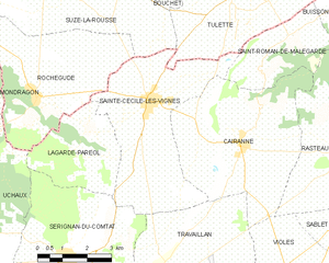
Sainte-Cécile-les-Vignes (Sainte-Cécile-les-Vignes)
- commune in Vaucluse, France
- Country:

- Postal Code: 84290
- Coordinates: 44° 14' 43" N, 4° 53' 10" E


- GPS tracks (wikiloc): [Link]
- Area: 19.82 sq km
- Population: 2445
- Wikipedia en: wiki(en)
- Wikipedia: wiki(fr)
- Wikidata storage: Wikidata: Q1044706
- Wikipedia Commons Category: [Link]
- Freebase ID: [/m/02vmnv2]
- GeoNames ID: Alt: [2980711]
- SIREN number: [218401065]
- BnF ID: [152780864]
- VIAF ID: Alt: [306367872]
- PACTOLS thesaurus ID: [pcrt8JuBy9290I]
- Trismegistos Geo ID: [21897]
- INSEE municipality code: 84106
Shares border with regions:


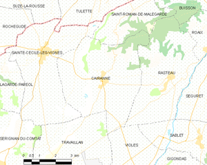
Cairanne
- commune in Vaucluse, France
Cairanne, located in the Provence region of France, is a charming village known for its beautiful landscapes and vineyards. While Cairanne itself is relatively small, it serves as a great base for exploring the surrounding countryside and enjoying hiking opportunities in the Vaucluse area. Here are some aspects to consider when hiking in and around Cairanne:...
- Country:

- Postal Code: 84290
- Coordinates: 44° 13' 59" N, 4° 56' 1" E


- GPS tracks (wikiloc): [Link]
- Area: 22.51 sq km
- Population: 1062
- Web site: [Link]


Lagarde-Paréol
- commune in Vaucluse, France
- Country:

- Postal Code: 84290
- Coordinates: 44° 13' 41" N, 4° 51' 4" E


- GPS tracks (wikiloc): [Link]
- Area: 9.29 sq km
- Population: 312


Travaillan
- commune in Vaucluse, France
- Country:

- Postal Code: 84850
- Coordinates: 44° 10' 58" N, 4° 54' 9" E


- GPS tracks (wikiloc): [Link]
- Area: 17.65 sq km
- Population: 721


Sérignan-du-Comtat
- commune in Vaucluse, France
- Country:

- Postal Code: 84830
- Coordinates: 44° 11' 21" N, 4° 50' 38" E


- GPS tracks (wikiloc): [Link]
- Area: 19.82 sq km
- Population: 2508


Saint-Roman-de-Malegarde
- commune in Vaucluse, France
 Hiking in Saint-Roman-de-Malegarde
Saint-Roman-de-Malegarde is a charming commune located in the Provence-Alpes-Côte d'Azur region of France, nestled at the foothills of the Dentelles de Montmirail mountains. This area provides a fantastic opportunity for hiking enthusiasts. Here are some key points to consider when exploring the hiking options in and around Saint-Roman-de-Malegarde:...
- Country:

- Postal Code: 84290
- Coordinates: 44° 16' 12" N, 4° 57' 48" E


- GPS tracks (wikiloc): [Link]
- Area: 8.21 sq km
- Population: 331


Suze-la-Rousse
- commune in Drôme, France
- Country:

- Postal Code: 26790
- Coordinates: 44° 17' 17" N, 4° 50' 32" E


- GPS tracks (wikiloc): [Link]
- Area: 30.6 sq km
- Population: 2066


Tulette
- commune in Drôme, France
Tulette is a charming commune located in the Vaucluse department of the Provence-Alpes-Côte d'Azur region in southeastern France. While it's not a major hiking destination like some of the larger national parks or mountain ranges in France, it offers a lovely setting for those looking to enjoy a more relaxed hiking experience in the French countryside....
- Country:

- Postal Code: 26790
- Coordinates: 44° 17' 11" N, 4° 55' 51" E


- GPS tracks (wikiloc): [Link]
- Area: 23.53 sq km
- Population: 1963


Rochegude
- commune in Drôme, France
- Country:

- Postal Code: 26790
- Coordinates: 44° 14' 56" N, 4° 49' 43" E


- GPS tracks (wikiloc): [Link]
- Area: 18.3 sq km
- Population: 1582
