Sainte-Céronne-lès-Mortagne (Sainte-Céronne-lès-Mortagne)

- commune in Orne, France
- Country:

- Postal Code: 61380
- Coordinates: 48° 34' 4" N, 0° 31' 58" E


- GPS tracks (wikiloc): [Link]
- Area: 12.55 sq km
- Population: 257
- Web site: http://www.sainte-ceronne-les-mortagne.fr
- Wikipedia en: wiki(en)
- Wikipedia: wiki(fr)
- Wikidata storage: Wikidata: Q1434441
- Wikipedia Commons Category: [Link]
- Freebase ID: [/m/03x_xs4]
- Freebase ID: [/m/03x_xs4]
- GeoNames ID: Alt: [6439234]
- GeoNames ID: Alt: [6439234]
- SIREN number: [216103739]
- SIREN number: [216103739]
- BnF ID: [152683037]
- BnF ID: [152683037]
- PACTOLS thesaurus ID: [pcrtMejy9n25wF]
- PACTOLS thesaurus ID: [pcrtMejy9n25wF]
- INSEE municipality code: 61373
- INSEE municipality code: 61373
Shares border with regions:


Bazoches-sur-Hoëne
- commune in Orne, France
- Country:
- Postal Code: 61560
- Coordinates: 48° 33' 7" N, 0° 28' 17" E
- GPS tracks (wikiloc): [Link]
- Area: 21.44 sq km
- Population: 879
- Web site: [Link]

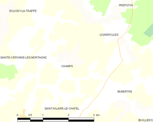
Champs
- former commune in Orne, France
- Country:
- Postal Code: 61190
- Coordinates: 48° 35' 2" N, 0° 33' 19" E
- GPS tracks (wikiloc): [Link]
- Area: 4.91 sq km
- Population: 83
Prépotin
- former commune in Orne, France
- Country:
- Postal Code: 61190
- Coordinates: 48° 36' 49" N, 0° 34' 39" E
- GPS tracks (wikiloc): [Link]
- Area: 10.53 sq km
- Population: 126


Soligny-la-Trappe
- commune in Orne, France
- Country:
- Postal Code: 61380
- Coordinates: 48° 36' 54" N, 0° 32' 8" E
- GPS tracks (wikiloc): [Link]
- Area: 19.5 sq km
- Population: 696
- Web site: [Link]

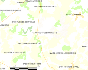
Saint-Ouen-de-Sécherouvre
- commune in Orne, France
- Country:
- Postal Code: 61560
- Coordinates: 48° 36' 2" N, 0° 29' 22" E
- GPS tracks (wikiloc): [Link]
- Area: 10.15 sq km
- Population: 180
Saint-Hilaire-le-Châtel
- commune in Orne, France
- Country:
- Postal Code: 61400
- Coordinates: 48° 33' 53" N, 0° 31' 52" E
- GPS tracks (wikiloc): [Link]
- Area: 22.34 sq km
- Population: 659
Lignerolles
- former commune in Orne, France
- Country:
- Postal Code: 61190
- Coordinates: 48° 35' 27" N, 0° 34' 59" E
- GPS tracks (wikiloc): [Link]
- Area: 5.28 sq km
- Population: 169