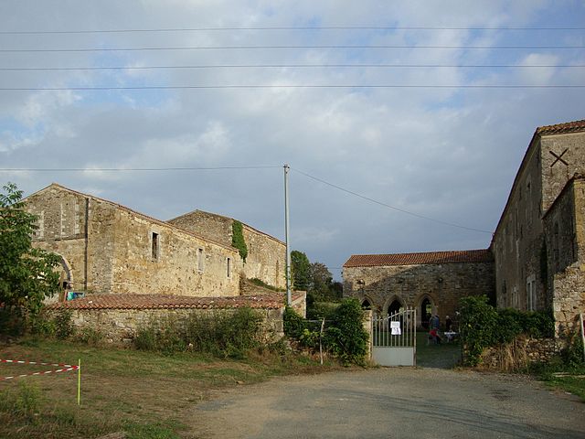
Sainte-Hermine (Sainte-Hermine)

- commune in Vendée, France
- Country:

- Postal Code: 85210
- Coordinates: 46° 33' 22" N, 1° 3' 20" E


- GPS tracks (wikiloc): [Link]
- Area: 34.47 sq km
- Population: 2884
- Web site: http://www.sainte-hermine.fr
- Wikipedia en: wiki(en)
- Wikipedia: wiki(fr)
- Wikidata storage: Wikidata: Q908541
- Wikipedia Commons Category: [Link]
- Freebase ID: [/m/02w94w4]
- GeoNames ID: Alt: [6454811]
- SIREN number: [218502235]
- BnF ID: [15278346q]
- VIAF ID: Alt: [238805168]
- Twitter username: Alt: [SainteHermine]
- INSEE municipality code: 85223
Shares border with regions:

Bournezeau
- commune in Vendée, France
- Country:
- Postal Code: 85480
- Coordinates: 46° 38' 14" N, 1° 10' 16" E
- GPS tracks (wikiloc): [Link]
- Area: 60.49 sq km
- Population: 3305
- Web site: [Link]


Saint-Juire-Champgillon
- commune in Vendée, France
- Country:
- Postal Code: 85210
- Coordinates: 46° 34' 41" N, 1° 1' 38" E
- GPS tracks (wikiloc): [Link]
- AboveSeaLevel: 65 м m
- Area: 20.75 sq km
- Population: 404


Saint-Jean-de-Beugné
- commune in Vendée, France
- Country:
- Postal Code: 85210
- Coordinates: 46° 31' 18" N, 1° 5' 14" E
- GPS tracks (wikiloc): [Link]
- Area: 13.36 sq km
- Population: 597
- Web site: [Link]


Saint-Étienne-de-Brillouet
- commune in Vendée, France
- Country:
- Postal Code: 85210
- Coordinates: 46° 31' 27" N, 0° 59' 58" E
- GPS tracks (wikiloc): [Link]
- Area: 18.93 sq km
- Population: 590

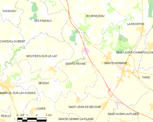
Sainte-Pexine
- commune in Vendée, France
- Country:
- Postal Code: 85320
- Coordinates: 46° 33' 40" N, 1° 8' 21" E
- GPS tracks (wikiloc): [Link]
- Area: 15.76 sq km
- Population: 246


Thiré
- commune in Vendée, France
- Country:
- Postal Code: 85210
- Coordinates: 46° 32' 57" N, 1° 0' 27" E
- GPS tracks (wikiloc): [Link]
- Area: 11.6 sq km
- Population: 567
- Web site: [Link]


La Réorthe
- commune in Vendée, France
- Country:
- Postal Code: 85210
- Coordinates: 46° 36' 25" N, 1° 2' 59" E
- GPS tracks (wikiloc): [Link]
- Area: 23.88 sq km
- Population: 1101

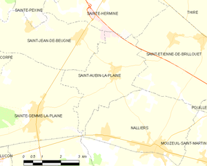
Saint-Aubin-la-Plaine
- commune in Vendée, France
- Country:
- Postal Code: 85210
- Coordinates: 46° 30' 23" N, 1° 3' 33" E
- GPS tracks (wikiloc): [Link]
- Area: 11.63 sq km
- Population: 529
- Web site: [Link]