Sammeron (Sammeron)

- commune in Seine-et-Marne, France
- Country:

- Postal Code: 77260
- Coordinates: 48° 56' 52" N, 3° 4' 55" E


- GPS tracks (wikiloc): [Link]
- Area: 6.06 sq km
- Population: 1121
- Web site: http://www.sammeron.fr
- Wikipedia en: wiki(en)
- Wikipedia: wiki(fr)
- Wikidata storage: Wikidata: Q243608
- Wikipedia Commons Category: [Link]
- Freebase ID: [/m/02rpxj3]
- Freebase ID: [/m/02rpxj3]
- GeoNames ID: Alt: [6443849]
- GeoNames ID: Alt: [6443849]
- SIREN number: [217704402]
- SIREN number: [217704402]
- BnF ID: [152757792]
- BnF ID: [152757792]
- INSEE municipality code: 77440
- INSEE municipality code: 77440
Shares border with regions:


Signy-Signets
- commune in Seine-et-Marne, France
- Country:
- Postal Code: 77640
- Coordinates: 48° 55' 40" N, 3° 4' 1" E
- GPS tracks (wikiloc): [Link]
- Area: 13.44 sq km
- Population: 596
- Web site: [Link]

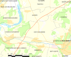
Ussy-sur-Marne
- commune in Seine-et-Marne, France
- Country:
- Postal Code: 77260
- Coordinates: 48° 57' 19" N, 3° 4' 23" E
- GPS tracks (wikiloc): [Link]
- Area: 13.93 sq km
- Population: 1042
- Web site: [Link]


Sept-Sorts
- commune in Seine-et-Marne, France
- Country:
- Postal Code: 77260
- Coordinates: 48° 56' 16" N, 3° 6' 11" E
- GPS tracks (wikiloc): [Link]
- Area: 3.22 sq km
- Population: 471


Jouarre
- commune in Seine-et-Marne, France
- Country:
- Postal Code: 77640
- Coordinates: 48° 55' 37" N, 3° 7' 48" E
- GPS tracks (wikiloc): [Link]
- Area: 42.19 sq km
- Population: 4214
- Web site: [Link]

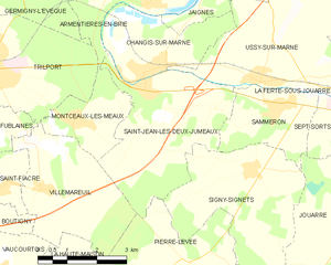
Saint-Jean-les-Deux-Jumeaux
- commune in Seine-et-Marne, France
- Country:
- Postal Code: 77660
- Coordinates: 48° 57' 5" N, 3° 1' 4" E
- GPS tracks (wikiloc): [Link]
- Area: 13.26 sq km
- Population: 1255