Sampigny (Sampigny)

- commune in Meuse, France
- Country:

- Postal Code: 55300
- Coordinates: 48° 49' 30" N, 5° 30' 41" E


- GPS tracks (wikiloc): [Link]
- Area: 20.53 sq km
- Population: 737
- Wikipedia en: wiki(en)
- Wikipedia: wiki(fr)
- Wikidata storage: Wikidata: Q816511
- Wikipedia Commons Category: [Link]
- Freebase ID: [/m/03qdtqx]
- GeoNames ID: Alt: [6454334]
- SIREN number: [215504671]
- BnF ID: [15265132j]
- VIAF ID: Alt: [236033427]
- GND ID: Alt: [4278629-0]
- INSEE municipality code: 55467
Shares border with regions:

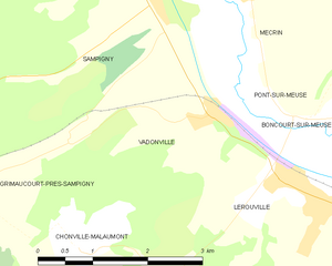
Vadonville
- commune in Meuse, France
- Country:
- Postal Code: 55200
- Coordinates: 48° 48' 7" N, 5° 31' 28" E
- GPS tracks (wikiloc): [Link]
- Area: 5.21 sq km
- Population: 262

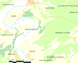
Han-sur-Meuse
- commune in Meuse, France
- Country:
- Postal Code: 55300
- Coordinates: 48° 51' 58" N, 5° 32' 20" E
- GPS tracks (wikiloc): [Link]
- Area: 17.22 sq km
- Population: 283


Mécrin
- commune in Meuse, France
- Country:
- Postal Code: 55300
- Coordinates: 48° 49' 31" N, 5° 31' 58" E
- GPS tracks (wikiloc): [Link]
- Area: 10.19 sq km
- Population: 225


Grimaucourt-près-Sampigny
- commune in Meuse, France
- Country:
- Postal Code: 55500
- Coordinates: 48° 47' 32" N, 5° 28' 7" E
- GPS tracks (wikiloc): [Link]
- Area: 9.27 sq km
- Population: 92


Ménil-aux-Bois
- commune in Meuse, France
- Country:
- Postal Code: 55260
- Coordinates: 48° 48' 19" N, 5° 26' 38" E
- GPS tracks (wikiloc): [Link]
- Area: 6.71 sq km
- Population: 43
Courcelles-en-Barrois
- commune in Meuse, France
- Country:
- Postal Code: 55260
- Coordinates: 48° 49' 30" N, 5° 26' 29" E
- GPS tracks (wikiloc): [Link]
- Area: 7.27 sq km
- Population: 35


Kœur-la-Petite
- commune in Meuse, France
- Country:
- Postal Code: 55300
- Coordinates: 48° 51' 19" N, 5° 29' 42" E
- GPS tracks (wikiloc): [Link]
- Area: 20.33 sq km
- Population: 301