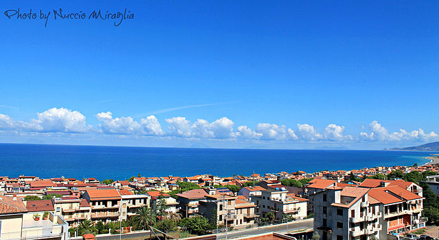
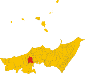
San Fratello (San Fratello)
.svg)
- Italian comune
 Hiking in San Fratello
San Fratello is a charming town in Sicily, Italy, nestled in the Nebrodi Mountains. The area is known for its stunning landscapes, diverse flora and fauna, and rich cultural heritage, making it a great destination for hiking enthusiasts.
Hiking Opportunities:
-
Trail Variety: The trails around San Fratello cater to various skill levels, from easy walks for beginners to more challenging treks for experienced hikers. You can find paths that lead through lush woodlands, alongside rivers, and up to panoramic viewpoints.
-
Nebrodi Park: Just a short distance from San Fratello, the Nebrodi Regional Park offers numerous hiking trails. The park is rich in biodiversity, home to unique plant species and wildlife such as wild boars and deer. Its trails often feature beautiful mountain vistas.
-
Historic Routes: Some trails may take you past ancient ruins, churches, and traditional Sicilian towns, allowing hikers to combine outdoor activities with cultural exploration.
-
Flora and Fauna: The area boasts a variety of ecosystems. As you hike, you may encounter chestnut groves, beech forests, and meadows filled with wildflowers. Birdwatching can also be rewarding, with numerous species inhabiting the region.
Hiking Tips:
- Best Time to Hike: Spring (April to June) and fall (September to October) are ideal times to hike, with mild temperatures and vibrant scenery.
- Gear: Wear sturdy hiking boots, and bring water, snacks, a map, and sun protection. A walking stick can be helpful on steeper trails.
- Local Guides: Consider hiring a local guide for a more enriching experience, as they can provide insights into the history and ecology of the area.
Safety Considerations:
- Always check the weather before heading out, as conditions can change rapidly in mountainous areas.
- Familiarize yourself with the trails and stay on marked paths to protect the environment.
Overall, hiking in and around San Fratello offers a beautiful blend of nature, culture, and adventure, making it a memorable experience for outdoor enthusiasts.
- Country:

- Postal Code: 98075
- Local Dialing Code: 0941
- Licence Plate Code: ME
- Coordinates: 38° 0' 46" N, 14° 35' 51" E


- GPS tracks (wikiloc): [Link]
- AboveSeaLevel: 675 м m
- Area: 67.63 sq km
- Population: 3592
- Web site: http://comunedisanfratello.it
- Wikipedia en: wiki(en)
- Wikipedia: wiki(it)
- Wikidata storage: Wikidata: Q491851
- Wikipedia Commons Category: [Link]
- Freebase ID: [/m/0gqd_2]
- GeoNames ID: Alt: [6539158]
- VIAF ID: Alt: [132691750]
- OSM relation ID: [39433]
- GND ID: Alt: [4507316-8]
- Library of Congress authority ID: Alt: [n96011567]
- ISTAT ID: 083078
- Italian cadastre code: H850
Shares border with regions:

Acquedolci
- Italian comune
Hiking in Acquedolci
Acquedolci, located in Sicily, Italy, offers a variety of hiking opportunities that showcase the region's natural beauty and rich cultural heritage. Here are some key aspects to consider if you're planning a hike in and around Acquedolci:...
- Country:
- Postal Code: 98070
- Local Dialing Code: 0941
- Licence Plate Code: ME
- Coordinates: 38° 3' 0" N, 14° 35' 0" E
- GPS tracks (wikiloc): [Link]
- AboveSeaLevel: 15 м m
- Area: 12.93 sq km
- Population: 5663
- Web site: [Link]


Militello Rosmarino
- Italian comune
Hiking in Militello Rosmarino
Militello Rosmarino, a charming town in Sicily, Italy, offers some wonderful opportunities for hiking, thanks to its scenic landscapes, mountainous terrain, and proximity to the Nebrodi National Park....
- Country:
- Postal Code: 98070
- Local Dialing Code: 0941
- Licence Plate Code: ME
- Coordinates: 38° 3' 0" N, 14° 41' 0" E
- GPS tracks (wikiloc): [Link]
- AboveSeaLevel: 450 м m
- Area: 29.54 sq km
- Population: 1276
- Web site: [Link]


Sant'Agata di Militello
- Italian comune
Hiking in Sant'Agata di Militello
Sant'Agata di Militello, located in the province of Messina in Sicily, is surrounded by beautiful natural landscapes that offer excellent hiking opportunities. The area is characterized by its scenic views, mountainous terrain, and proximity to the Nebrodi National Park, which is one of the largest protected natural areas in Sicily....
- Country:
- Postal Code: 98076
- Local Dialing Code: 0941
- Licence Plate Code: ME
- Coordinates: 38° 4' 0" N, 14° 38' 0" E
- GPS tracks (wikiloc): [Link]
- AboveSeaLevel: 30 м m
- Area: 33.98 sq km
- Population: 12393
- Web site: [Link]


Cesarò
- Italian comune
Hiking in Cesarò
Cesarò, located in the Nebrodi Mountains in Sicily, Italy, is a beautiful destination for hiking enthusiasts. The region is known for its stunning landscapes, rich biodiversity, and charming villages. Here are some key highlights and considerations for hiking in Cesarò:...
- Country:
- Postal Code: 98033
- Local Dialing Code: 095
- Licence Plate Code: ME
- Coordinates: 37° 51' 0" N, 14° 43' 0" E
- GPS tracks (wikiloc): [Link]
- AboveSeaLevel: 1150 м m
- Area: 216.93 sq km
- Population: 2379
- Web site: [Link]

Alcara li Fusi
- Italian comune
Hiking in Alcara li Fusi
Alcara li Fusi is a charming town located in the Sicilian region of Italy, nestled within the Nebrodi Mountains. This area is known for its stunning natural landscapes, rich biodiversity, and unique cultural heritage, making it an excellent destination for hiking enthusiasts....
- Country:
- Postal Code: 98070
- Local Dialing Code: 0941
- Licence Plate Code: ME
- Coordinates: 38° 1' 0" N, 14° 42' 0" E
- GPS tracks (wikiloc): [Link]
- AboveSeaLevel: 400 м m
- Area: 62.94 sq km
- Population: 1913
- Web site: [Link]


Caronia
- Italian comune
Hiking in Caronia
Caronia, a small coastal town in Sicily, Italy, is a great place for hiking enthusiasts who appreciate stunning landscapes and a rich cultural backdrop. While the town itself may not have extensive marked trails, the surrounding areas offer a variety of hiking opportunities....
- Country:
- Postal Code: 98072
- Local Dialing Code: 0921
- Licence Plate Code: ME
- Coordinates: 38° 1' 0" N, 14° 26' 0" E
- GPS tracks (wikiloc): [Link]
- AboveSeaLevel: 304 м m
- Area: 227.26 sq km
- Population: 3279
- Web site: [Link]