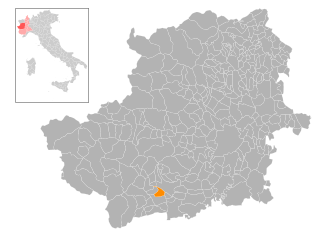
San Germano Chisone (San Germano Chisone)

- Italian comune
 Hiking in San Germano Chisone
San Germano Chisone is a charming village located in the Piedmont region of Italy, nestled in the Susa Valley and surrounded by the breathtaking Alpine landscape. Hiking in this area offers a range of trails suitable for various skill levels, allowing you to experience the stunning natural beauty and rich culture of the region.
Popular Hiking Trails
-
Monte F indicta: This is a moderately challenging trail that leads you to the summit of Monte F indicta. The views from the top are spectacular, offering panoramic vistas of the Susa Valley and the surrounding mountains.
-
Val Chisone: The trails in Val Chisone provide beautiful routes that roam through forests, meadows, and alongside rivers. You can find both easier paths for leisurely walks and more strenuous climbs for experienced hikers.
-
Colle delle Finestre: This trail provides access to historical military fortifications and offers a glimpse into the region's history. The hike is rewarding, with impressive views of the surrounding peaks, especially on clearer days.
-
Trail to Fenestrelle Fort: Hiking to the famous Fenestrelle Fort from San Germano provides a fascinating blend of history and nature. The trail takes you through beautiful landscapes, and the fort itself is a remarkable site that you can explore.
Things to Consider
-
Difficulty Levels: As with any hiking location, be sure to choose trails that match your experience and fitness level. Many trails are well-marked, but some can be challenging, especially in inclement weather.
-
Seasonality: The best time to hike in San Germano Chisone is during the spring to fall months. Winters can bring snow, and certain trails may become impassable. Always check local conditions before heading out.
-
Wildlife and Flora: The region is rich in biodiversity. Keep an eye out for local wildlife and take note of the various plant species along your route.
-
Navigation: While many trails are well-marked, having a map or hiking app can enhance your experience and help you stay oriented.
-
Safety: Always inform someone of your hiking plans, bring enough water and snacks, wear suitable footwear, and consider carrying a first-aid kit.
Local Culture
In addition to hiking, San Germano Chisone offers a glimpse into local culture, with charming architecture and traditional cuisine to enjoy after a day on the trails. Be sure to try regional dishes, such as hearty polenta or local cheeses, which can provide a delicious end to your hiking adventures.
Whether you’re looking for a relaxing day hike or an adventurous trek, San Germano Chisone has something to offer for everyone. Enjoy your hiking experience in this beautiful part of Italy!
- Country:

- Postal Code: 10065
- Local Dialing Code: 0121
- Licence Plate Code: TO
- Coordinates: 44° 54' 0" N, 7° 14' 0" E


- GPS tracks (wikiloc): [Link]
- AboveSeaLevel: 488 м m
- Area: 15.86 sq km
- Population: 1776
- Web site: http://www.comune.sangermanochisone.to.it
- Wikipedia en: wiki(en)
- Wikipedia: wiki(it)
- Wikidata storage: Wikidata: Q10264
- Wikipedia Commons Category: [Link]
- Freebase ID: [/m/0g8lnb]
- GeoNames ID: Alt: [6543265]
- OSM relation ID: [43758]
- Quora topic ID: [San-German]
- ISTAT ID: 001242
- Italian cadastre code: H862
Shares border with regions:


Porte
- comune (municipality) in the Province of Turin in the Italian region Piedmont
Hiking in Porte
Hiking in Porte, located in the Piedmont region of Italy, offers a wealth of opportunities for outdoor enthusiasts. Nestled in the Susa Valley and surrounded by the stunning peaks of the Alps, Porte is an excellent base for exploring the natural beauty of the area....
- Country:
- Postal Code: 10060
- Local Dialing Code: 0121
- Licence Plate Code: TO
- Coordinates: 44° 53' 13" N, 7° 16' 4" E
- GPS tracks (wikiloc): [Link]
- AboveSeaLevel: 427 м m
- Area: 4.45 sq km
- Population: 1058
- Web site: [Link]


Pramollo
- Italian comune
Hiking in Pramollo
Pramollo, also known as the Pramollo Pass, is located in the Carnic Alps along the border between Italy and Austria. This region offers a variety of hiking opportunities with stunning landscapes, diverse flora, and impressive views of the surrounding mountains....
- Country:
- Postal Code: 10065
- Local Dialing Code: 0121
- Licence Plate Code: TO
- Coordinates: 44° 54' 0" N, 7° 13' 0" E
- GPS tracks (wikiloc): [Link]
- AboveSeaLevel: 1071 м m
- Area: 22.48 sq km
- Population: 229
- Web site: [Link]
Prarostino
- Italian comune
Hiking in Prarostino
Prarostino is a charming village located in the Piedmont region of Italy, nestled within the Susa Valley and surrounded by the breathtaking landscapes of the Italian Alps. It is an excellent destination for hiking enthusiasts, thanks to its diverse trails and stunning natural beauty....
- Country:
- Postal Code: 10060
- Local Dialing Code: 0121
- Licence Plate Code: TO
- Coordinates: 44° 52' 0" N, 7° 16' 0" E
- GPS tracks (wikiloc): [Link]
- AboveSeaLevel: 738 м m
- Area: 10.51 sq km
- Population: 1271
- Web site: [Link]

San Secondo di Pinerolo
- Italian comune
Hiking in San Secondo di Pinerolo
San Secondo di Pinerolo is a charming municipality in the Piedmont region of Italy, located near the foothills of the Susa Valley and the broader Alps. Hiking in this area offers a mix of scenic views, historical sites, and a rich natural environment. Here’s what you can expect:...
- Country:
- Postal Code: 10060
- Local Dialing Code: 0121
- Licence Plate Code: TO
- Coordinates: 44° 52' 0" N, 7° 18' 0" E
- GPS tracks (wikiloc): [Link]
- AboveSeaLevel: 413 м m
- Area: 12.57 sq km
- Population: 3632
- Web site: [Link]


Villar Perosa
- Italian comune
Hiking in Villar Perosa
Villar Perosa is a small town located in the province of Turin, in the Piedmont region of Italy. The area is known for its natural beauty and proximity to the Susa Valley and the surrounding mountains, making it a great destination for hiking enthusiasts....
- Country:
- Postal Code: 10069
- Local Dialing Code: 0121
- Licence Plate Code: TO
- Coordinates: 44° 55' 0" N, 7° 15' 0" E
- GPS tracks (wikiloc): [Link]
- AboveSeaLevel: 489 м m
- Area: 11.42 sq km
- Population: 4026
- Web site: [Link]


Angrogna
- Italian comune
Hiking in Angrogna
Angrogna, located in the Piedmont region of northern Italy, is an excellent destination for hiking enthusiasts. Nestled in the Susa Valley, it offers breathtaking landscapes, rich history, and an array of trails suited for various skill levels. Here are some key highlights about hiking in Angrogna:...
- Country:
- Postal Code: 10060
- Local Dialing Code: 0121
- Licence Plate Code: TO
- Coordinates: 44° 51' 0" N, 7° 13' 0" E
- GPS tracks (wikiloc): [Link]
- AboveSeaLevel: 782 м m
- Area: 38.88 sq km
- Population: 868
- Web site: [Link]


Inverso Pinasca
- Italian comune
Hiking in Inverso Pinasca
Inverso Pinasca, located in the beautiful Italian region of Piedmont, is a popular destination for hiking enthusiasts. Nestled in the Susa Valley and surrounded by impressive mountains, it offers a range of trails that cater to varying levels of experience and fitness. Here are some highlights of hiking in the area:...
- Country:
- Postal Code: 10060
- Local Dialing Code: 0121
- Licence Plate Code: TO
- Coordinates: 44° 57' 0" N, 7° 13' 0" E
- GPS tracks (wikiloc): [Link]
- AboveSeaLevel: 560 м m
- Area: 8.03 sq km
- Population: 704
- Web site: [Link]