
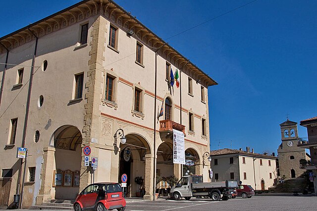
San Leo (San Leo)
.svg)
- Italian comune
 Hiking in San Leo
San Leo is a picturesque town located in the Emilia-Romagna region of Italy, perched on a rocky outcrop and surrounded by stunning landscapes. Hiking in and around San Leo offers a unique blend of natural beauty and historical exploration.
Hiking Trails and Routes
-
The San Leo Fortress Loop:
- This loop takes you around the impressive San Leo Fortress, a stunning example of Renaissance military architecture.
- The trail offers panoramic views of the surrounding hills and valleys, making it a great choice for photography enthusiasts.
-
Montefeltro Hills Trails:
- The area surrounding San Leo is part of the Montefeltro region, characterized by rolling hills and lush greenery.
- Several trails wind through this landscape, ranging from easy to moderate, perfect for all skill levels.
-
Path of the Pilgrim:
- This historical path connects religious sites in the region, including visits to neighboring towns like Pennabilli and Sant'Agata Feltria.
- The trail provides a spiritual experience combined with the beauty of nature, as you hike through forests and meadows.
-
Gola del Furlo Nature Reserve:
- Located a bit further away, this reserve features dramatic cliffs and the Furlo Gorge, providing beautiful hiking opportunities along the River Candigliano.
- Trails vary in length and difficulty, with options for both short walks and longer treks.
What to Bring
- Footwear: Proper hiking boots or shoes are essential for comfort and safety on varied terrain.
- Clothing: Dress in layers to accommodate changing weather conditions. Lightweight, breathable fabrics are ideal.
- Navigation: A map or a GPS device can be helpful for exploring the trails, as some routes may not be well-marked.
- Water and Snacks: Hydration is important, so carry sufficient water, as well as energy-boosting snacks.
- Sun Protection: Sunscreen, a hat, and sunglasses are recommended, especially during warmer months.
Local Insights
- Best Season: Spring (April to June) and Fall (September to October) are ideal for hiking in San Leo due to mild weather and stunning foliage.
- Cultural Attractions: When not hiking, take the time to explore San Leo’s historical sites, such as the Cathedral of San Leo and the various museums in town.
Safety Tips
- Always let someone know your hiking plans and estimated return time.
- Be aware of your limits and choose trails that match your experience level.
- Check the weather forecast before heading out to avoid sudden changes in conditions.
Hiking in San Leo combines the joys of outdoor adventure with the chance to immerse yourself in rich Italian culture and history, making it an excellent destination for all nature lovers and hikers.
- Country:

- Postal Code: 47865
- Local Dialing Code: 0541
- Licence Plate Code: RN
- Coordinates: 43° 53' 47" N, 12° 20' 36" E


- GPS tracks (wikiloc): [Link]
- AboveSeaLevel: 589 м m
- Area: 53.14 sq km
- Population: 2883
- Web site: http://www.comune.san-leo.ps.it
- Wikipedia en: wiki(en)
- Wikipedia: wiki(it)
- Wikidata storage: Wikidata: Q111942
- Wikipedia Commons Gallery: [Link]
- Wikipedia Commons Category: [Link]
- Freebase ID: [/m/0gl530]
- GeoNames ID: Alt: [6539721]
- VIAF ID: Alt: [240516987]
- OSM relation ID: [42716]
- GND ID: Alt: [4370023-8]
- UN/LOCODE: [ITZUX]
- Digital Atlas of the Roman Empire ID: [18743]
- Pleiades ID: [413210]
- ISTAT ID: 099025
- Italian cadastre code: H949
Shares border with regions:
Maiolo
- Italian comune
Hiking in Maiolo
Maiolo, a small village in the Emilia-Romagna region of Italy, offers an array of hiking opportunities that highlight its stunning landscapes and natural beauty. Nestled in the Apennine Mountains, Maiolo is known for its rolling hills, lush forests, and scenic vistas, making it a great destination for outdoor enthusiasts....
- Country:
- Postal Code: 47862
- Local Dialing Code: 0541
- Licence Plate Code: RN
- Coordinates: 43° 52' 27" N, 12° 18' 34" E
- GPS tracks (wikiloc): [Link]
- AboveSeaLevel: 590 м m
- Area: 24.28 sq km
- Population: 819
- Web site: [Link]

Novafeltria
- Italian comune
Hiking in Novafeltria
Novafeltria, located in the Emilia-Romagna region of Italy, is surrounded by the stunning landscapes of the Apennine Mountains. This area offers a variety of hiking opportunities for different skill levels. Here’s what you can expect when hiking in Novafeltria:...
- Country:
- Postal Code: 47863
- Local Dialing Code: 0541
- Licence Plate Code: RN
- Coordinates: 43° 53' 43" N, 12° 17' 26" E
- GPS tracks (wikiloc): [Link]
- AboveSeaLevel: 275 м m
- Area: 41.84 sq km
- Population: 7119
- Web site: [Link]


Verucchio
- Italian comune
Hiking in Verucchio
Verucchio, located in the Emilia-Romagna region of Italy, is a picturesque village that offers an array of hiking opportunities amidst stunning landscapes and historical landmarks. Here are some highlights about hiking in and around Verucchio:...
- Country:
- Postal Code: 47826
- Local Dialing Code: 0541
- Licence Plate Code: RN
- Coordinates: 43° 59' 0" N, 12° 25' 17" E
- GPS tracks (wikiloc): [Link]
- AboveSeaLevel: 330 м m
- Area: 27.3 sq km
- Population: 10012
- Web site: [Link]


Monte Grimano
- Italian comune
Hiking in Monte Grimano
Monte Grimano Terme, located in the Marche region of Italy, is a fantastic destination for hiking enthusiasts. The area is known for its beautiful landscapes, rolling hills, and lush green forests, making it perfect for outdoor activities like hiking....
- Country:
- Postal Code: 61010
- Local Dialing Code: 0541
- Licence Plate Code: PU
- Coordinates: 43° 52' 4" N, 12° 28' 16" E
- GPS tracks (wikiloc): [Link]
- AboveSeaLevel: 536 м m
- Area: 23.97 sq km
- Population: 1119
- Web site: [Link]


Montecopiolo
- Italian comune
Hiking in Montecopiolo
Montecopiolo is a beautiful destination for hiking enthusiasts, located in the Marche region of Italy. The area offers a variety of scenic trails with stunning views, rich biodiversity, and the charm of the surrounding Italian countryside....
- Country:
- Postal Code: 61014
- Local Dialing Code: 0722
- Licence Plate Code: PU
- Coordinates: 43° 50' 28" N, 12° 21' 35" E
- GPS tracks (wikiloc): [Link]
- AboveSeaLevel: 915 м m
- Area: 35.81 sq km
- Population: 1101
- Web site: [Link]


Sassofeltrio
- Italian comune
Hiking in Sassofeltrio
Sassofeltrio is a picturesque area located in the Marche region of Italy, near the border with San Marino. It's known for its beautiful landscapes, rolling hills, and charming villages. While Sassofeltrio itself may not be as widely recognized as a hiking destination compared to other areas in Italy, it offers various trails that can provide a delightful hiking experience....
- Country:
- Postal Code: 61013
- Local Dialing Code: 0541
- Licence Plate Code: PU
- Coordinates: 43° 53' 31" N, 12° 30' 33" E
- GPS tracks (wikiloc): [Link]
- AboveSeaLevel: 468 м m
- Area: 21.08 sq km
- Population: 1418
- Web site: [Link]