San Paolo Albanese (San Paolo Albanese)
.svg)
- Italian comune
 Hiking in San Paolo Albanese
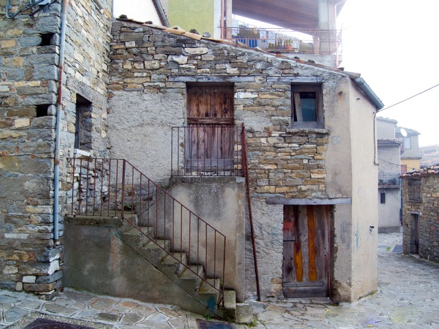
San Paolo Albanese is a quaint village located in the region of Basilicata in southern Italy, known for its stunning landscapes, rich history, and Albanian heritage. Hiking in this area offers a unique blend of natural beauty and cultural experiences.
Hiking Trails:
-
Villages of the Sila: The surrounding area, including parts of the Sila National Park, offers well-marked trails with varying levels of difficulty. You can enjoy hiking through dense forests, alongside rivers, and up to panoramic viewpoints.
-
Natural Parks: The nearby Pollino National Park boasts spectacular mountain ranges, diverse flora and fauna, and breathtaking views. Trails range from easy walks to more challenging hikes, suitable for all levels.
-
Historical Trails: Explore paths that lead through the village itself, where you can experience the unique cultural blend of Italian and Albanian traditions. The architecture and the local cuisine are highlights of the area.
What to Bring:
- Footwear: Sturdy hiking boots are recommended for varied terrains.
- Water: Carry enough water to stay hydrated, especially during warmer months.
- Map and Compass: While many trails are marked, it’s good to have a map for navigation.
- Snacks: Energy bars or fruits can keep your energy levels up during the hike.
- Weather Gear: Depending on the season, prepare for possible rain or sudden changes in weather.
Best Time to Hike:
- Spring (April to June): Ideal for blooming wildflowers and mild temperatures.
- Fall (September to November): Cooler weather and beautiful autumn colors make for a scenic hiking experience.
- Summer (July to August): Can be hot, so early morning or late evening hikes are preferable.
Cultural Insights:
- Local Cuisine: After hiking, indulge in local dishes such as "pasta alla Gricia" or traditional Albanian meals that reflect the area’s unique heritage.
- Festivals: If your visit coincides with local festivals, participating can enhance your experience and connection to the culture.
Tips:
- Always inform someone of your hiking plans and expected return time.
- Be mindful of wildlife and respect local habitats.
- Follow "Leave No Trace" principles to preserve the natural beauty of the area.
Hiking in San Paolo Albanese can be a truly rewarding experience, intertwining the exploration of nature with cultural richness. Enjoy your adventure!
- Country:

- Postal Code: 85030
- Local Dialing Code: 0973
- Licence Plate Code: PZ
- Coordinates: 40° 2' 0" N, 16° 20' 0" E


- GPS tracks (wikiloc): [Link]
- AboveSeaLevel: 800 м m
- Area: 30.22 sq km
- Population: 260
- Web site: http://www.comune.sanpaoloalbanese.pz.it
- Wikipedia en: wiki(en)
- Wikipedia: wiki(it)
- Wikidata storage: Wikidata: Q52664
- Wikipedia Commons Category: [Link]
- Freebase ID: [/m/0fh3th]
- GeoNames ID: Alt: [6542067]
- BnF ID: [12078051q]
- VIAF ID: Alt: [150951161]
- OSM relation ID: [40191]
- Library of Congress authority ID: Alt: [n85061495]
- ISTAT ID: 076020
- Italian cadastre code: B906
Shares border with regions:
Cersosimo
- Italian comune
Hiking in Cersosimo
Cersosimo, a charming town in the Calabria region of southern Italy, is known for its stunning natural landscapes, making it a great destination for hiking enthusiasts. The area is characterized by rugged terrain, this town offers various trails that cater to different skill levels. Here are some aspects to consider when hiking in and around Cersosimo:...
- Country:
- Postal Code: 85030
- Local Dialing Code: 0973
- Licence Plate Code: PZ
- Coordinates: 40° 3' 0" N, 16° 21' 0" E
- GPS tracks (wikiloc): [Link]
- AboveSeaLevel: 548 м m
- Area: 24.75 sq km
- Population: 622
- Web site: [Link]
Noepoli
- Italian comune
Hiking in Noepoli
Noepoli is a small town located in the southern part of Italy, specifically in the Basilicata region. While it may not be as widely known for hiking as some other areas in Italy, it does offer opportunities for outdoor enthusiasts looking to explore the natural beauty of the region....
- Country:
- Postal Code: 85035
- Local Dialing Code: 0973
- Licence Plate Code: PZ
- Coordinates: 40° 5' 0" N, 16° 20' 0" E
- GPS tracks (wikiloc): [Link]
- AboveSeaLevel: 676 м m
- Area: 46.71 sq km
- Population: 841
- Web site: [Link]


San Costantino Albanese
- Italian comune
Hiking in San Costantino Albanese
San Costantino Albanese is a charming village located in the Basilicata region of southern Italy. It sits in the Pollino National Park, which offers stunning landscapes and diverse ecosystems, making it an excellent destination for hiking enthusiasts....
- Country:
- Postal Code: 85030
- Local Dialing Code: 0973
- Licence Plate Code: PZ
- Coordinates: 40° 2' 0" N, 16° 18' 0" E
- GPS tracks (wikiloc): [Link]
- AboveSeaLevel: 650 м m
- Area: 43.25 sq km
- Population: 686
- Web site: [Link]
Terranova di Pollino
- Italian comune
Hiking in Terranova di Pollino
Terranova di Pollino, located in the Pollino National Park in southern Italy, is a fantastic destination for hiking enthusiasts. The park is known for its stunning landscapes, diverse flora and fauna, and significant geological formations. Here are some key highlights about hiking in this area:...
- Country:
- Postal Code: 85030
- Local Dialing Code: 0973
- Licence Plate Code: PZ
- Coordinates: 39° 59' 0" N, 16° 18' 0" E
- GPS tracks (wikiloc): [Link]
- AboveSeaLevel: 926 м m
- Area: 113.07 sq km
- Population: 1141
- Web site: [Link]

Alessandria del Carretto
- Italian comune
Hiking in Alessandria del Carretto
Alessandria del Carretto is a charming village located in the Calabria region of southern Italy, nestled in the Sila National Park. The area is known for its stunning landscapes, rich biodiversity, and unique cultural heritage, making it an excellent destination for hikers and nature enthusiasts....
- Country:
- Postal Code: 87070
- Local Dialing Code: 0981
- Licence Plate Code: CS
- Coordinates: 39° 58' 0" N, 16° 23' 0" E
- GPS tracks (wikiloc): [Link]
- AboveSeaLevel: 1005 м m
- Area: 41.12 sq km
- Population: 432
- Web site: [Link]