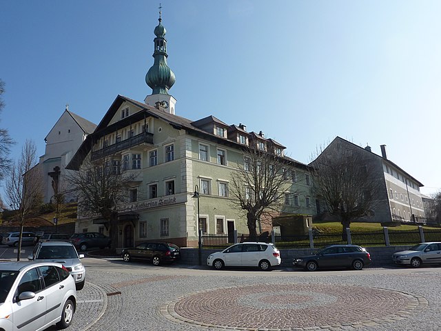
Sankt Veit im Innkreis (St. Veit im Innkreis)
- municipality in Austria
 Hiking in Sankt Veit im Innkreis
Sankt Veit im Innkreis, located in the Austrian state of Upper Austria, offers a charming setting for hiking enthusiasts. The region is characterized by picturesque landscapes featuring rolling hills, lush forests, and stunning views of the surrounding countryside.
Hiking Opportunities
-
Trails: There are several marked hiking trails in and around Sankt Veit im Innkreis, catering to various skill levels. Some trails are easy walks suitable for families, while others may present more of a challenge for seasoned hikers.
-
Scenic Views: Many trails provide beautiful panoramic views of the Inn Valley and the nearby hills. Depending on your route, you may also encounter quaint villages and historical sites along the way.
-
Wildlife and Nature: The area is home to diverse flora and fauna. As you hike, keep an eye out for local wildlife, including birds and small mammals that inhabit the forests.
-
Local Parks: Nearby parks and nature reserves can offer additional hiking options. These areas often have well-maintained paths and facilities for resting, picnicking, or simply enjoying the natural beauty.
Preparation Tips
- Footwear: Good hiking boots are essential for comfort and safety, especially on uneven terrain.
- Weather: Check the weather forecast before your hike, as conditions can change quickly.
- Navigation: Carry a map or use a GPS-enabled device to help navigate the trails, particularly if you’re venturing into less familiar areas.
- Hydration and Snacks: Bring plenty of water and some snacks to keep your energy levels up during your hike.
Local Insights
Engaging with local hiking clubs or guides can enhance your experience, as they can provide valuable insights into the best trails, local history, and wildlife observations.
Overall, Sankt Veit im Innkreis offers a great hiking experience for those looking to explore Austria's natural beauty while enjoying the tranquility of the countryside.
- Country:

- Postal Code: 5273
- Local Dialing Code: 07723
- Licence Plate Code: BR
- Coordinates: 48° 12' 33" N, 13° 16' 32" E


- GPS tracks (wikiloc): [Link]
- AboveSeaLevel: 411 м m
- Area: 5.39 sq km
- Population: 408
- Web site: http://www.st-veit-innkreis.at/
- Wikipedia en: wiki(en)
- Wikipedia: wiki(de)
- Wikidata storage: Wikidata: Q669081
- Wikipedia Commons Category: [Link]
- Freebase ID: [/m/03gv2s4]
- GeoNames ID: Alt: [7873112]
- Austrian municipality key: [40440]
Shares border with regions:

Altheim
- municipality in Austria
Hiking in Altheim
Altheim, Austria, is a small but charming town located in the upper part of the country, nestled amidst beautiful landscapes that provide opportunities for various outdoor activities, including hiking. While Altheim itself might not be a major hiking destination, its surrounding areas offer numerous trails and routes suitable for hikers of all skill levels....
- Country:
- Postal Code: 4950
- Local Dialing Code: 07723
- Licence Plate Code: BR
- Coordinates: 48° 15' 0" N, 13° 14' 0" E
- GPS tracks (wikiloc): [Link]
- AboveSeaLevel: 363 м m
- Area: 22.63 sq km
- Population: 4839
- Web site: [Link]

Polling im Innkreis
- municipality in Austria
Hiking in Polling im Innkreis
Polling im Innkreis, a charming municipality in Austria, offers a variety of hiking opportunities surrounded by picturesque landscapes. The region features rolling hills, meadows, and forests that provide a serene setting for outdoor enthusiasts....
- Country:
- Postal Code: 4951
- Local Dialing Code: 07723
- Licence Plate Code: BR
- Coordinates: 48° 13' 50" N, 13° 16' 50" E
- GPS tracks (wikiloc): [Link]
- AboveSeaLevel: 385 м m
- Area: 15.11 sq km
- Population: 997
- Web site: [Link]
Roßbach
- municipality in Austria
Hiking in Roßbach
Roßbach, Austria, is a beautiful destination for hiking enthusiasts, offering stunning natural landscapes, serene trails, and a pleasant climate. While it may be a smaller village, it is surrounded by the picturesque scenery of the Austrian countryside, making it an ideal base for exploring the region's trails....
- Country:
- Postal Code: 5273
- Licence Plate Code: BR
- Coordinates: 48° 12' 0" N, 13° 15' 10" E
- GPS tracks (wikiloc): [Link]
- AboveSeaLevel: 442 м m
- Area: 14.92 sq km
- Population: 935
- Web site: [Link]
Aspach, Upper Austria
- municipality in Austria
Hiking in Aspach, Upper Austria
Aspach, located in Upper Austria, is a charming destination for hiking enthusiasts. The region is characterized by its picturesque landscapes, rolling hills, and lush forests, making it ideal for outdoor activities. Here are some key points to consider when hiking in Aspach:...
- Country:
- Local Dialing Code: 07755
- Licence Plate Code: BR
- Coordinates: 48° 11' 10" N, 13° 18' 20" E
- GPS tracks (wikiloc): [Link]
- AboveSeaLevel: 443 м m
- Area: 31.46 sq km
- Population: 2596
- Web site: [Link]