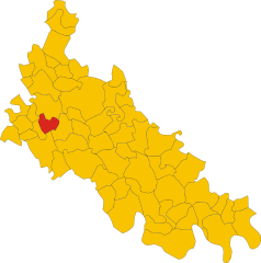
Sant'Angelo Lodigiano (Sant'Angelo Lodigiano)
.svg)
- Italian comune
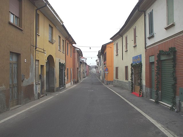
 Hiking in Sant'Angelo Lodigiano
Sant'Angelo Lodigiano, located in the Lombardy region of Italy, offers a picturesque setting for hiking enthusiasts. While it may not be as famous as other Italian hiking destinations, it does have its own charm and opportunities for outdoor activities.
Hiking Areas and Trails
-
Natural Surroundings: The area around Sant'Angelo Lodigiano is characterized by gentle hills, the rugged banks of the river Adda, and rolling countryside. This makes for lovely hiking trails that allow you to enjoy the natural beauty and tranquility of the region.
-
Parco Adda Sud: A short distance from Sant'Angelo Lodigiano, this park offers a variety of trails for hikers. You can explore the riverbanks and enjoy the diverse flora and fauna. It’s also a great place for birdwatching.
-
Local Trails: There are various walking routes that can lead you through charming villages and scenic landscapes. Many of these trails are relatively flat, making them suitable for all skill levels.
-
Cultural Stops: As you hike, you can take time to explore local cultural and historical sites. Villages along the way may have beautiful churches, historic buildings, and local food specialties.
Tips for Hiking in Sant'Angelo Lodigiano
-
Timing: Spring and early autumn are ideal times to hike in this region, as the weather is mild and the landscapes are lush.
-
Gear: Wear comfortable hiking shoes, and dress in layers, as weather can change quickly.
-
Navigation: It’s advisable to have a map or a GPS device, as while many trails are marked, some may not be easily identifiable.
-
Hydration and Snacks: Carry enough water and snacks, especially if you plan to hike longer distances.
-
Respect Nature: Follow local guidelines for wildlife conservation and leave no trace behind.
While Sant'Angelo Lodigiano may not offer the dramatic mountain scenery found in other regions of Italy, it does provide a lovely backdrop for a peaceful hiking experience full of natural beauty and cultural exploration.
- Country:

- Postal Code: 26866
- Local Dialing Code: 0371
- Licence Plate Code: LO
- Coordinates: 45° 14' 20" N, 9° 24' 35" E


- GPS tracks (wikiloc): [Link]
- AboveSeaLevel: 73 м m
- Area: 20.05 sq km
- Population: 13202
- Web site: http://www.comune.santangelolodigiano.lo.it/
- Wikipedia en: wiki(en)
- Wikipedia: wiki(it)
- Wikidata storage: Wikidata: Q42220
- Wikipedia Commons Category: [Link]
- Freebase ID: [/m/0gr65f]
- GeoNames ID: Alt: [6538015]
- VIAF ID: Alt: [155048581]
- OSM relation ID: [44438]
- UN/LOCODE: [ITSOH]
- ISTAT ID: 098050
- Italian cadastre code: I274
Shares border with regions:


Inverno e Monteleone
- Italian comune
Hiking in Inverno e Monteleone
Inverno e Monteleone, located in the Lombardy region of Italy, offers a picturesque backdrop for hiking enthusiasts. This area combines natural beauty with cultural heritage, making it ideal for those looking to explore both landscapes and local history....
- Country:
- Postal Code: 27010
- Local Dialing Code: 0382
- Licence Plate Code: PV
- Coordinates: 45° 12' 0" N, 9° 23' 0" E
- GPS tracks (wikiloc): [Link]
- AboveSeaLevel: 74 м m
- Area: 9.64 sq km
- Population: 1493
- Web site: [Link]

Miradolo Terme
- Italian comune
Hiking in Miradolo Terme
Miradolo Terme is a charming village located in the Lombardy region of Italy, known for its scenic landscapes and outdoor activities, including hiking. The area around Miradolo Terme offers a variety of trails that cater to different skill levels, making it suitable for both beginners and experienced hikers....
- Country:
- Postal Code: 27010
- Local Dialing Code: 0382
- Licence Plate Code: PV
- Coordinates: 45° 9' 0" N, 9° 29' 0" E
- GPS tracks (wikiloc): [Link]
- AboveSeaLevel: 72 м m
- Area: 9.56 sq km
- Population: 3714
- Web site: [Link]


Villanterio
- Italian comune
Hiking in Villanterio
Villanterio is a small village located in Italy, nestled in the countryside, which may be less known compared to major hiking destinations. However, the surrounding area and the region's natural landscapes can provide some wonderful hiking opportunities....
- Country:
- Postal Code: 27019
- Local Dialing Code: 0382
- Licence Plate Code: PV
- Coordinates: 45° 13' 0" N, 9° 22' 0" E
- GPS tracks (wikiloc): [Link]
- AboveSeaLevel: 75 м m
- Area: 14.77 sq km
- Population: 3065
- Web site: [Link]


Villanova del Sillaro
- Italian comune
Hiking in Villanova del Sillaro
Villanova del Sillaro is a charming small village located in the Emilia-Romagna region of Italy. While it may not be as famed as some larger Italian hiking destinations, it offers an enchanting landscape for those looking to explore the Italian countryside....
- Country:
- Postal Code: 26818
- Local Dialing Code: 0371
- Licence Plate Code: LO
- Coordinates: 45° 14' 20" N, 9° 28' 58" E
- GPS tracks (wikiloc): [Link]
- AboveSeaLevel: 69 м m
- Area: 13.5 sq km
- Population: 1869
- Web site: [Link]


Pieve Fissiraga
- Italian comune
Hiking in Pieve Fissiraga
Pieve Fissiraga is a small town in the Lombardy region of Italy, situated near Lodi, and while it may not be a well-known hiking destination, it can serve as a starting point for exploring the surrounding countryside. Here are some insights into hiking in and around Pieve Fissiraga:...
- Country:
- Postal Code: 26854
- Local Dialing Code: 0371
- Licence Plate Code: LO
- Coordinates: 45° 15' 51" N, 9° 27' 34" E
- GPS tracks (wikiloc): [Link]
- AboveSeaLevel: 76 м m
- Area: 12.27 sq km
- Population: 1780
- Web site: [Link]

Borgo San Giovanni
- Italian comune
Hiking in Borgo San Giovanni
Borgo San Giovanni, located in the Lombardy region of Italy, offers a range of hiking opportunities for outdoor enthusiasts. While it may not be as well-known as some of the larger national parks or mountain ranges, it has its unique charm and beautiful landscapes for those looking to explore....
- Country:
- Postal Code: 26851
- Local Dialing Code: 0371
- Licence Plate Code: LO
- Coordinates: 45° 16' 44" N, 9° 26' 10" E
- GPS tracks (wikiloc): [Link]
- AboveSeaLevel: 77 м m
- Area: 7.5 sq km
- Population: 2445
- Web site: [Link]
Marudo
- Italian comune
Hiking in Marudo
Marudo, a region in Spain, is known for its beautiful landscapes and rich natural environment, making it an excellent destination for hiking enthusiasts. Here are some highlights to consider if you're planning a hiking trip to Marudo:...
- Country:
- Postal Code: 26866
- Local Dialing Code: 0371
- Licence Plate Code: LO
- Coordinates: 45° 15' 14" N, 9° 22' 42" E
- GPS tracks (wikiloc): [Link]
- AboveSeaLevel: 77 м m
- Area: 4.2 sq km
- Population: 1720
- Web site: [Link]


Graffignana
- Italian comune
Hiking in Graffignana
Graffignana is a small town located in the Lombardy region of northern Italy. While it might not be as well-known for hiking as some other areas in Italy, there are still opportunities for outdoor enthusiasts to enjoy nature and engage in hiking activities in and around the town....
- Country:
- Postal Code: 26813
- Local Dialing Code: 0371
- Licence Plate Code: LO
- Coordinates: 45° 12' 27" N, 9° 27' 19" E
- GPS tracks (wikiloc): [Link]
- AboveSeaLevel: 67 м m
- Area: 10.92 sq km
- Population: 2612
- Web site: [Link]


Castiraga Vidardo
- Italian comune
Hiking in Castiraga Vidardo
Castiraga Vidardo is a small municipality located in the Lombardy region of Italy. While it might not be as widely known for hiking as some of the larger natural parks or mountainous areas in Italy, it's situated in a region that offers a variety of outdoor activities, including hiking....
- Country:
- Postal Code: 26866
- Local Dialing Code: 0371
- Licence Plate Code: LO
- Coordinates: 45° 15' 45" N, 9° 23' 58" E
- GPS tracks (wikiloc): [Link]
- AboveSeaLevel: 74 м m
- Area: 5.04 sq km
- Population: 2836
- Web site: [Link]