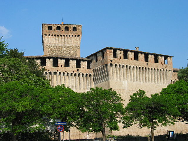
Sant'Ilario d'Enza (Sant'Ilario d'Enza)
.svg)
- Italian comune
 Hiking in Sant'Ilario d'Enza
Sant'Ilario d'Enza is a charming town located in the Emilia-Romagna region of Italy, and while it may not be as well-known as some other hiking destinations, it offers beautiful landscapes and opportunities for outdoor activities. Here are some insights into hiking in and around Sant'Ilario d'Enza:
Hiking Trails
-
Local Nature Paths: There are several local paths around Sant'Ilario d'Enza that offer scenic views of the countryside, including vineyards, fields, and small woodlands. These trails are perfect for leisurely walks and nature observation.
-
Parco di Monte Fuso: A bit further away, this park is part of the larger regional park system and features a variety of trails that cater to different hiking levels. It's known for its picturesque landscapes and rich biodiversity.
-
Close to the Po River: As Sant'Ilario d'Enza is not far from the Po River, consider exploring trails along the riverbanks. These paths often provide stunning views and a chance to see local wildlife, particularly birds.
Difficulty Levels
- Trails vary in difficulty, from easy walks suitable for families and beginners to more challenging hikes for those seeking a rigorous workout. It’s important to assess the trail maps and signs at the beginning of each path.
Best Times to Hike
- Spring and Fall: These seasons are ideal for hiking in the region due to milder temperatures and beautiful seasonal colors in the landscape.
Essential Tips
- Gear Up: Wear appropriate hiking footwear, and dress in layers to accommodate changing weather conditions.
- Hydration: Always carry enough water, especially during warmer months.
- Local Advice: Check in at local tourist information centers for the latest information on trail conditions and any recommended routes.
- Respect Nature: Practice Leave No Trace principles such as taking your trash with you and respecting wildlife.
Cultural Aspect
While hiking, take some time to explore the local culture, cuisine, and historical sites in Sant'Ilario d'Enza. Enjoying a meal featuring local cuisine can be a great way to conclude your outdoor adventure.
Overall, Sant'Ilario d'Enza provides a wonderful backdrop for hiking enthusiasts looking to explore the picturesque Emilia-Romagna countryside. Happy hiking!
- Country:

- Postal Code: 42049
- Local Dialing Code: 0522
- Licence Plate Code: RE
- Coordinates: 44° 46' 0" N, 10° 27' 0" E


- GPS tracks (wikiloc): [Link]
- AboveSeaLevel: 59 м m
- Area: 20.23 sq km
- Population: 11263
- Web site: http://www.comune.santilariodenza.re.it
- Wikipedia en: wiki(en)
- Wikipedia: wiki(it)
- Wikidata storage: Wikidata: Q111284
- Wikipedia Commons Category: [Link]
- Freebase ID: [/m/0gkfxp]
- GeoNames ID: Alt: [6538445]
- VIAF ID: Alt: [248179768]
- OSM relation ID: [43561]
- UN/LOCODE: [ITSIZ]
- ISTAT ID: 035039
- Italian cadastre code: I342
Shares border with regions:

Montechiarugolo
- Italian comune
Hiking in Montechiarugolo
Montechiarugolo, located in the Emilia-Romagna region of northern Italy, is known for its beautiful landscapes, rolling hills, and rich history. While it may not be as famous for hiking as some other regions in Italy, it offers several opportunities for outdoor activities and exploration....
- Country:
- Postal Code: 43022
- Local Dialing Code: 0521
- Licence Plate Code: PR
- Coordinates: 44° 41' 36" N, 10° 25' 21" E
- GPS tracks (wikiloc): [Link]
- AboveSeaLevel: 128 м m
- Area: 48.2 sq km
- Population: 10976
- Web site: [Link]


Campegine
- Italian comune
Hiking in Campegine
Campegine, located in the Emilia-Romagna region of Italy, is a small town that offers some lovely opportunities for hiking and outdoor activities, although it’s not as well-known as some more prominent hiking destinations. Here’s an overview of hiking in and around Campegine:...
- Country:
- Postal Code: 42040
- Local Dialing Code: 0522
- Licence Plate Code: RE
- Coordinates: 44° 47' 4" N, 10° 31' 58" E
- GPS tracks (wikiloc): [Link]
- AboveSeaLevel: 34 м m
- Area: 22.62 sq km
- Population: 5121
- Web site: [Link]


Gattatico
- Italian comune
Hiking in Gattatico
Gattatico is a municipality located in the Emilia-Romagna region of Italy. While it may not be widely recognized as a major hiking destination, the area around Gattatico offers some picturesque landscapes and opportunities for outdoor activities, particularly for those interested in exploring the countryside and rural areas of northern Italy....
- Country:
- Postal Code: 42043
- Local Dialing Code: 0522
- Licence Plate Code: RE
- Coordinates: 44° 48' 0" N, 10° 28' 0" E
- GPS tracks (wikiloc): [Link]
- AboveSeaLevel: 40 м m
- Area: 42 sq km
- Population: 5744
- Web site: [Link]


Montecchio Emilia
- Italian comune
Hiking in Montecchio Emilia
Montecchio Emilia, located in the Emilia-Romagna region of Italy, offers a variety of hiking opportunities that showcase the beautiful landscapes, historical sites, and charming countryside of the area. Here are some key points to consider for hiking in this region:...
- Country:
- Postal Code: 42027
- Local Dialing Code: 0522
- Licence Plate Code: RE
- Coordinates: 44° 41' 55" N, 10° 26' 55" E
- GPS tracks (wikiloc): [Link]
- AboveSeaLevel: 99 м m
- Area: 24.39 sq km
- Population: 10578
- Web site: [Link]


Reggio nell’Emilia
- Italian comune
Hiking in Reggio nell’Emilia
Reggio Emilia, located in northern Italy, is known for its beautiful landscapes, rolling hills, and rich cultural heritage, making it a great destination for hiking enthusiasts. Here are some highlights and tips for hiking in the Reggio Emilia area:...
- Country:
- Postal Code: 42121–42124
- Local Dialing Code: 0522
- Licence Plate Code: RE
- Coordinates: 44° 42' 0" N, 10° 38' 0" E
- GPS tracks (wikiloc): [Link]
- AboveSeaLevel: 58 м m
- Area: 230.66 sq km
- Population: 170996
- Web site: [Link]


Parma
- city in the northern Italian region of Emilia-Romagna
Hiking in Parma
Parma, located in northern Italy, is not just known for its rich culinary heritage, but it also offers beautiful hiking opportunities in its surroundings. The region is characterized by rolling hills, lush landscapes, and a variety of trails suitable for different levels of hikers....
- Country:
- Postal Code: 43121–43126
- Local Dialing Code: 0521
- Licence Plate Code: PR
- Coordinates: 44° 48' 5" N, 10° 19' 41" E
- GPS tracks (wikiloc): [Link]
- AboveSeaLevel: 55 м m
- Area: 260.6 sq km
- Population: 194417
- Web site: [Link]