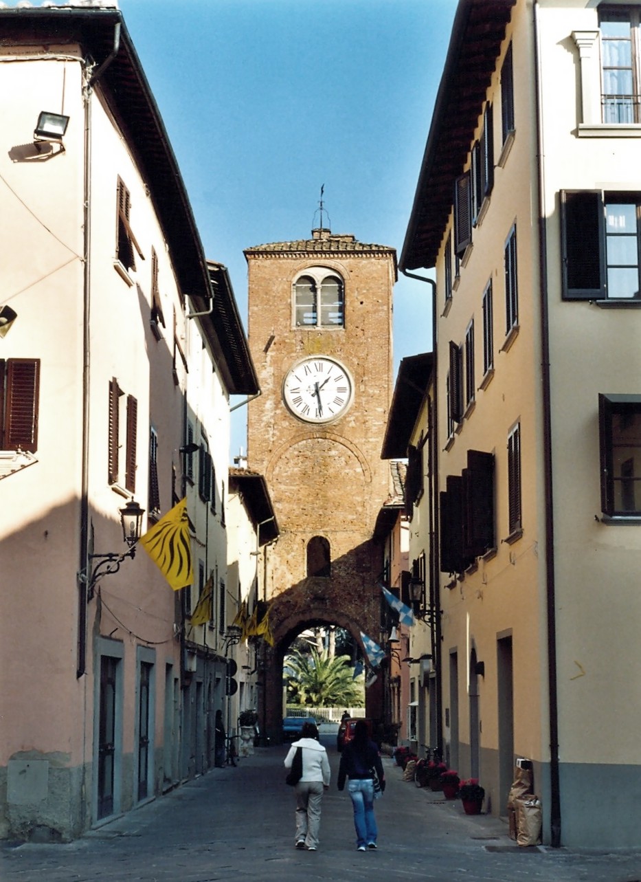
Santa Maria a Monte (Santa Maria a Monte)
- Italian comune
Santa Maria a Monte, located in the Tuscany region of Italy, offers some picturesque hiking opportunities amidst its serene landscapes. The area features rolling hills, vineyards, olive groves, and charming medieval architecture, making it an ideal destination for hikers seeking both natural beauty and cultural experiences.
Hiking Trails
-
Monte Serra Trail: This trail leads to Monte Serra and provides stunning panoramic views of the surrounding countryside. The hike can be moderate to challenging, depending on the specific route you choose, and generally takes a few hours.
-
Vineyard Trails: Many paths wind through the local vineyards, allowing hikers to experience the peace of the countryside while tasting the very essence of this region’s renowned wines. These trails are usually easier and can be explored at a leisurely pace.
-
Nature Reserves: Nearby nature reserves, such as the Lipu Oasis in Massaciuccoli, offer well-marked trails for hiking and birdwatching, giving visitors a chance to engage with the local flora and fauna.
Tips for Hiking in Santa Maria a Monte
-
Season: Spring and autumn are the best times for hiking in Tuscany, as the weather is usually mild, and the landscapes are vibrant.
-
Local Guide: Consider hiring a local guide to enhance your experience, as they can share the history and significance of the trails and landscapes.
-
Preparation: Bring ample water, snacks, and a map or GPS device. While many trails are marked, it's good to be prepared, especially if you venture into less traveled paths.
-
Footwear: Sturdy hiking shoes are recommended, as some trails can be rocky or uneven.
Conclusion
Hiking in Santa Maria a Monte provides an opportunity to immerse yourself in the natural beauty and rich heritage of Tuscany. Whether you're looking for a challenging trek or a peaceful stroll through the vineyards, you'll find something that suits your preferences. Enjoy your hike!
- Country:

- Postal Code: 56020
- Local Dialing Code: 0587
- Licence Plate Code: PI
- Coordinates: 43° 42' 0" N, 10° 41' 0" E


- GPS tracks (wikiloc): [Link]
- AboveSeaLevel: 56 м m
- Area: 38.04 sq km
- Population: 13061
- Web site: http://www.comune.santamariaamonte.pi.it/
- Wikipedia en: wiki(en)
- Wikipedia: wiki(it)
- Wikidata storage: Wikidata: Q103270
- Wikipedia Commons Gallery: [Link]
- Wikipedia Commons Category: [Link]
- Freebase ID: [/m/0glg35]
- GeoNames ID: Alt: [6538582]
- VIAF ID: Alt: [125020153]
- OSM relation ID: [42571]
- GND ID: Alt: [4527088-0]
- Library of Congress authority ID: Alt: [no93024422]
- MusicBrainz area ID: [24236ab3-ba48-42d6-b60a-1c065b1369ec]
- UN/LOCODE: [ITSAH]
- ISTAT ID: 050035
- Italian cadastre code: I232
Shares border with regions:


Bientina
- Italian comune
Bientina, located in the Tuscany region of Italy, offers a unique blend of natural beauty, historical sites, and charming villages, making it an interesting destination for hiking enthusiasts. Here are some aspects to consider when hiking in and around Bientina:...
- Country:

- Postal Code: 56031
- Local Dialing Code: 0587
- Licence Plate Code: PI
- Coordinates: 43° 42' 26" N, 10° 37' 14" E


- GPS tracks (wikiloc): [Link]
- AboveSeaLevel: 10 м m
- Area: 29.48 sq km
- Population: 8377
- Web site: [Link]


Calcinaia
- Italian comune
Calcinaia is a charming town located in the Tuscany region of Italy, nestled between Pisa and Florence. While the town itself is more known for its historical architecture and local culture, there are various hiking opportunities in the surrounding area that are perfect for outdoor enthusiasts exploring the beauty of Tuscany....
- Country:

- Postal Code: 56012
- Local Dialing Code: 0587
- Licence Plate Code: PI
- Coordinates: 43° 41' 1" N, 10° 37' 0" E


- GPS tracks (wikiloc): [Link]
- AboveSeaLevel: 16 м m
- Area: 14.89 sq km
- Population: 12582
- Web site: [Link]


Castelfranco di Sotto
- Italian comune
 Hiking in Castelfranco di Sotto
Castelfranco di Sotto is a charming town located in the Tuscany region of Italy, known for its rich history, beautiful landscapes, and proximity to the Lucca and Pisa provinces. While the town itself is not a major hiking destination, it offers access to several nearby trails and natural areas that are perfect for hiking enthusiasts....
- Country:

- Postal Code: 56022
- Local Dialing Code: 0571
- Licence Plate Code: PI
- Coordinates: 43° 42' 0" N, 10° 45' 0" E


- GPS tracks (wikiloc): [Link]
- AboveSeaLevel: 16 м m
- Area: 48.33 sq km
- Population: 13396
- Web site: [Link]


Montopoli in Val d'Arno
- Italian comune
 Hiking in Montopoli in Val d'Arno
Montopoli in Val d'Arno is a picturesque town located in the Tuscany region of Italy. Nestled in the beautiful Val d'Arno area between Florence and Pisa, it offers a range of hiking opportunities that showcase the stunning landscapes and cultural heritage of the region. Here are some tips and highlights for hiking in and around Montopoli:...
- Country:

- Postal Code: 56020
- Local Dialing Code: 0571
- Licence Plate Code: PI
- Coordinates: 43° 40' 28" N, 10° 45' 1" E


- GPS tracks (wikiloc): [Link]
- AboveSeaLevel: 98 м m
- Area: 30.22 sq km
- Population: 11149
- Web site: [Link]


Pontedera
- Italian comune
Pontedera, located in the Tuscany region of Italy, is a charming town with a rich industrial history and beautiful surrounding landscapes. While Pontedera itself is not primarily known as a hiking destination, it serves as a good base for exploring the natural beauty of the nearby hills and countryside....
- Country:

- Postal Code: 56025
- Local Dialing Code: 0587
- Licence Plate Code: PI
- Coordinates: 43° 39' 45" N, 10° 37' 58" E


- GPS tracks (wikiloc): [Link]
- AboveSeaLevel: 14 м m
- Area: 46.02 sq km
- Population: 29168
- Web site: [Link]
