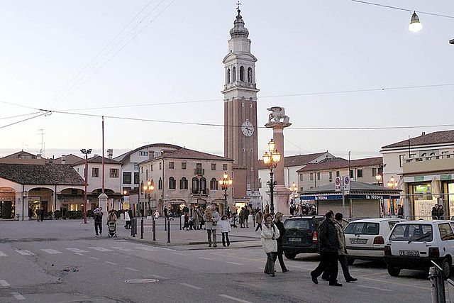
Santa Maria di Sala (Santa Maria di Sala)
.svg)
- Italian comune
 Hiking in Santa Maria di Sala
Santa Maria di Sala, located in the Veneto region of Italy, is not primarily known as a hiking destination, as it is more of a rural area characterized by flat lands and agricultural scenery. However, there are still opportunities for pleasant walks and outdoor activities in and around the region.
Hiking and Walking Opportunities:
-
Countryside Trails:
- The flat landscapes around Santa Maria di Sala offer various rural paths and trails. You can explore the picturesque countryside, dotted with farms and vineyards.
- Walking through the fields can provide a unique insight into the local agricultural practices and serene landscapes.
-
Nearby Natural Areas:
- River Sile Park: A short drive away, this park features trails along the Sile River, providing beautiful views and opportunities for birdwatching.
- Natural Reserves: Explore nearby natural reserves that offer more rugged terrains and additional hiking options.
-
Cultural Routes:
- Combine your hiking experience with cultural visits to nearby towns, such as Mirano or Noale, where you can enjoy historical architecture and local traditions along the way.
Tips for Hiking in the Area:
- Footwear: Wear comfortable hiking shoes, especially if you’re planning to walk on dirt paths.
- Weather Considerations: Check the weather beforehand, as conditions in the Veneto region can change. Late spring and early autumn are generally the best times for hiking.
- Local Maps: It can be helpful to obtain local maps or guidebooks for walking routes from tourist information centers or local shops.
- Hydration and Snacks: Always carry water and some snacks, especially if you plan to spend several hours outdoors.
While Santa Maria di Sala doesn’t offer high elevation hikes or mountainous terrain, you can still enjoy the natural beauty of the region on foot through leisurely walks and explorations of the surrounding countryside.
- Country:

- Postal Code: 30036
- Local Dialing Code: 041
- Licence Plate Code: VE
- Coordinates: 45° 30' 32" N, 12° 2' 11" E


- GPS tracks (wikiloc): [Link]
- AboveSeaLevel: 13 м m
- Area: 28.05 sq km
- Population: 17774
- Web site: http://www.comune.santantonioabate.na.it
- Wikipedia en: wiki(en)
- Wikipedia: wiki(it)
- Wikidata storage: Wikidata: Q46973
- Wikipedia Commons Category: [Link]
- Freebase ID: [/m/0g9nvb]
- GeoNames ID: Alt: [6536661]
- VIAF ID: Alt: [167603839]
- OSM relation ID: [45096]
- TGN ID: [7040788]
- UN/LOCODE: [ITSMS]
- Gran Enciclopèdia Catalana ID: [0267357]
- ISTAT ID: 027035
- Italian cadastre code: I242
Shares border with regions:
Villanova di Camposampiero
- Italian comune
Hiking in Villanova di Camposampiero
Villanova di Camposampiero is a charming town in the Veneto region of Italy, situated near Padua. While it may not be as well-known for hiking as other regions in Italy, there are still opportunities to enjoy the outdoors and explore the picturesque countryside....
- Country:
- Postal Code: 35010
- Local Dialing Code: 049
- Licence Plate Code: PD
- Coordinates: 45° 29' 20" N, 11° 58' 29" E
- GPS tracks (wikiloc): [Link]
- AboveSeaLevel: 12 м m
- Area: 12.23 sq km
- Population: 6121
- Web site: [Link]

Borgoricco
- Italian comune
Hiking in Borgoricco
Borgoricco is a charming town in the province of Padua, Italy, and while it may not be as well-known as some other hiking destinations, it offers beautiful landscapes and opportunities for outdoor enthusiasts. Here are some aspects to consider when hiking in and around Borgoricco:...
- Country:
- Postal Code: 35010
- Local Dialing Code: 049
- Licence Plate Code: PD
- Coordinates: 45° 32' 7" N, 11° 56' 28" E
- GPS tracks (wikiloc): [Link]
- AboveSeaLevel: 18 м m
- Area: 20.39 sq km
- Population: 8774
- Web site: [Link]
Massanzago
- Italian comune
Hiking in Massanzago
Massanzago is a picturesque town located in the Veneto region of Italy, known for its beautiful landscapes and rich agricultural heritage. While the town itself is not famous for extensive hiking trails, the surrounding areas offer opportunities for nature lovers and hikers to explore the countryside....
- Country:
- Postal Code: 35010
- Local Dialing Code: 049
- Licence Plate Code: PD
- Coordinates: 45° 33' 23" N, 12° 0' 26" E
- GPS tracks (wikiloc): [Link]
- AboveSeaLevel: 18 м m
- Area: 13.22 sq km
- Population: 6039
- Web site: [Link]

Mirano
- Italian comune
Hiking in Mirano
Mirano is a charming town located in the Veneto region of Italy, not far from Venice. While it may not be as widely recognized for hiking compared to mountainous areas, there are some lovely walks and trails in and around the town, making it a pleasant destination for hikers who want to explore the countryside and enjoy picturesque views....
- Country:
- Postal Code: 30035
- Local Dialing Code: 041
- Licence Plate Code: VE
- Coordinates: 45° 30' 0" N, 12° 6' 0" E
- GPS tracks (wikiloc): [Link]
- AboveSeaLevel: 9 м m
- Area: 45.63 sq km
- Population: 27169
- Web site: [Link]


Pianiga
- Italian comune
Hiking in Pianiga
Pianiga, located in the Veneto region of Italy, offers a unique hiking experience characterized by its scenic landscapes, charming countryside, and access to the nearby Brenta River. While it may not be as widely known as some other hiking destinations, it boasts a variety of trails suitable for different skill levels....
- Country:
- Postal Code: 30030
- Local Dialing Code: 041
- Licence Plate Code: VE
- Coordinates: 45° 27' 30" N, 12° 0' 29" E
- GPS tracks (wikiloc): [Link]
- AboveSeaLevel: 8 м m
- Area: 20.07 sq km
- Population: 12363
- Web site: [Link]


Noale
- Italian comune
Hiking in Noale
Noale is a charming town in the Veneto region of Italy, known for its medieval architecture and beautiful countryside. While it might not be as famous for hiking as some of the surrounding areas, there are still plenty of opportunities for outdoor enthusiasts to explore scenic trails and enjoy the natural beauty of the region....
- Country:
- Postal Code: 30033
- Local Dialing Code: 041
- Licence Plate Code: VE
- Coordinates: 45° 33' 0" N, 12° 4' 0" E
- GPS tracks (wikiloc): [Link]
- AboveSeaLevel: 18 м m
- Area: 24.69 sq km
- Population: 16017
- Web site: [Link]