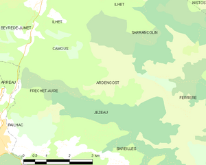
Sarrancolin (Sarrancolin)

- commune in Hautes-Pyrénées, France
- Country:

- Postal Code: 65410
- Coordinates: 42° 57' 59" N, 0° 22' 38" E


- GPS tracks (wikiloc): [Link]
- Area: 32.1 sq km
- Population: 570
- Web site: http://www.sarrancolin.com
- Wikipedia en: wiki(en)
- Wikipedia: wiki(fr)
- Wikidata storage: Wikidata: Q1599885
- Wikipedia Commons Category: [Link]
- Freebase ID: [/m/03nv70r]
- Freebase ID: [/m/03nv70r]
- GeoNames ID: Alt: [2975985]
- GeoNames ID: Alt: [2975985]
- SIREN number: [216504084]
- SIREN number: [216504084]
- BnF ID: [15270839w]
- BnF ID: [15270839w]
- Library of Congress authority ID: Alt: [no99036378]
- Library of Congress authority ID: Alt: [no99036378]
- WOEID: [621064]
- WOEID: [621064]
- INSEE municipality code: 65408
- INSEE municipality code: 65408
Shares border with regions:


Beyrède-Jumet
- commune in Hautes-Pyrénées, France
- Country:
- Postal Code: 65410
- Coordinates: 42° 57' 29" N, 0° 22' 33" E
- GPS tracks (wikiloc): [Link]
- Area: 15.9 sq km
- Population: 188

Ardengost
- commune in Hautes-Pyrénées, France
- Country:
- Postal Code: 65240
- Coordinates: 42° 55' 29" N, 0° 24' 15" E
- GPS tracks (wikiloc): [Link]
- Area: 5.82 sq km
- Population: 11


Ferrère
- commune in Hautes-Pyrénées, France
- Country:
- Postal Code: 65370
- Coordinates: 42° 57' 12" N, 0° 32' 12" E
- GPS tracks (wikiloc): [Link]
- Area: 57.56 sq km
- Population: 44
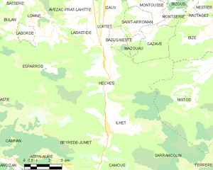
Hèches
- commune in Hautes-Pyrénées, France
- Country:
- Postal Code: 65250
- Coordinates: 43° 0' 59" N, 0° 22' 20" E
- GPS tracks (wikiloc): [Link]
- Area: 35.44 sq km
- Population: 607


Ilhet
- commune in Hautes-Pyrénées, France
- Country:
- Postal Code: 65410
- Coordinates: 42° 57' 50" N, 0° 22' 57" E
- GPS tracks (wikiloc): [Link]
- Area: 8.02 sq km
- Population: 119


Nistos
- commune in Hautes-Pyrénées, France
- Country:
- Postal Code: 65150
- Coordinates: 43° 1' 2" N, 0° 28' 45" E
- GPS tracks (wikiloc): [Link]
- AboveSeaLevel: 640 м m
- Area: 32.59 sq km
- Population: 223

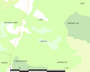
Camous
- commune in Hautes-Pyrénées, France
- Country:
- Postal Code: 65410
- Coordinates: 42° 56' 42" N, 0° 22' 32" E
- GPS tracks (wikiloc): [Link]
- Area: 3.29 sq km
- Population: 24