Saussines (Saussines)

- commune in Hérault, France
- Country:

- Postal Code: 34160
- Coordinates: 43° 45' 48" N, 4° 3' 26" E


- GPS tracks (wikiloc): [Link]
- AboveSeaLevel: 50 м m
- Area: 6.28 sq km
- Population: 1001
- Web site: http://www.mairie-saussines.fr/
- Wikipedia en: wiki(en)
- Wikipedia: wiki(fr)
- Wikidata storage: Wikidata: Q1154735
- Wikipedia Commons Category: [Link]
- Freebase ID: [/m/03mgp39]
- Freebase ID: [/m/03mgp39]
- GeoNames ID: Alt: [6616599]
- GeoNames ID: Alt: [6616599]
- SIREN number: [213402969]
- SIREN number: [213402969]
- BnF ID: [15256896r]
- BnF ID: [15256896r]
- VIAF ID: Alt: [240063629]
- VIAF ID: Alt: [240063629]
- PACTOLS thesaurus ID: [pcrtQGzFkGRMjO]
- PACTOLS thesaurus ID: [pcrtQGzFkGRMjO]
- INSEE municipality code: 34296
- INSEE municipality code: 34296
Shares border with regions:

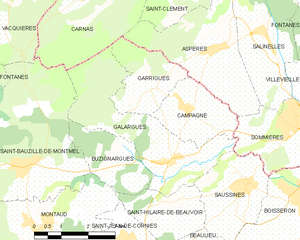
Galargues
- commune in Hérault, France
- Country:
- Postal Code: 34160
- Coordinates: 43° 46' 14" N, 4° 1' 17" E
- GPS tracks (wikiloc): [Link]
- Area: 11.43 sq km
- Population: 709


Saint-Hilaire-de-Beauvoir
- commune in Hérault, France
- Country:
- Postal Code: 34160
- Coordinates: 43° 45' 23" N, 4° 0' 49" E
- GPS tracks (wikiloc): [Link]
- Area: 4.69 sq km
- Population: 402

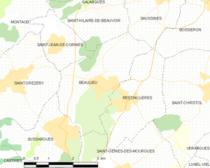
Beaulieu
- commune in Hérault, France
- Country:
- Postal Code: 34160
- Coordinates: 43° 43' 41" N, 4° 1' 17" E
- GPS tracks (wikiloc): [Link]
- Area: 7.73 sq km
- Population: 1724
- Web site: [Link]


Boisseron
- commune in Hérault, France
- Country:
- Postal Code: 34160
- Coordinates: 43° 45' 35" N, 4° 4' 52" E
- GPS tracks (wikiloc): [Link]
- Area: 7.46 sq km
- Population: 1909
- Web site: [Link]


Sommières
- commune in Gard, France
- Country:
- Postal Code: 30250
- Coordinates: 43° 47' 4" N, 4° 5' 24" E
- GPS tracks (wikiloc): [Link]
- AboveSeaLevel: 34 м m
- Area: 10.36 sq km
- Population: 4753
- Web site: [Link]