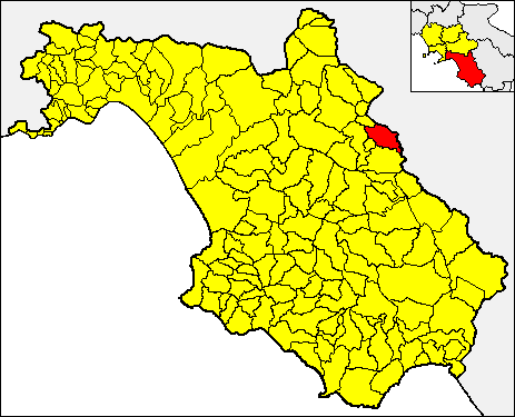
Savoia di Lucania (Savoia di Lucania)
.svg)
- Italian comune
 Hiking in Savoia di Lucania
Savoia di Lucania is a charming town in the mountainous region of Basilicata, Italy, known for its beautiful landscapes and rich cultural heritage. If you're considering hiking in this area, here are some key aspects to keep in mind:
Trails and Terrain
- Diverse Terrain: The hiking trails around Savoia di Lucania range from easy walks to more challenging hikes that lead through forests, along rivers, and up to panoramic viewpoints.
- Natural Parks: Nearby, the Pollino National Park offers a variety of trails that showcase the region’s rich biodiversity, featuring flora and fauna unique to southern Italy. The park is also home to stunning mountain scenery and scenic viewpoints.
Recommended Hikes
- Sentiero del Lupo: This trail focuses on the area's natural landscapes and wildlife, with specific attention to the local wolf population.
- Cima del Monte: A more challenging ascent takes you to higher altitudes with breathtaking views over the surrounding valleys and mountains.
- Cascate di San Fele: Though a bit further from Savoia di Lucania, this hike to the waterfalls offers an impressive natural experience.
Preparation and Safety
- Gear: Ensure you have appropriate hiking boots, water, snacks, and possibly trekking poles for steeper sections.
- Maps and Guides: It's advisable to carry a physical map of the trails or use a reliable hiking app, as cell service may be limited in some areas.
- Weather: Check the local weather conditions before heading out, as the region can experience rapid changes, especially in higher altitudes.
Local Culture
- Historical Sites: When not hiking, take time to explore Savoia di Lucania’s historic buildings, churches, and local cuisine, which offers traditional dishes of the Basilicata region.
- Community Events: Depending on the time of year, there may be local festivals or events that can enhance your visit.
Conclusion
Hiking in Savoia di Lucania provides a unique opportunity to explore one of Italy's more tranquil and less-traveled regions. With its combination of natural beauty and cultural richness, it's a rewarding destination for hikers of all levels. Always remember to respect the local environment and leave no trace while enjoying your adventures.
- Country:

- Postal Code: 85050
- Local Dialing Code: 0971
- Licence Plate Code: PZ
- Coordinates: 40° 34' 0" N, 15° 33' 0" E


- GPS tracks (wikiloc): [Link]
- AboveSeaLevel: 750 м m
- Area: 32.84 sq km
- Population: 1089
- Web site: http://www.comune.savoia.pz.it
- Wikipedia en: wiki(en)
- Wikipedia: wiki(it)
- Wikidata storage: Wikidata: Q52675
- Wikipedia Commons Category: [Link]
- Freebase ID: [/m/0781b3]
- GeoNames ID: Alt: [6537635]
- OSM relation ID: [40604]
- TGN ID: [7040160]
- ISTAT ID: 076084
- Italian cadastre code: H730
Shares border with regions:
Picerno
- Italian comune
Hiking in Picerno
Picerno, a charming town located in the Basilicata region of southern Italy, offers a variety of hiking opportunities that allow you to explore its beautiful landscapes, rich flora and fauna, and historical sites. Here are some key points about hiking in and around Picerno:...
- Country:
- Postal Code: 85055
- Local Dialing Code: 0971
- Licence Plate Code: PZ
- Coordinates: 40° 38' 0" N, 15° 38' 0" E
- GPS tracks (wikiloc): [Link]
- AboveSeaLevel: 721 м m
- Area: 78.51 sq km
- Population: 5869
- Web site: [Link]
Sant'Angelo Le Fratte
- Italian comune
Hiking in Sant'Angelo Le Fratte
Sant'Angelo Le Fratte is a charming village located in the Basilicata region of southern Italy, known for its stunning landscapes and rich natural beauty. The area offers various hiking opportunities for both novice and seasoned hikers, providing a unique glimpse into the local environment, culture, and history....
- Country:
- Postal Code: 85050
- Local Dialing Code: 0975
- Licence Plate Code: PZ
- Coordinates: 40° 32' 49" N, 15° 33' 27" E
- GPS tracks (wikiloc): [Link]
- AboveSeaLevel: 560 м m
- Area: 23.1 sq km
- Population: 1395
- Web site: [Link]


Satriano di Lucania
- Italian comune
Hiking in Satriano di Lucania
Satriano di Lucania, located in the Basilicata region of southern Italy, is a charming destination for hiking enthusiasts. The surrounding landscape offers a variety of trails that showcase the beauty of the Apennine Mountains and the rich natural environment of the area....
- Country:
- Postal Code: 85050
- Local Dialing Code: 0975
- Licence Plate Code: PZ
- Coordinates: 40° 32' 42" N, 15° 38' 21" E
- GPS tracks (wikiloc): [Link]
- AboveSeaLevel: 650 м m
- Area: 33.02 sq km
- Population: 2342
- Web site: [Link]


Tito
- Italian comune
Hiking in Tito
Hiking in Tito, a town situated in the Basilicata region of Italy, offers a wonderful blend of natural beauty, historical sites, and diverse landscapes. Here are some key points to consider:...
- Country:
- Postal Code: 85050
- Local Dialing Code: 0971
- Licence Plate Code: PZ
- Coordinates: 40° 35' 0" N, 15° 41' 0" E
- GPS tracks (wikiloc): [Link]
- AboveSeaLevel: 650 м m
- Area: 71.27 sq km
- Population: 7355
- Web site: [Link]


Vietri di Potenza
- Italian comune
Hiking in Vietri di Potenza
Vietri di Potenza is a charming village located in the heart of the Basilicata region in southern Italy. This area is surrounded by the beautiful Lucanian Apennines, making it a fantastic location for hiking enthusiasts. Here are some highlights and considerations for hiking in this area:...
- Country:
- Postal Code: 85058
- Local Dialing Code: 0971
- Licence Plate Code: PZ
- Coordinates: 40° 36' 0" N, 15° 30' 0" E
- GPS tracks (wikiloc): [Link]
- AboveSeaLevel: 405 м m
- Area: 52.25 sq km
- Population: 2787
- Web site: [Link]

Caggiano
- Italian comune
Hiking in Caggiano
Caggiano is a charming town located in the province of Salerno, in the Campania region of Italy. It’s positioned in the beautiful Apennine Mountains, which provides a stunning backdrop for hiking enthusiasts. Here are some key points about hiking in and around Caggiano:...
- Country:
- Postal Code: 84030
- Local Dialing Code: 0975
- Licence Plate Code: SA
- Coordinates: 40° 34' 0" N, 15° 30' 0" E
- GPS tracks (wikiloc): [Link]
- AboveSeaLevel: 828 м m
- Area: 35.43 sq km
- Population: 2676
- Web site: [Link]