
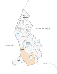
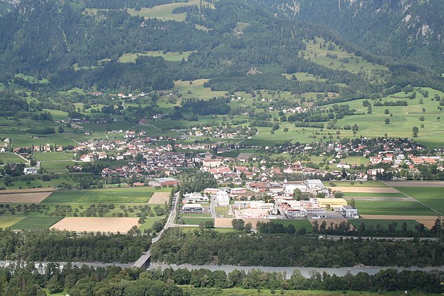
Schaan (Schaan)


- municipality of Liechtenstein
 Hiking in Schaan
Schaan, located in Liechtenstein, is a great destination for hiking enthusiasts. It offers a picturesque landscape and access to various trails that cater to different skill levels. Here are some details about hiking in and around Schaan:
Trails and Routes
-
Hiking Trails: The area features numerous marked hiking trails that weave through the stunning countryside and mountainous regions. You can find both easy, family-friendly paths and more challenging hikes for experienced trekkers.
-
Connecting to Nearby Areas: Schaan serves as a gateway to the surrounding regions, including trails that lead to the nearby Malbun area, which is popular for hiking during the summer and skiing in the winter.
-
Rhine Valley Trails: The trails along the Rhine River offer beautiful views and relatively flat terrain, perfect for leisurely hikes. These paths are ideal for both walking and cycling.
-
Rugged Terrain: For those looking for more challenging hikes, the nearby mountains provide steep ascents and rocky paths. The paths can lead you to higher altitudes, giving you breathtaking views of the Alps and the valley below.
Scenic Views
- Panoramic Views: Many trails in the area culminate in stunning viewpoints where you can overlook the Rhine Valley, the Alps, and the small towns nearby.
- Nature: The routes are often surrounded by lush greenery, wildflowers, and diverse wildlife, making it a delightful experience for nature lovers.
Practical Tips
- Seasonal Considerations: Spring and autumn are particularly good times to hike in the region, with mild temperatures and beautiful foliage. Summer can get warm, while winter hikes may require appropriate gear if venturing into snowy areas.
- Maps and Signage: Always carry a detailed map or use a GPS-enabled app for navigation. The trails in Liechtenstein are generally well-marked, but it’s essential to stay aware of your surroundings.
Local Amenities
- Accommodations: Schaan has various accommodations, from hotels to guesthouses, making it convenient for hikers.
- Refreshments: You can find local eateries and cafés in and around Schaan, offering a chance to refuel after your hike.
Overall, hiking in Schaan and its surroundings makes for a fantastic outdoor experience, whether you're seeking a peaceful stroll or an adventurous climb. Always remember to check the local weather conditions, trail status, and bring adequate supplies before setting out on your hike. Enjoy your adventure!
- Country:

- Postal Code: 9494
- Local Dialing Code: 7005
- Coordinates: 47° 10' 0" N, 9° 31' 0" E


- GPS tracks (wikiloc): [Link]
- AboveSeaLevel: 450 м m
- Area: 26.8 sq km
- Population: 5959
- Web site: http://www.schaan.li
- Wikipedia en: wiki(en)
- Wikipedia: wiki(de)
- Wikidata storage: Wikidata: Q49657
- Wikipedia Commons Category: [Link]
- Freebase ID: [/m/03y5r4]
- GeoNames ID: Alt: [3042042]
- VIAF ID: Alt: [236984171]
- GND ID: Alt: [4367460-4]
- archINFORM location ID: [9541]
- Library of Congress authority ID: Alt: [no98068251]
- MusicBrainz area ID: [dcec0e05-e863-49a8-9728-d9efea5dad28]
- TGN ID: [1047536]
- Gran Enciclopèdia Catalana ID: [0061277]
- HDS ID: [7113]
- Swiss municipality code: [7005]
- Digital Atlas of the Roman Empire ID: [17293]
- NKCR AUT ID: [ge948495]
- Pleiades ID: [187541]
- ISO 3166-2 code: LI-07
- FIPS 10-4 (countries and regions): LS07
Shares border with regions:


Vaduz
- capital of Liechtenstein
Hiking in Vaduz
Hiking in Vaduz, the capital of Liechtenstein, offers a wonderful blend of stunning alpine scenery, cultural landmarks, and well-maintained trails. Here are some highlights to consider if you're planning a hiking trip in this picturesque area:...
- Country:
- Postal Code: 9490
- Coordinates: 47° 8' 23" N, 9° 31' 19" E
- GPS tracks (wikiloc): [Link]
- AboveSeaLevel: 455 м m
- Area: 17.3 sq km
- Population: 5429
- Web site: [Link]


Eschen
- municipality in the north of Liechtenstein
Hiking in Eschen
Eschen, located in Liechtenstein, offers a unique hiking experience characterized by beautiful landscapes, scenic views, and well-marked trails. While Eschen itself is a small municipality, it is surrounded by stunning natural beauty, including rolling hills and the nearby Rhine Valley....
- Country:
- Postal Code: 9492
- Local Dialing Code: 7007
- Coordinates: 47° 12' 6" N, 9° 32' 9" E
- GPS tracks (wikiloc): [Link]
- AboveSeaLevel: 453 м m
- Area: 10.333 sq km
- Population: 4375
- Web site: [Link]


Triesenberg
- largest municipality of Liechtenstein
Hiking in Triesenberg
Triesenberg is a picturesque village in Liechtenstein, nestled in the foothills of the Alps. It's an excellent destination for hiking enthusiasts, offering a variety of trails that cater to different skill levels and preferences. Here are some highlights of hiking in Triesenberg:...
- Country:
- Postal Code: 9497
- Local Dialing Code: 7004
- Coordinates: 47° 7' 0" N, 9° 32' 0" E
- GPS tracks (wikiloc): [Link]
- AboveSeaLevel: 884 м m
- Area: 29.8 sq km
- Population: 2596
- Web site: [Link]

Triesen
- municipality of Liechtenstein
Hiking in Triesen
Triesen, a charming municipality located in Liechtenstein, offers some wonderful hiking opportunities for outdoor enthusiasts. Nestled in the Rhine Valley, surrounded by scenic landscapes and the backdrop of the Alps, Triesen presents a variety of hiking trails suitable for different skill levels....
- Country:
- Postal Code: 9495
- Local Dialing Code: 7002
- Coordinates: 47° 6' 0" N, 9° 31' 0" E
- GPS tracks (wikiloc): [Link]
- AboveSeaLevel: 512 м m
- Area: 26.4 sq km
- Web site: [Link]


Planken
- municipality of Liechtenstein
Hiking in Planken
Planken is a charming municipality located in the Principality of Liechtenstein. While it's not as well-known as some larger hiking destinations, it offers a variety of scenic trails suitable for different skill levels. Here are some key points to consider when hiking in Planken:...
- Country:
- Postal Code: 9498
- Local Dialing Code: 7006
- Coordinates: 47° 10' 49" N, 9° 33' 36" E
- GPS tracks (wikiloc): [Link]
- AboveSeaLevel: 786 м m
- Area: 5.3 sq km
- Web site: [Link]


Gamprin
- municipality of Liechtenstein
Hiking in Gamprin
Gamprin is a small municipality located in Liechtenstein, nestled in the beautiful mountainous landscapes of the Alps. Hiking in Gamprin offers a unique experience as you can enjoy breathtaking views, explore lush greenery, and appreciate the serene environment that characterizes this region....
- Country:
- Postal Code: 9487
- Local Dialing Code: 7009
- Coordinates: 47° 13' 11" N, 9° 30' 36" E
- GPS tracks (wikiloc): [Link]
- AboveSeaLevel: 472 м m
- Area: 6.1 sq km
- Web site: [Link]


Balzers
- municipality of Liechtenstein
Hiking in Balzers
Balzers is a beautiful municipality in Liechtenstein, known for its scenic landscapes, historic sites, and outdoor activities, including hiking. Situated in the Rhine Valley, Balzers offers a range of hiking trails suitable for all skill levels, from leisurely walks to more challenging hikes....
- Country:
- Postal Code: 9496
- Local Dialing Code: 7003
- Coordinates: 47° 4' 0" N, 9° 30' 0" E
- GPS tracks (wikiloc): [Link]
- AboveSeaLevel: 472 м m
- Area: 19.6 sq km
- Population: 4583
- Web site: [Link]
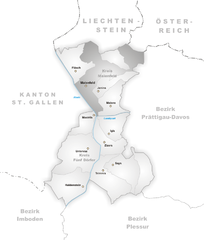
Maienfeld
- municipality in Switzerland
Hiking in Maienfeld
Maienfeld, located in the canton of Graubünden in Switzerland, is a picturesque village famous for its stunning landscapes and wine production, particularly its Bündner wine. The area offers a variety of hiking trails that cater to different skill levels, providing hikers with breathtaking views of the surrounding Alps, charming vineyards, and lush meadows....
- Country:

- Postal Code: 7304
- Local Dialing Code: 081
- Licence Plate Code: GR
- Coordinates: 47° 0' 28" N, 9° 31' 51" E
- GPS tracks (wikiloc): [Link]
- AboveSeaLevel: 1469 м m
- Area: 32.33 sq km
- Population: 2860
- Web site: [Link]

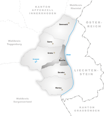
Buchs
- municipality in the canton of St. Gallen, Switzerland
Hiking in Buchs
Buchs, located in the canton of St. Gallen, Switzerland, is a great starting point for hiking enthusiasts. Nestled in the Rhine Valley and surrounded by beautiful landscapes, it offers a variety of hiking trails that cater to different skill levels. Here are some highlights:...
- Country:
- Postal Code: 9470
- Local Dialing Code: 081
- Licence Plate Code: SG
- Coordinates: 47° 9' 57" N, 9° 27' 46" E
- GPS tracks (wikiloc): [Link]
- AboveSeaLevel: 519 м m
- Area: 15.95 sq km
- Population: 12612
- Web site: [Link]