Schrattenthal (Schrattenthal)
- municipality in Austria
 Hiking in Schrattenthal
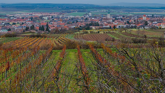
Schrattenthal, a picturesque village located in the wine region of Lower Austria, offers an array of hiking opportunities for adventurers and nature enthusiasts. The area is characterized by rolling hills, vineyards, and the stunning landscapes of the Weinviertel region.
Hiking Trails
-
Wine Trails: Schrattenthal is surrounded by vineyards, and there are several established wine trails that allow hikers to explore the scenic countryside while sampling local wines. These trails often lead through charming villages and offer beautiful views of the grapevines.
-
Nature Trails: The region features numerous marked hiking trails that take you through forests and natural habitats. These trails may vary in difficulty, making it suitable for families with children as well as more experienced hikers.
-
Cultural Routes: Some trails also incorporate stops at historical sites or cultural landmarks, providing insight into the local heritage and traditions.
Best Times to Hike
The best seasons for hiking in Schrattenthal are spring and autumn. During these seasons, the weather is typically mild, and the natural scenery is at its most vibrant. Spring brings blooming flowers and lush green landscapes, while autumn offers stunning fall foliage.
Preparation
- Footwear: Make sure to wear sturdy hiking boots for better grip and comfort.
- Clothing: Dress in layers, as temperatures can vary throughout the day.
- Water and Snacks: Always carry enough water and some snacks, especially if you're planning a longer hike.
- Maps and Guides: While many trails are well-marked, it's advisable to carry a map or download a hiking app for navigation.
Local Attractions
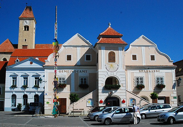
After your hike, take some time to explore Schrattenthal itself. The village is known for its charming architecture and local wine taverns, where you can relax and enjoy the local culinary offerings.
Hiking in Schrattenthal not only allows you to connect with nature but also offers a unique opportunity to experience the rich wine culture and stunning landscapes of Lower Austria. Enjoy your adventure!
- Country:

- Postal Code: 2073
- Local Dialing Code: 02942
- Licence Plate Code: HL
- Coordinates: 48° 43' 0" N, 15° 54' 0" E


- GPS tracks (wikiloc): [Link]
- AboveSeaLevel: 289 м m
- Area: 22.43 sq km
- Population: 868
- Web site: http://www.schrattenthal.at
- Wikipedia en: wiki(en)
- Wikipedia: wiki(de)
- Wikidata storage: Wikidata: Q666958
- Wikipedia Commons Category: [Link]
- Freebase ID: [/m/02qx77_]
- GeoNames ID: Alt: [2765614]
- VIAF ID: Alt: [234326929]
- GND ID: Alt: [4527726-6]
- MusicBrainz area ID: [87d6de3c-ab13-43d1-8c0f-41d5e33fbe16]
- WOEID: [543769]
- Austrian municipality key: [31041]
Shares border with regions:
Retz
- town in the district of Hollabrunn in Lower Austria, Austria
Hiking in Retz
Retz, located in the Lower Austria region, is a charming town known for its scenic landscapes, historical architecture, and outdoor recreational opportunities. Hiking around Retz offers a variety of trails that cater to different skill levels, making it a great destination for both novice and experienced hikers....
- Country:
- Postal Code: 2070
- Local Dialing Code: 02942
- Licence Plate Code: HL
- Coordinates: 48° 45' 22" N, 15° 57' 8" E
- GPS tracks (wikiloc): [Link]
- AboveSeaLevel: 252 м m
- Area: 45.01 sq km
- Population: 4249
- Web site: [Link]

Zellerndorf
- municipality in Austria
Hiking in Zellerndorf
Zellerndorf, located in the scenic wine region of Lower Austria, offers a beautiful backdrop for hiking enthusiasts. The area is characterized by rolling hills, vineyards, and picturesque landscapes, making it ideal for both moderate day hikes and leisurely strolls....
- Country:
- Postal Code: 2051
- Local Dialing Code: 02945
- Licence Plate Code: HL
- Coordinates: 48° 42' 0" N, 15° 57' 0" E
- GPS tracks (wikiloc): [Link]
- AboveSeaLevel: 230 м m
- Area: 41.12 sq km
- Population: 2432
- Web site: [Link]
Weitersfeld
- municipality in Austria
Hiking in Weitersfeld
Weitersfeld, located in Lower Austria, is a picturesque area that offers a variety of hiking opportunities. The region is known for its beautiful landscapes, including rolling hills, forests, and vineyards. Here are some aspects to consider if you're planning to hike in Weitersfeld:...
- Country:
- Postal Code: 2084
- Local Dialing Code: 02948
- Licence Plate Code: HO
- Coordinates: 48° 46' 56" N, 15° 48' 40" E
- GPS tracks (wikiloc): [Link]
- AboveSeaLevel: 441 м m
- Area: 87.2 sq km
- Population: 1576
- Web site: [Link]
Pulkau
- municipality in Austria
Hiking in Pulkau
Pulkau is a charming village located in the heart of Lower Austria, known for its picturesque landscapes, vineyards, and historic sites. Hiking in and around Pulkau is a delightful experience, offering a mix of scenic views, natural beauty, and cultural exploration....
- Country:
- Postal Code: 3741
- Local Dialing Code: 02946
- Licence Plate Code: HL
- Coordinates: 48° 42' 0" N, 15° 51' 0" E
- GPS tracks (wikiloc): [Link]
- AboveSeaLevel: 289 м m
- Area: 36.66 sq km
- Population: 1560
- Web site: [Link]