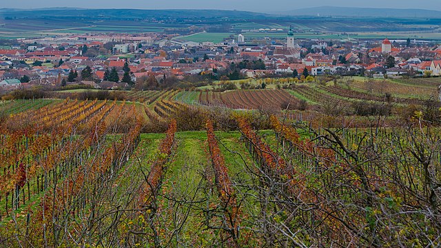
Zellerndorf (Zellerndorf)
- municipality in Austria
 Hiking in Zellerndorf
Zellerndorf, located in the scenic wine region of Lower Austria, offers a beautiful backdrop for hiking enthusiasts. The area is characterized by rolling hills, vineyards, and picturesque landscapes, making it ideal for both moderate day hikes and leisurely strolls.
Hiking Opportunities:
-
Panoramic Trails: Zellerndorf has various trails that provide stunning views of the surrounding vineyards and landscapes. The panoramic views are particularly beautiful during sunrise and sunset.
-
Vineyard Walks: Many trails wind through local vineyards, where you can enjoy the sights and tastes of local wines. Some routes may even lead to wine taverns or heurigen (wine pubs) where you can take a break and sample local vintages.
-
Nature and Wildlife: The region is rich in biodiversity. Keep an eye out for local flora and fauna as you hike through forests and meadows.
-
Cultural Sites: There are several historical and cultural sites along some of the hiking routes, including charming villages and churches. This allows hikers to combine outdoor activities with cultural experiences.
Tips for Hiking in Zellerndorf:
-
Trail Maps: It’s a good idea to have a map or GPS device to navigate the trails. Local tourist information centers often provide hiking maps and information about the routes.
-
Seasonal Considerations: Spring and fall are ideal times for hiking due to pleasant weather and beautiful scenery. Summer can be hot, and winter hikes may require special equipment.
-
Hiking Gear: Wear comfortable hiking shoes and clothing suitable for the weather. Don’t forget to bring water, snacks, and sunscreen.
-
Local Regulations: Respect local guidelines regarding trails, wildlife, and environment conservation.
Whether you're looking for a quick jaunt through the vineyards or a longer hike that explores the natural beauty of Lower Austria, Zellerndorf has something to offer for every hiking enthusiast. Enjoy your adventure in this charming region!
- Country:

- Postal Code: 2051
- Local Dialing Code: 02945
- Licence Plate Code: HL
- Coordinates: 48° 42' 0" N, 15° 57' 0" E


- GPS tracks (wikiloc): [Link]
- AboveSeaLevel: 230 м m
- Area: 41.12 sq km
- Population: 2432
- Web site: http://www.zellerndorf.gv.at
- Wikipedia en: wiki(en)
- Wikipedia: wiki(de)
- Wikidata storage: Wikidata: Q187779
- Wikipedia Commons Category: [Link]
- Freebase ID: [/m/02qx7tx]
- GeoNames ID: Alt: [2760622]
- VIAF ID: Alt: [246278972]
- GND ID: Alt: [4523575-2]
- Austrian municipality key: [31052]
Shares border with regions:
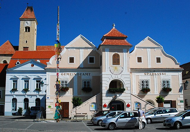
Retz
- town in the district of Hollabrunn in Lower Austria, Austria
Hiking in Retz
Retz, located in the Lower Austria region, is a charming town known for its scenic landscapes, historical architecture, and outdoor recreational opportunities. Hiking around Retz offers a variety of trails that cater to different skill levels, making it a great destination for both novice and experienced hikers....
- Country:
- Postal Code: 2070
- Local Dialing Code: 02942
- Licence Plate Code: HL
- Coordinates: 48° 45' 22" N, 15° 57' 8" E
- GPS tracks (wikiloc): [Link]
- AboveSeaLevel: 252 м m
- Area: 45.01 sq km
- Population: 4249
- Web site: [Link]

Guntersdorf
- municipality in Austria
Hiking in Guntersdorf
Guntersdorf is a charming village located in Austria, nestled in the scenic landscape of Lower Austria. While Guntersdorf itself is small, the surrounding area offers beautiful hiking opportunities that allow you to explore nature, enjoy the countryside, and soak in the tranquil atmosphere....
- Country:
- Postal Code: 2042
- Local Dialing Code: 02951
- Licence Plate Code: HL
- Coordinates: 48° 39' 0" N, 16° 3' 0" E
- GPS tracks (wikiloc): [Link]
- AboveSeaLevel: 246 м m
- Area: 28.41 sq km
- Population: 1145
- Web site: [Link]

Schrattenthal
- municipality in Austria
Hiking in Schrattenthal
Schrattenthal, a picturesque village located in the wine region of Lower Austria, offers an array of hiking opportunities for adventurers and nature enthusiasts. The area is characterized by rolling hills, vineyards, and the stunning landscapes of the Weinviertel region....
- Country:
- Postal Code: 2073
- Local Dialing Code: 02942
- Licence Plate Code: HL
- Coordinates: 48° 43' 0" N, 15° 54' 0" E
- GPS tracks (wikiloc): [Link]
- AboveSeaLevel: 289 м m
- Area: 22.43 sq km
- Population: 868
- Web site: [Link]

Sitzendorf an der Schmida
- municipality in Austria
Hiking in Sitzendorf an der Schmida
Sitzendorf an der Schmida is a picturesque village located in the Lower Austria region of Austria. The surrounding countryside offers a delightful range of hiking opportunities, making it a great destination for outdoor enthusiasts....
- Country:
- Postal Code: 3714
- Local Dialing Code: 02959
- Licence Plate Code: HL
- Coordinates: 48° 35' 59" N, 15° 56' 24" E
- GPS tracks (wikiloc): [Link]
- AboveSeaLevel: 244 м m
- Area: 61.85 sq km
- Population: 2162
- Web site: [Link]

Pernersdorf
- municipality in Austria
Hiking in Pernersdorf
Pernersdorf, located in the northeastern part of Austria, offers a tranquil hiking experience with its picturesque landscapes and serene countryside. While it's less known than some of Austria's popular hiking destinations, it presents a charming opportunity for outdoor enthusiasts who appreciate less crowded trails....
- Country:
- Postal Code: 2052
- Local Dialing Code: 02944
- Licence Plate Code: HL
- Coordinates: 48° 42' 0" N, 16° 1' 0" E
- GPS tracks (wikiloc): [Link]
- AboveSeaLevel: 214 м m
- Area: 25.81 sq km
- Population: 1022
- Web site: [Link]

Röschitz
- municipality in Austria
Hiking in Röschitz
Röschitz is a charming village located in the Lower Austria region of Austria, surrounded by picturesque landscapes that are perfect for hiking enthusiasts. The area is known for its rolling hills, vineyards, and lush natural surroundings, making it an ideal destination for both novice and experienced hikers....
- Country:
- Postal Code: 3743
- Local Dialing Code: 02984
- Licence Plate Code: HO
- Coordinates: 48° 40' 0" N, 15° 53' 0" E
- GPS tracks (wikiloc): [Link]
- AboveSeaLevel: 280 м m
- Area: 21.16 sq km
- Population: 1052
- Web site: [Link]
Pulkau
- municipality in Austria
Hiking in Pulkau
Pulkau is a charming village located in the heart of Lower Austria, known for its picturesque landscapes, vineyards, and historic sites. Hiking in and around Pulkau is a delightful experience, offering a mix of scenic views, natural beauty, and cultural exploration....
- Country:
- Postal Code: 3741
- Local Dialing Code: 02946
- Licence Plate Code: HL
- Coordinates: 48° 42' 0" N, 15° 51' 0" E
- GPS tracks (wikiloc): [Link]
- AboveSeaLevel: 289 м m
- Area: 36.66 sq km
- Population: 1560
- Web site: [Link]