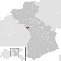
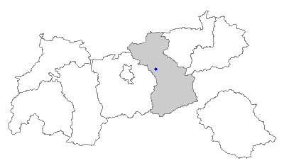
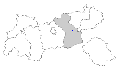
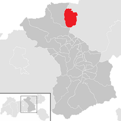
Schwaz District (Bezirk Schwaz)

- district of Austria
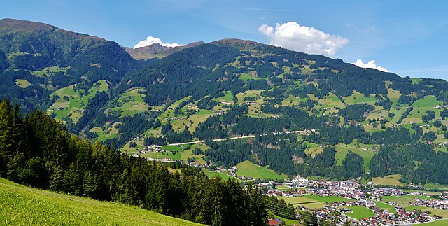
 Hiking in Schwaz District
Hiking in the Schwaz District, located in Tyrol, Austria, offers stunning landscapes, varied terrain, and a rich cultural experience. The area is surrounded by the impressive mountain ranges of the Alps, making it a fantastic location for both casual hikers and experienced trekkers.
Key Highlights:
-
Scenic Trails: There are numerous well-marked hiking trails ranging from easy walks to challenging mountain hikes. Notable trails include routes around the Zillertal Alps and the surrounding valleys, offering breathtaking views of glaciers, alpine meadows, and picturesque villages.
-
Nature and Wildlife: The district is rich in flora and fauna, making it an excellent destination for nature lovers. You might encounter diverse wildlife, including chamois, ibex, and various bird species.
-
Cultural Experiences: After a day of hiking, you can explore local traditions and cuisine in the charming villages like Schwaz, which is known for its silver mining history. There are historical sites, such as the Schwaz Silver Mine, and unique local restaurants offering Tyrolean specialties.
-
Accessibility: Many trails start from nearby towns and are accessible by public transportation. The well-maintained paths make it easier for families and those with varying fitness levels to enjoy the outdoors.
-
Seasonal Considerations: The best time for hiking in Schwaz is typically from late spring to early autumn (May to September). During winter, trails may be covered in snow, so it’s wise to check local conditions and possibly consider snowshoeing or skiing in the region's higher elevations.
Hiking Tips:
- Proper Gear: Ensure you have suitable hiking boots, weather-appropriate clothing, and enough water and snacks.
- Navigation: Carry a map or GPS device, as some trails may not be well-marked.
- Local Guides: Consider hiring a local guide for more challenging hikes or to learn about the area's cultural and natural history.
Whether you're seeking a relaxing day in nature or an adventurous climb, the Schwaz District has something to offer for every hiking enthusiast. Enjoy your adventure!
- Country:

- Capital: Schwaz
- Licence Plate Code: SZ
- Coordinates: 47° 24' 0" N, 11° 48' 0" E


- GPS tracks (wikiloc): [Link]
- AboveSeaLevel: 1676 м m
- Area: 1843 sq km
- Population: 81841
- Web site: http://www.tirol.gv.at/bh-schwaz
- Wikipedia en: wiki(en)
- Wikipedia: wiki(de)
- Wikidata storage: Wikidata: Q266685
- Wikipedia Commons Category: [Link]
- Wikipedia Commons Maps Category: [Link]
- Freebase ID: [/m/06s8pn]
- GeoNames ID: Alt: [2765389]
- BnF ID: [12330349r]
- VIAF ID: Alt: [157208237]
- GND ID: Alt: [10008615-9]
- archINFORM location ID: [14622]
- Library of Congress authority ID: Alt: [n88080967]
Includes regions:


Tux, Tyrol
- municipality in Austria
Hiking in Tux, Tyrol
Tux, located in Tyrol, Austria, is a stunning destination for hiking enthusiasts, offering a diverse range of trails set against the backdrop of the majestic Zillertal Alps. Here are some key highlights and tips for hiking in Tux:...
- Country:
- Postal Code: 6293
- Local Dialing Code: 05287
- Licence Plate Code: SZ
- Coordinates: 47° 7' 0" N, 11° 40' 0" E
- GPS tracks (wikiloc): [Link]
- AboveSeaLevel: 1281 м m
- Area: 111.1 sq km
- Population: 1941
- Web site: [Link]
Zell am Ziller
- municipality in Austria
Hiking in Zell am Ziller
Zell am Ziller, located in the Zillertal Valley in Austria, is a fantastic destination for hiking enthusiasts of all levels. Surrounded by the stunning Zillertal Alps, it offers a variety of trails that allow hikers to explore the breathtaking alpine scenery, including lush valleys, meandering rivers, and rugged mountain peaks. Here are some highlights and tips for hiking in the area:...
- Country:
- Postal Code: 6280
- Local Dialing Code: 05282
- Licence Plate Code: SZ
- Coordinates: 47° 13' 59" N, 11° 52' 55" E
- GPS tracks (wikiloc): [Link]
- AboveSeaLevel: 575 м m
- Area: 2.4 sq km
- Population: 1758
- Web site: [Link]
Zellberg
- municipality in Austria
Hiking in Zellberg
Zellberg, located in the heart of Austria, is a beautiful destination for hiking enthusiasts. Nestled in the Zillertal Valley, it offers stunning views of the surrounding mountains, lush green meadows, and charming alpine villages. Here are some key highlights and tips for hiking in Zellberg:...
- Country:
- Postal Code: 6277
- Local Dialing Code: 05282
- Licence Plate Code: SZ
- Coordinates: 47° 13' 52" N, 11° 52' 19" E
- GPS tracks (wikiloc): [Link]
- AboveSeaLevel: 575 м m
- Area: 12.13 sq km
- Population: 648
- Web site: [Link]


Vomp
- municipality in Austria
Hiking in Vomp
Vomp, located in the Tyrol region of Austria, is a charming village that serves as a gateway to stunning hiking experiences in the surrounding mountains. Here are some key points about hiking in and around Vomp:...
- Country:
- Licence Plate Code: SZ
- Coordinates: 47° 20' 32" N, 11° 41' 0" E
- GPS tracks (wikiloc): [Link]
- AboveSeaLevel: 563 м m
- Area: 182.61 sq km
- Population: 5146
- Web site: [Link]


Schlitters
- municipality in Austria
Hiking in Schlitters
Schlitters is a charming village located in the Zillertal valley of Tyrol, Austria, making it a fantastic base for hiking enthusiasts. The surrounding area boasts a variety of trails that cater to different skill levels, from leisurely walks to more challenging hikes. Here are some highlights for hiking in Schlitters:...
- Country:
- Postal Code: 6262
- Local Dialing Code: 05288
- Licence Plate Code: SZ
- Coordinates: 47° 22' 0" N, 11° 49' 0" E
- GPS tracks (wikiloc): [Link]
- AboveSeaLevel: 548 м m
- Area: 10.36 sq km
- Population: 1481
- Web site: [Link]


Achenkirch
- municipality in Austria
Hiking in Achenkirch
Achenkirch is a picturesque village located in the Tyrolean Alps of Austria, and it is a fantastic destination for hiking enthusiasts. Nestled at the northern shore of Lake Achensee, it offers stunning views, diverse landscapes, and well-marked trails that cater to all levels of hikers, from beginners to experienced trekkers....
- Country:
- Postal Code: 6215
- Local Dialing Code: 05246
- Licence Plate Code: SZ
- Coordinates: 47° 31' 37" N, 11° 42' 26" E
- GPS tracks (wikiloc): [Link]
- AboveSeaLevel: 916 м m
- Area: 113.95 sq km
- Population: 2185
- Web site: [Link]


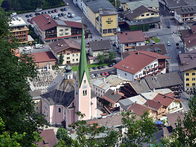
Schwaz
- city in the Austrian state of Tyrol
Hiking in Schwaz
Schwaz, located in the Tyrolean region of Austria, is a wonderful destination for hikers due to its stunning natural landscapes, rich history, and varied trails. The area offers numerous hiking opportunities that cater to all skill levels, from leisurely walks to challenging mountain treks....
- Country:
- Postal Code: 6130
- Local Dialing Code: 05242
- Licence Plate Code: SZ
- Coordinates: 47° 21' 0" N, 11° 42' 0" E
- GPS tracks (wikiloc): [Link]
- AboveSeaLevel: 545 м m
- Area: 20 sq km
- Population: 13728
- Web site: [Link]

Weer
- municipality in Austria
Hiking in Weer
Weer, located near the Inn Valley in Tyrol, Austria, is a picturesque town surrounded by stunning alpine scenery, making it an excellent destination for hiking enthusiasts....
- Country:
- Postal Code: 6116
- Local Dialing Code: 05224
- Licence Plate Code: SZ
- Coordinates: 47° 18' 19" N, 11° 38' 44" E
- GPS tracks (wikiloc): [Link]
- AboveSeaLevel: 558 м m
- Area: 5.61 sq km
- Population: 1539
- Web site: [Link]

Stans
- municipality in Austria
Hiking in Stans
Stans, a picturesque village located in the Tyrol region of Austria, offers a variety of hiking opportunities that cater to different skill levels and preferences. Nestled in the foothills of the Alps, the area is known for its stunning landscapes, lush forests, and breathtaking mountain views....
- Country:
- Postal Code: 6135
- Local Dialing Code: 05242
- Licence Plate Code: SZ
- Coordinates: 47° 22' 8" N, 11° 43' 8" E
- GPS tracks (wikiloc): [Link]
- AboveSeaLevel: 563 м m
- Area: 20.1 sq km
- Population: 2035
- Web site: [Link]
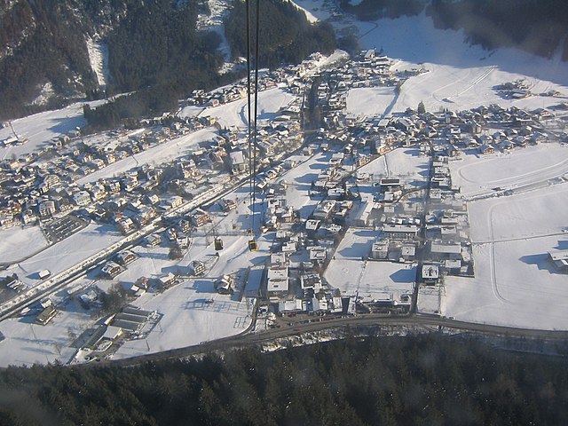
Mayrhofen
- municipality in Austria
Hiking in Mayrhofen
Mayrhofen, located in the Zillertal Valley of Austria, is a fantastic destination for hiking enthusiasts. Nestled within the stunning Tyrolean Alps, it offers a wide variety of trails that cater to different skill levels, from beginners to experienced hikers. Here's what you can expect when hiking in and around Mayrhofen:...
- Country:
- Postal Code: 6290
- Local Dialing Code: 05285
- Licence Plate Code: SZ
- Coordinates: 47° 10' 0" N, 11° 52' 0" E
- GPS tracks (wikiloc): [Link]
- AboveSeaLevel: 633 м m
- Area: 178.8 sq km
- Population: 3858
- Web site: [Link]


Jenbach
- municipality in Austria
Hiking in Jenbach
Jenbach, located in the Tyrol region of Austria, serves as an excellent base for hiking enthusiasts. Nestled in the foothills of the Alps, it offers a range of hiking trails suitable for varying skill levels, from leisurely walks to challenging alpine routes. Here are some key points about hiking in and around Jenbach:...
- Country:
- Postal Code: 6200
- Local Dialing Code: 05244
- Licence Plate Code: SZ
- Coordinates: 47° 23' 36" N, 11° 46' 36" E
- GPS tracks (wikiloc): [Link]
- AboveSeaLevel: 563 м m
- Area: 15.22 sq km
- Population: 7120
- Web site: [Link]


Aschau im Zillertal
- municipality in Austria
Hiking in Aschau im Zillertal
Aschau im Zillertal is a beautiful destination for hiking enthusiasts, nestled in the scenic Zillertal Valley of Tyrol, Austria. Here are some highlights that you might find appealing:...
- Country:
- Postal Code: 6274
- Local Dialing Code: 05282
- Licence Plate Code: SZ
- Coordinates: 47° 16' 0" N, 11° 54' 0" E
- GPS tracks (wikiloc): [Link]
- AboveSeaLevel: 567 м m
- Area: 20.27 sq km
- Population: 1866
- Web site: [Link]

Strass im Zillertal
- municipality in Austria
Hiking in Strass im Zillertal
Strass im Zillertal is a charming village in the Zillertal Valley of Tyrol, Austria, surrounded by stunning alpine landscapes, making it an excellent destination for hiking enthusiasts. Here are some highlights about hiking in this area:...
- Country:
- Postal Code: 6261
- Local Dialing Code: 05244
- Licence Plate Code: SZ
- Coordinates: 47° 23' 0" N, 11° 49' 0" E
- GPS tracks (wikiloc): [Link]
- AboveSeaLevel: 523 м m
- Area: 5.96 sq km
- Population: 836
- Web site: [Link]

Terfens
- municipality in Austria
Hiking in Terfens
Terfens is a picturesque village located in the Tyrol region of Austria, surrounded by stunning natural landscapes that are perfect for hiking enthusiasts. The area is characterized by its beautiful alpine scenery, diverse flora and fauna, and a range of hiking trails suitable for all skills levels. Here are some highlights and recommendations for hiking in Terfens:...
- Country:
- Postal Code: 6123
- Licence Plate Code: SZ
- Coordinates: 47° 19' 34" N, 11° 38' 46" E
- GPS tracks (wikiloc): [Link]
- AboveSeaLevel: 591 м m
- Area: 15.22 sq km
- Population: 2184
- Web site: [Link]

Finkenberg
- municipality in Austria
Hiking in Finkenberg
Finkenberg is a picturesque village located in the Zillertal Valley of Tyrol, Austria, known for its stunning alpine scenery and a variety of hiking opportunities. Here are some key points about hiking in Finkenberg:...
- Country:
- Postal Code: 6292
- Local Dialing Code: 05285
- Licence Plate Code: SZ
- Coordinates: 47° 9' 10" N, 11° 49' 18" E
- GPS tracks (wikiloc): [Link]
- AboveSeaLevel: 839 м m
- Area: 171.6 sq km
- Population: 1421
- Web site: [Link]

Brandberg
- municipality in Austria
Hiking in Brandberg
Brandberg, located in the Tyrolean region of Austria, is known for its stunning landscapes and diverse hiking opportunities. This area is nestled within the majestic Alps, offering hikers a mix of alpine meadows, rugged mountains, and picturesque valleys. Here's what you can expect when hiking in Brandberg:...
- Country:
- Postal Code: 6290
- Local Dialing Code: 05285
- Licence Plate Code: SZ
- Coordinates: 47° 10' 0" N, 11° 54' 0" E
- GPS tracks (wikiloc): [Link]
- AboveSeaLevel: 1082 м m
- Area: 156.5 sq km
- Population: 354
- Web site: [Link]

Schwendau
- municipality in Austria
Hiking in Schwendau
Schwendau is a picturesque village located in the Zillertal Valley of Tyrol, Austria. It is an excellent base for hiking due to its stunning scenery, diverse trails, and proximity to the Zillertal Alps. Here are some key points about hiking in Schwendau:...
- Country:
- Licence Plate Code: SZ
- Coordinates: 47° 11' 51" N, 11° 51' 36" E
- GPS tracks (wikiloc): [Link]
- AboveSeaLevel: 620 м m
- Area: 17.36 sq km
- Population: 1682
- Web site: [Link]

Buch in Tirol
- municipality in Austria
Hiking in Buch in Tirol
Buch in Tirol is a charming village located in the Tyrol region of Austria, surrounded by stunning alpine landscapes that offer a variety of hiking opportunities. Here are some highlights and tips for hiking in and around Buch:...
- Country:
- Postal Code: 6220
- Local Dialing Code: 05244
- Licence Plate Code: SZ
- Coordinates: 47° 22' 41" N, 11° 46' 8" E
- GPS tracks (wikiloc): [Link]
- AboveSeaLevel: 545 м m
- Area: 9.49 sq km
- Population: 2548
- Web site: [Link]


Fügen
- municipality in Austria
Hiking in Fügen
Fügen is a picturesque village located in the Zillertal Valley of Tyrol, Austria. It offers stunning natural landscapes, rich cultural experiences, and numerous hiking trails suitable for all levels of hikers. Here’s what you need to know about hiking in Fügen:...
- Country:
- Postal Code: 6263
- Local Dialing Code: 05288
- Licence Plate Code: SZ
- Coordinates: 47° 21' 0" N, 11° 50' 0" E
- GPS tracks (wikiloc): [Link]
- AboveSeaLevel: 545 м m
- Area: 6.64 sq km
- Population: 4169
- Web site: [Link]


Hart im Zillertal
- municipality in Austria
Hiking in Hart im Zillertal
Hart im Zillertal is a beautiful destination for hiking in the Tyrol region of Austria, known for its stunning natural landscapes and well-maintained trails. Nestled in the Zillertal Valley, it offers a variety of hiking opportunities suitable for different skill levels, from easy walks to more challenging mountain hikes....
- Country:
- Postal Code: 6265
- Local Dialing Code: 05288
- Licence Plate Code: SZ
- Coordinates: 47° 21' 0" N, 11° 52' 0" E
- GPS tracks (wikiloc): [Link]
- AboveSeaLevel: 666 м m
- Area: 35.54 sq km
- Population: 1587
- Web site: [Link]


Hippach
- municipality in Austria
Hiking in Hippach
Hippach is a charming village located in the Zillertal Valley of Tyrol, Austria, and it’s an excellent base for hikers of all levels. Surrounded by stunning alpine landscapes, lush forests, and beautiful meadows, the region offers a wide variety of hiking trails that cater to different preferences, from leisurely walks to challenging mountain hikes....
- Country:
- Postal Code: 6283
- Local Dialing Code: 05282
- Licence Plate Code: SZ
- Coordinates: 47° 12' 0" N, 11° 52' 0" E
- GPS tracks (wikiloc): [Link]
- AboveSeaLevel: 608 м m
- Area: 39.37 sq km
- Population: 1455
- Web site: [Link]


Bruck am Ziller
- municipality in Austria
Hiking in Bruck am Ziller
Bruck am Ziller is a charming village located in the Zillertal Valley of Austria, surrounded by beautiful alpine landscapes, making it an excellent destination for hiking enthusiasts. The region offers a variety of trails suitable for hikers of all experience levels, from gentle walks through picturesque valleys to challenging mountain hikes....
- Country:
- Postal Code: 6260
- Local Dialing Code: 05288
- Licence Plate Code: SZ
- Coordinates: 47° 22' 0" N, 11° 50' 0" E
- GPS tracks (wikiloc): [Link]
- AboveSeaLevel: 579 м m
- Area: 6.01 sq km
- Population: 1098
- Web site: [Link]

Wiesing
- municipality in Austria
Hiking in Wiesing
Wiesing, located in the Tyrol region of Austria, is a picturesque destination for hiking enthusiasts. Nestled between stunning mountains and beautiful natural landscapes, it offers numerous trails catering to various skill levels. Here are some key highlights and recommendations for hiking in the Wiesing area:...
- Country:
- Postal Code: 6210
- Local Dialing Code: 05244
- Licence Plate Code: SZ
- Coordinates: 47° 24' 19" N, 11° 47' 52" E
- GPS tracks (wikiloc): [Link]
- AboveSeaLevel: 566 м m
- Area: 10.36 sq km
- Population: 2124
- Web site: [Link]

Pill
- municipality in Austria
Hiking in Pill
Pill, a charming village in the Tyrol region of Austria, offers a splendid base for hiking enthusiasts looking to explore the stunning landscapes of the Alps. Nestled near the Inn River and surrounded by lush greenery, Pill is characterized by its picturesque mountain views, making it an ideal location for various hiking trails....
- Country:
- Postal Code: 6136
- Local Dialing Code: 05242
- Licence Plate Code: SZ
- Coordinates: 47° 19' 15" N, 11° 40' 57" E
- GPS tracks (wikiloc): [Link]
- AboveSeaLevel: 556 м m
- Area: 20.9 sq km
- Population: 1174
- Web site: [Link]
Gallzein
- municipality in Austria
Hiking in Gallzein
Gallzein is a charming village located in the Austrian state of Tyrol, near the Zillertal Alps, known for its stunning scenery and extensive hiking opportunities. Here are some highlights about hiking in Gallzein:...
- Country:
- Postal Code: 6222
- Local Dialing Code: 05244
- Licence Plate Code: SZ
- Coordinates: 47° 22' 0" N, 11° 46' 0" E
- GPS tracks (wikiloc): [Link]
- AboveSeaLevel: 825 м m
- Area: 10.10 sq km
- Population: 668
- Web site: [Link]

Eben am Achensee
- municipality in Austria
Hiking in Eben am Achensee
Eben am Achensee, located in Tyrol, Austria, is a picturesque destination ideal for hiking enthusiasts. Nestled near Lake Achensee, which is the largest freshwater lake in Tyrol, the area boasts stunning mountain scenery, diverse trails, and a variety of outdoor activities. Here are some highlights about hiking in this beautiful region:...
- Country:
- Postal Code: 6215 (Hinterriß, Bächental); 6213 (Pertisau); 6212 (Maurach)
- Licence Plate Code: SZ
- Coordinates: 47° 25' 22" N, 11° 45' 7" E
- GPS tracks (wikiloc): [Link]
- AboveSeaLevel: 970 м m
- Area: 196.56 sq km
- Population: 3180
- Web site: [Link]

Weerberg
- municipality in Austria
Hiking in Weerberg
Weerberg is a charming village located in the Tyrol region of Austria, along the Inn Valley. It's a beautiful area for hiking, offering stunning views of the surrounding mountains and lush alpine landscapes. Here are some key points to consider when planning a hike in Weerberg:...
- Country:
- Postal Code: 6133
- Local Dialing Code: 05224
- Licence Plate Code: SZ
- Coordinates: 47° 17' 54" N, 11° 39' 57" E
- GPS tracks (wikiloc): [Link]
- AboveSeaLevel: 882 м m
- Area: 55.4 sq km
- Population: 2482
- Web site: [Link]

Fügenberg
- municipality in Austria
Hiking in Fügenberg
Fügenberg is a beautiful hiking destination located in the Zillertal Valley of Tyrol, Austria. Known for its stunning landscapes, lush forests, and panoramic mountain views, it offers a range of hiking trails suitable for various skill levels, from easy walks to more challenging hikes....
- Country:
- Postal Code: 6264
- Local Dialing Code: 05288
- Licence Plate Code: SZ
- Coordinates: 47° 20' 17" N, 11° 50' 40" E
- GPS tracks (wikiloc): [Link]
- AboveSeaLevel: 681 м m
- Area: 58.5 sq km
- Population: 1405
- Web site: [Link]


Stumm
- municipality in Austria
Hiking in Stumm
Stumm, located in the Zillertal Valley in Austria, is a small village surrounded by beautiful alpine landscapes, making it a great destination for hiking enthusiasts. The area offers a variety of trails suitable for different skill levels, from leisurely walks to more challenging hikes....
- Country:
- Postal Code: 6275
- Local Dialing Code: 05283
- Licence Plate Code: SZ
- Coordinates: 47° 16' 0" N, 11° 52' 0" E
- GPS tracks (wikiloc): [Link]
- AboveSeaLevel: 556 м m
- Area: 4.95 sq km
- Population: 1885
- Web site: [Link]

Hainzenberg
- municipality in Austria
Hiking in Hainzenberg
Hainzenberg is a beautiful area in Austria, part of the Zillertal Valley, known for its stunning alpine landscapes and various hiking opportunities. Here are some key points to consider when hiking in Hainzenberg:...
- Country:
- Postal Code: 6278
- Local Dialing Code: 05282
- Licence Plate Code: SZ
- Coordinates: 47° 13' 0" N, 11° 54' 0" E
- GPS tracks (wikiloc): [Link]
- AboveSeaLevel: 910 м m
- Area: 21.5 sq km
- Population: 731
- Web site: [Link]

Ried im Zillertal
- municipality in Austria
Hiking in Ried im Zillertal
Ried im Zillertal is a charming village located in the Zillertal Valley of Tyrol, Austria. This area is renowned for its stunning alpine scenery, making it a fantastic destination for hiking enthusiasts of all levels. Here are some highlights and tips for hiking in and around Ried im Zillertal:...
- Country:
- Postal Code: 6273
- Local Dialing Code: 05283
- Licence Plate Code: SZ
- Coordinates: 47° 18' 0" N, 11° 52' 10" E
- GPS tracks (wikiloc): [Link]
- AboveSeaLevel: 573 м m
- Area: 9.46 sq km
- Population: 1280
- Web site: [Link]


Gerlosberg
- municipality in Austria
Hiking in Gerlosberg
Gerlosberg is a picturesque area located in the Zillertal Valley in Austria, known for its stunning landscapes, lush greenery, and a range of hiking opportunities. Here are some key points to consider if you're planning a hiking trip there:...
- Country:
- Postal Code: 6280
- Local Dialing Code: 05282
- Licence Plate Code: SZ
- Coordinates: 47° 13' 0" N, 11° 55' 0" E
- GPS tracks (wikiloc): [Link]
- AboveSeaLevel: 1050 м m
- Area: 16.19 sq km
- Population: 465
- Web site: [Link]
Stummerberg
- municipality in Austria
Hiking in Stummerberg
Stummerberg is a beautiful hiking area located in the Tyrol region of Austria, known for its stunning mountain landscapes and well-maintained trails. Here are some key points about hiking in Stummerberg:...
- Country:
- Postal Code: 6276
- Local Dialing Code: 05283
- Licence Plate Code: SZ
- Coordinates: 47° 16' 0" N, 11° 55' 0" E
- GPS tracks (wikiloc): [Link]
- AboveSeaLevel: 800 м m
- Area: 56.73 sq km
- Population: 844
- Web site: [Link]

Kaltenbach
- municipality in Austria
Hiking in Kaltenbach
Kaltenbach, located in the Zillertal Valley of Austria, is an excellent destination for hiking enthusiasts. The region offers a stunning natural landscape characterized by lush valleys, impressive mountain ranges, and a variety of trails catering to different skill levels....
- Country:
- Postal Code: 6272
- Local Dialing Code: 05283
- Licence Plate Code: SZ
- Coordinates: 47° 16' 0" N, 11° 52' 0" E
- GPS tracks (wikiloc): [Link]
- AboveSeaLevel: 558 м m
- Area: 56.7 sq km
- Population: 1313
- Web site: [Link]
Rohrberg
- municipality in Austria
Hiking in Rohrberg
Rohrberg is a picturesque village located in the Zillertal Valley of Austria, surrounded by stunning alpine scenery. Hiking in this area offers a range of beautiful trails suitable for different skill levels, making it a great destination for both beginner and experienced hikers....
- Country:
- Postal Code: 6280
- Local Dialing Code: 05282
- Licence Plate Code: SZ
- Coordinates: 47° 14' 15" N, 11° 53' 56" E
- GPS tracks (wikiloc): [Link]
- AboveSeaLevel: 675 м m
- Area: 10.17 sq km
- Population: 574
- Web site: [Link]

Gerlos
- municipality in Austria
Hiking in Gerlos
Gerlos is a picturesque village located in the Zillertal Valley of Tyrol, Austria, renowned for its stunning mountainous landscapes and diverse hiking opportunities. Whether you're an experienced hiker or a beginner, Gerlos offers a range of trails that cater to all levels of fitness and experience....
- Country:
- Postal Code: 6281
- Local Dialing Code: 05284
- Licence Plate Code: SZ
- Coordinates: 47° 13' 0" N, 12° 0' 0" E
- GPS tracks (wikiloc): [Link]
- AboveSeaLevel: 1247 м m
- Area: 118.7 sq km
- Population: 790
- Web site: [Link]

Steinberg am Rofan
- municipality in Austria
Hiking in Steinberg am Rofan
Steinberg am Rofan is a picturesque village in the Tyrol region of Austria, surrounded by the stunning Rofan mountain range. It’s an excellent destination for hikers of all skill levels, offering a variety of trails and breathtaking landscapes....
- Country:
- Postal Code: 6215
- Local Dialing Code: 05248
- Licence Plate Code: SZ
- Coordinates: 47° 30' 55" N, 11° 47' 46" E
- GPS tracks (wikiloc): [Link]
- AboveSeaLevel: 1010 м m
- Area: 68.6 sq km
- Population: 286
- Web site: [Link]

Uderns
- municipality in Austria
Hiking in Uderns
Uderns is a charming village located in the Zillertal Valley in Tyrol, Austria, surrounded by stunning alpine scenery. The area offers a variety of hiking opportunities suitable for different skill levels, making it a great destination for both beginners and experienced hikers....
- Country:
- Postal Code: 6271
- Local Dialing Code: 05288
- Licence Plate Code: SZ
- Coordinates: 47° 19' 37" N, 11° 51' 53" E
- GPS tracks (wikiloc): [Link]
- AboveSeaLevel: 549 м m
- Area: 6.72 sq km
- Population: 1845
- Web site: [Link]


Ramsau im Zillertal
- municipality in Austria
Hiking in Ramsau im Zillertal
Ramsau im Zillertal is a picturesque village in the Zillertal Valley of Austria, known for its stunning mountain scenery and diverse hiking opportunities. It's an ideal destination for both casual hikers and experienced trekkers. Here are some key highlights regarding hiking in the area:...
- Country:
- Postal Code: 6283
- Local Dialing Code: 05282
- Licence Plate Code: SZ
- Coordinates: 47° 12' 0" N, 11° 52' 0" E
- GPS tracks (wikiloc): [Link]
- AboveSeaLevel: 604 м m
- Area: 8.96 sq km
- Population: 1617
- Web site: [Link]
Shares border with regions:


Garmisch-Partenkirchen
- district of Bavaria, Germany
Hiking in Garmisch-Partenkirchen
Garmisch-Partenkirchen is a beautiful district located in Bavaria, Germany, and is renowned for its stunning alpine scenery and outdoor recreational activities, making it a popular destination for hikers. Here are some key points about hiking in this picturesque area:...
- Country:

- Capital: Garmisch-Partenkirchen
- Licence Plate Code: GAP
- Coordinates: 47° 34' 48" N, 11° 10' 12" E
- GPS tracks (wikiloc): [Link]
- AboveSeaLevel: 1296 м m
- Area: 1012.00 sq km
- Population: 78782
- Web site: [Link]

Bad Tölz-Wolfratshausen
- district of Bavaria, Germany
Hiking in Bad Tölz-Wolfratshausen
Bad Tölz-Wolfratshausen is a picturesque region in Bavaria, Germany, known for its stunning landscapes and excellent hiking opportunities. Nestled in the foothills of the Alps, this area offers a variety of trails that cater to different skill levels, from gentle walks suitable for families to more challenging hikes for experienced adventurers....
- Country:
- Capital: Bad Tölz
- Licence Plate Code: WOR; TÖL
- Coordinates: 47° 45' 0" N, 11° 34' 48" E
- GPS tracks (wikiloc): [Link]
- AboveSeaLevel: 848 м m
- Area: 1111.00 sq km
- Population: 126572
- Web site: [Link]

Miesbach
- district of Bavaria, Germany
Hiking in Miesbach
Miesbach is a scenic district located in Bavaria, Germany, known for its stunning landscapes, rolling hills, and proximity to the Alps. It offers a wealth of hiking opportunities for both beginners and experienced hikers. Here are some highlights about hiking in the Miesbach district:...
- Country:
- Capital: Miesbach
- Licence Plate Code: MB
- Coordinates: 47° 44' 24" N, 11° 48' 36" E
- GPS tracks (wikiloc): [Link]
- AboveSeaLevel: 741 м m
- Area: 864.00 sq km
- Population: 93630
- Web site: [Link]