Vomp (Vomp)
- municipality in Austria
Vomp, located in the Tyrol region of Austria, is a charming village that serves as a gateway to stunning hiking experiences in the surrounding mountains. Here are some key points about hiking in and around Vomp:
Trails and Routes
- Scenic Trails: Vomp and the surrounding areas offer a variety of hiking trails that cater to different skill levels, from easy family-friendly walks to more challenging mountain hikes.
- Ski- & Freizeit-Arena Bergeralm: Although primarily known as a ski resort, in the summer, it transforms into a hiking paradise with well-marked trails.
- Zillertal Valley: Nearby, the Zillertal Valley offers extensive hiking opportunities, with numerous routes that lead through beautiful landscapes, alpine meadows, and offer spectacular mountain views.
- Vomp's Mountain Trails: Consider trails leading to the surrounding peaks, such as the Gschwandtkopf or nearby Rofangebirge for breathtaking panoramas.
Natural Attractions
- Lakes & Rivers: Enjoy paths that take you past pristine lakes and rivers, perfect for a refreshing break during your hike.
- Flora and Fauna: Experience vibrant alpine flowers and diverse wildlife during your hikes, particularly in late spring and summer.
Tips for Hiking in Vomp
- Seasons: Late spring to early autumn is ideal for hiking, with the best conditions found from June to September.
- Equipment: Wear sturdy hiking boots, bring plenty of water, snacks, and appropriate clothing for variable weather conditions.
- Trail Maps: Utilize local resources for trail maps and guidance, and consider joining guided hikes if you are unfamiliar with the area.
- Local Culture: Take some time to appreciate the local culture, food, and hospitality in Vomp. It’s a great place to unwind after a day on the trails.
Getting There
Vomp is easily accessible by car or public transport from larger cities such as Innsbruck, making it a convenient spot for both locals and tourists looking for hiking adventures.
Whether you're enjoying a leisurely stroll or tackling a more demanding hike, Vomp’s stunning landscapes and well-maintained trails make it a fantastic destination for outdoor enthusiasts. Happy hiking!
- Country:

- Licence Plate Code: SZ
- Coordinates: 47° 20' 32" N, 11° 41' 0" E


- GPS tracks (wikiloc): [Link]
- AboveSeaLevel: 563 м m
- Area: 182.61 sq km
- Population: 5146
- Web site: http://www.vomp.tirol.gv.at
- Wikipedia en: wiki(en)
- Wikipedia: wiki(de)
- Wikidata storage: Wikidata: Q202007
- Wikipedia Commons Category: [Link]
- Freebase ID: [/m/02vwl3y]
- GeoNames ID: Alt: [2762303]
- VIAF ID: Alt: [159654400]
- GND ID: Alt: [4490302-9]
- archINFORM location ID: [11167]
- Library of Congress authority ID: Alt: [n2005065032]
- MusicBrainz area ID: [23861e17-80d1-41d7-9bb7-f0934b231607]
- Austrian municipality key: [70936]
Shares border with regions:


Mittenwald
- town in Bavaria, Germany
Mittenwald, located in Bavaria, Germany, is a beautiful destination for hiking enthusiasts. Nestled in the Karwendel Mountain range, it offers a variety of trails that cater to all levels of hikers, from beginners to seasoned adventurers. Here are some highlights about hiking in the area:...
- Country:

- Postal Code: 82481
- Local Dialing Code: 08823
- Licence Plate Code: GAP
- Coordinates: 47° 25' 0" N, 11° 15' 0" E


- GPS tracks (wikiloc): [Link]
- AboveSeaLevel: 923 м m
- Area: 132.85 sq km
- Population: 7387
- Web site: [Link]


Absam
- municipality in Austria
Absam, located in Tyrol, Austria, is a beautiful area surrounded by the stunning scenery of the Alps, making it a fantastic destination for hiking enthusiasts. Here are a few key points about hiking in Absam:...
- Country:

- Postal Code: 6067
- Local Dialing Code: 05223
- Licence Plate Code: IL
- Coordinates: 47° 17' 0" N, 11° 30' 0" E


- GPS tracks (wikiloc): [Link]
- AboveSeaLevel: 632 м m
- Area: 51.92 sq km
- Population: 7112
- Web site: [Link]
Lenggries
- place in Bavaria, Germany
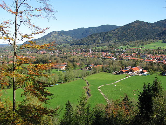
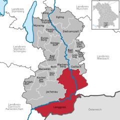
Lenggries is a charming town located in Bavaria, Germany, and is surrounded by beautiful mountains, making it a great destination for hiking enthusiasts. The area offers a variety of trails suitable for all levels, from leisurely walks to challenging hikes, all amidst stunning natural scenery....
- Country:

- Postal Code: 83661
- Local Dialing Code: 08042
- Coordinates: 47° 40' 49" N, 11° 34' 26" E


- GPS tracks (wikiloc): [Link]
- AboveSeaLevel: 679 м m
- Area: 242.90 sq km
- Population: 10001
- Web site: [Link]


Schwaz
- city in the Austrian state of Tyrol
Schwaz, located in the Tyrolean region of Austria, is a wonderful destination for hikers due to its stunning natural landscapes, rich history, and varied trails. The area offers numerous hiking opportunities that cater to all skill levels, from leisurely walks to challenging mountain treks....
- Country:

- Postal Code: 6130
- Local Dialing Code: 05242
- Licence Plate Code: SZ
- Coordinates: 47° 21' 0" N, 11° 42' 0" E


- GPS tracks (wikiloc): [Link]
- AboveSeaLevel: 545 м m
- Area: 20 sq km
- Population: 13728
- Web site: [Link]

Gnadenwald
- municipality in Austria
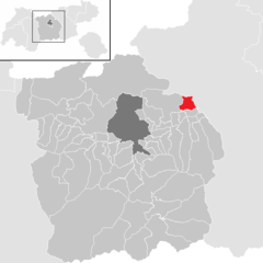
Gnadenwald is a charming area in Austria located in the Tyrol region, just a short distance from the city of Innsbruck. Known for its beautiful landscapes and serene environment, it offers a range of hiking opportunities suitable for various skill levels....
- Country:

- Postal Code: 6069
- Local Dialing Code: 05223
- Licence Plate Code: IL
- Coordinates: 47° 19' 0" N, 11° 33' 0" E


- GPS tracks (wikiloc): [Link]
- AboveSeaLevel: 879 м m
- Area: 11.49 sq km
- Population: 826
- Web site: [Link]
Scharnitz
- municipality in Austria
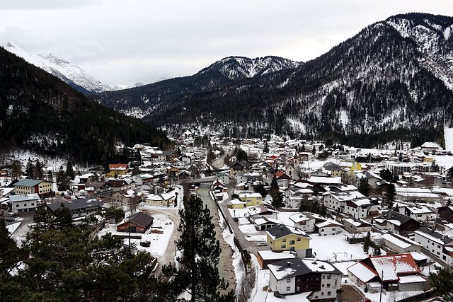
Scharnitz is a picturesque village located at the border between Germany and Austria, serving as a perfect starting point for various hiking adventures in the Tyrolean Alps. The area is known for its stunning natural beauty, diverse trails, and opportunities for outdoor activities....
- Country:

- Postal Code: 6108
- Local Dialing Code: 05213
- Licence Plate Code: IL
- Coordinates: 47° 23' 18" N, 11° 15' 54" E


- GPS tracks (wikiloc): [Link]
- AboveSeaLevel: 964 м m
- Area: 158.77 sq km
- Population: 1403
- Web site: [Link]

Stans
- municipality in Austria
Stans, a picturesque village located in the Tyrol region of Austria, offers a variety of hiking opportunities that cater to different skill levels and preferences. Nestled in the foothills of the Alps, the area is known for its stunning landscapes, lush forests, and breathtaking mountain views....
- Country:

- Postal Code: 6135
- Local Dialing Code: 05242
- Licence Plate Code: SZ
- Coordinates: 47° 22' 8" N, 11° 43' 8" E


- GPS tracks (wikiloc): [Link]
- AboveSeaLevel: 563 м m
- Area: 20.1 sq km
- Population: 2035
- Web site: [Link]

Terfens
- municipality in Austria
Terfens is a picturesque village located in the Tyrol region of Austria, surrounded by stunning natural landscapes that are perfect for hiking enthusiasts. The area is characterized by its beautiful alpine scenery, diverse flora and fauna, and a range of hiking trails suitable for all skills levels. Here are some highlights and recommendations for hiking in Terfens:...
- Country:

- Postal Code: 6123
- Licence Plate Code: SZ
- Coordinates: 47° 19' 34" N, 11° 38' 46" E


- GPS tracks (wikiloc): [Link]
- AboveSeaLevel: 591 м m
- Area: 15.22 sq km
- Population: 2184
- Web site: [Link]

Pill
- municipality in Austria
Pill, a charming village in the Tyrol region of Austria, offers a splendid base for hiking enthusiasts looking to explore the stunning landscapes of the Alps. Nestled near the Inn River and surrounded by lush greenery, Pill is characterized by its picturesque mountain views, making it an ideal location for various hiking trails....
- Country:

- Postal Code: 6136
- Local Dialing Code: 05242
- Licence Plate Code: SZ
- Coordinates: 47° 19' 15" N, 11° 40' 57" E


- GPS tracks (wikiloc): [Link]
- AboveSeaLevel: 556 м m
- Area: 20.9 sq km
- Population: 1174
- Web site: [Link]

Eben am Achensee
- municipality in Austria
Eben am Achensee, located in Tyrol, Austria, is a picturesque destination ideal for hiking enthusiasts. Nestled near Lake Achensee, which is the largest freshwater lake in Tyrol, the area boasts stunning mountain scenery, diverse trails, and a variety of outdoor activities. Here are some highlights about hiking in this beautiful region:...
- Country:

- Postal Code: 6215 (Hinterriß, Bächental); 6213 (Pertisau); 6212 (Maurach)
- Licence Plate Code: SZ
- Coordinates: 47° 25' 22" N, 11° 45' 7" E


- GPS tracks (wikiloc): [Link]
- AboveSeaLevel: 970 м m
- Area: 196.56 sq km
- Population: 3180
- Web site: [Link]

