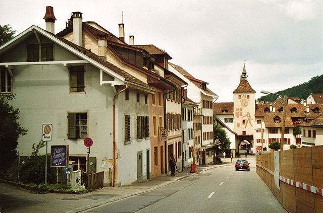
Seltisberg (Seltisberg)

- municipality in Switzerland
 Hiking in Seltisberg
Seltisberg is a picturesque municipality located in the Canton of Basel-Landschaft in Switzerland. Hiking in this area offers beautiful landscapes, lush greenery, and an opportunity to enjoy serene natural surroundings. Here are some highlights and tips for hiking in Seltisberg:
Popular Trails
-
Seltisberg Trail: Various trails traverse through charming meadows and forests providing great views of the surrounding hills and valleys. Look out for signposts indicating various routes.
-
Hiking to the Reigoldswil: This route often leads you through some less-traveled areas and provides picturesque views of the local flora and fauna.
-
Nearby Routes: Seltisberg is close to some more prominent hiking routes in the region, including those leading towards the Belchen, which is part of the Swiss Jura mountain range.
Terrain & Difficulty
- The terrain in Seltisberg can vary from gentle slopes to more challenging paths. Most trails are well-marked and cater to different levels of hiking experience, so you can find routes suitable for beginners or more experienced hikers.
Scenic Views
- From many points along the trails, you can enjoy stunning views of the surrounding landscapes, including valleys, hills, and sometimes even glimpses of the distant Alps on clear days.
Wildlife & Flora
- The area is rich in biodiversity, so keep an eye out for various bird species, local wildlife, and beautiful wildflowers during your hike, especially in spring and summer.
Access & Transportation
- Seltisberg is accessible from major Swiss cities via public transport. It’s relatively easy to reach by train and bus, making it a convenient spot for day hikes.
Practical Tips
-
Weather: Always check the weather forecast before heading out; conditions can change rapidly in mountainous areas.
-
Equipment: Proper hiking shoes, water, and snacks are essential. Depending on the season, consider layering clothing to adjust to changing temperatures.
-
Trail Maps: While many trails are marked, it can be helpful to carry a map or download a hiking app for navigation.
Local Amenities
- After your hike, you may find local cafes or restaurants where you can enjoy traditional Swiss food or refreshments.
Hiking in Seltisberg allows you to experience the stunning natural beauty of Switzerland and enjoy a peaceful day outdoors. Happy hiking!
- Country:

- Postal Code: 4411
- Local Dialing Code: 061
- Licence Plate Code: BL
- Coordinates: 47° 27' 43" N, 7° 42' 56" E


- GPS tracks (wikiloc): [Link]
- AboveSeaLevel: 491 м m
- Area: 3.57 sq km
- Population: 1311
- Web site: http://www.seltisberg.ch
- Wikipedia en: wiki(en)
- Wikipedia: wiki(de)
- Wikidata storage: Wikidata: Q66547
- Wikipedia Commons Category: [Link]
- Freebase ID: [/m/0g6fbp]
- GeoNames ID: Alt: [7287143]
- VIAF ID: Alt: [238098351]
- OSM relation ID: [1683706]
- HDS ID: [1215]
- Swiss municipality code: [2833]
Shares border with regions:
Lupsingen
- municipality in Switzerland
Hiking in Lupsingen
Lupsingen, located in the Basel-Landschaft region of Switzerland, is a charming area that offers several opportunities for hiking enthusiasts. While the region is not as well-known as some other Swiss hiking destinations, it boasts beautiful landscapes, scenic trails, and a tranquil atmosphere....
- Country:
- Postal Code: 4419
- Local Dialing Code: 061
- Licence Plate Code: BL
- Coordinates: 47° 26' 47" N, 7° 41' 46" E
- GPS tracks (wikiloc): [Link]
- AboveSeaLevel: 430 м m
- Area: 3.12 sq km
- Population: 1422
- Web site: [Link]


Bubendorf
- municipality in the canton Basel-Landschaft, Switzerland
Hiking in Bubendorf
Bubendorf is a small municipality located in the canton of Basel-Landschaft in Switzerland. Although it may not be as widely known as some of the larger hiking destinations in the region, it offers a variety of scenic trails and opportunities for outdoor activities....
- Country:
- Postal Code: 4416
- Local Dialing Code: 061
- Licence Plate Code: BL
- Coordinates: 47° 26' 45" N, 7° 44' 13" E
- GPS tracks (wikiloc): [Link]
- AboveSeaLevel: 376 м m
- Area: 10.81 sq km
- Population: 4339
- Web site: [Link]

Liestal
- town in, and capital of, the Swiss canton of Basel-Country
Hiking in Liestal
Liestal, located in the Basel-Landschaft region of Switzerland, is a beautiful area that offers a variety of hiking opportunities suited for all levels of hikers. Here are some highlights about hiking in and around Liestal:...
- Country:
- Postal Code: 4410
- Local Dialing Code: 061
- Licence Plate Code: BL
- Coordinates: 47° 29' 2" N, 7° 44' 6" E
- GPS tracks (wikiloc): [Link]
- AboveSeaLevel: 342 м m
- Area: 18.19 sq km
- Population: 14269
- Web site: [Link]