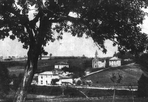
Semons (Semons)

- commune in Isère, France
 Hiking in Semons
It seems like there may be a slight misspelling or misunderstanding regarding the location "Semons." If you meant "Semon," "Semon Mountain," or perhaps a different location known for hiking (like the area around Semons or another name similar), please clarify.
However, if you're referring to a specific destination or region that involves hiking, I'd be happy to provide general tips, popular trails, or information relevant to hiking in that area once I have more details!
If you're looking for hiking advice that could apply to various locations, I can help with that too! Just let me know which trails or areas you’re interested in.
- Country:

- Postal Code: 38260
- Coordinates: 45° 25' 56" N, 5° 11' 41" E


- GPS tracks (wikiloc): [Link]
- Area: 10.55 sq km
- Population: 362
- Web site: http://semons.e-monsite.com
- Wikipedia en: wiki(en)
- Wikipedia: wiki(fr)
- Wikidata storage: Wikidata: Q1067827
- Wikipedia Commons Category: [Link]
- Freebase ID: [/m/03nvkvf]
- GeoNames ID: Alt: [6613263]
- SIREN number: [213804792]
- BnF ID: [15258284k]
- INSEE municipality code: 38479
Shares border with regions:


Commelle
- commune in Isère, France
Hiking in Commelle
Commelle is a lesser-known hiking destination, but if you're referring to a specific region or trail system, I would need a bit more clarity, as there may be multiple locations with similar names around the world....
- Country:
- Postal Code: 38260
- Coordinates: 45° 25' 41" N, 5° 13' 35" E
- GPS tracks (wikiloc): [Link]
- Area: 14.04 sq km
- Population: 927
- Web site: [Link]


Ornacieux
- commune in Isère, France
Hiking in Ornacieux
Ornacieux is a charming village located in the Rhône-Alpes region of France, surrounded by beautiful natural landscapes, making it a great destination for hiking enthusiasts. The area offers a variety of trails that cater to different skill levels, from leisurely walks to more challenging hikes....
- Country:
- Postal Code: 38260
- Coordinates: 45° 24' 2" N, 5° 12' 40" E
- GPS tracks (wikiloc): [Link]
- Area: 4.89 sq km
- Population: 416
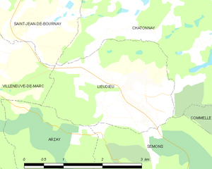
Lieudieu
- commune in Isère, France
Hiking in Lieudieu
Lieudieu is a scenic area located in the Auvergne-Rhône-Alpes region of France, nestled in the beautiful landscapes of the Alps. Hiking in this region can offer breathtaking views, diverse terrain, and opportunities to explore both nature and local culture....
- Country:
- Postal Code: 38440
- Coordinates: 45° 27' 30" N, 5° 10' 53" E
- GPS tracks (wikiloc): [Link]
- Area: 5.94 sq km
- Population: 341

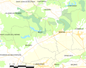
Arzay
- commune in Isère, France
Hiking in Arzay
As of my last update, there's limited information specifically about "Arzay" as a hiking destination. It's possible that you might be referring to a less-known area or there might be a misspelling. However, I can provide general hiking tips and suggestions for exploring regions that might include areas like Arzay if they are situated near popular hiking destinations....
- Country:
- Postal Code: 38260
- Coordinates: 45° 25' 32" N, 5° 10' 13" E
- GPS tracks (wikiloc): [Link]
- Area: 9.79 sq km
- Population: 226


Châtonnay
- commune in Isère, France
Hiking in Châtonnay
Châtonnay is a charming village located in the Isère department of the Auvergne-Rhône-Alpes region in France, offering beautiful landscapes and a variety of hiking opportunities. While it may not be as well-known as some of the larger national parks or hiking destinations in France, the surrounding areas feature picturesque scenery, including rolling hills, forests, and valleys....
- Country:
- Postal Code: 38440
- Coordinates: 45° 29' 9" N, 5° 12' 25" E
- GPS tracks (wikiloc): [Link]
- Area: 31.84 sq km
- Population: 2070
- Web site: [Link]