Semur-en-Vallon (Semur-en-Vallon)

- commune in Sarthe, France
- Country:

- Postal Code: 72390
- Coordinates: 48° 1' 23" N, 0° 39' 15" E


- GPS tracks (wikiloc): [Link]
- Area: 15.13 sq km
- Population: 439
- Wikipedia en: wiki(en)
- Wikipedia: wiki(fr)
- Wikidata storage: Wikidata: Q929993
- Wikipedia Commons Category: [Link]
- Freebase ID: [/m/03qj0yt]
- GeoNames ID: Alt: [6442737]
- SIREN number: [217203330]
- BnF ID: [15273885s]
- INSEE municipality code: 72333
Shares border with regions:

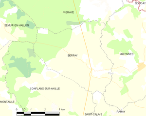
Berfay
- commune in Sarthe, France
- Country:
- Postal Code: 72320
- Coordinates: 47° 59' 38" N, 0° 45' 51" E
- GPS tracks (wikiloc): [Link]
- Area: 18.28 sq km
- Population: 337

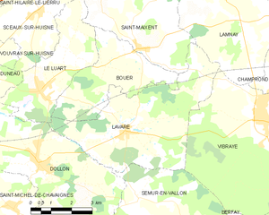
Lavaré
- commune in Sarthe, France
- Country:
- Postal Code: 72390
- Coordinates: 48° 3' 12" N, 0° 38' 41" E
- GPS tracks (wikiloc): [Link]
- Area: 22.88 sq km
- Population: 842


Coudrecieux
- commune in Sarthe, France
- Country:
- Postal Code: 72440
- Coordinates: 47° 59' 33" N, 0° 37' 48" E
- GPS tracks (wikiloc): [Link]
- Area: 24.27 sq km
- Population: 631


Dollon
- commune in Sarthe, France
- Country:
- Postal Code: 72390
- Coordinates: 48° 2' 20" N, 0° 35' 11" E
- GPS tracks (wikiloc): [Link]
- Area: 25.33 sq km
- Population: 1476


Montaillé
- commune in Sarthe, France
- Country:
- Postal Code: 72120
- Coordinates: 47° 56' 16" N, 0° 42' 4" E
- GPS tracks (wikiloc): [Link]
- Area: 30.18 sq km
- Population: 553


Conflans-sur-Anille
- commune in Sarthe, France
- Country:
- Postal Code: 72120
- Coordinates: 47° 56' 45" N, 0° 44' 44" E
- GPS tracks (wikiloc): [Link]
- Area: 30.8 sq km
- Population: 533
- Web site: [Link]


Vibraye
- commune in Sarthe, France
- Country:
- Postal Code: 72320
- Coordinates: 48° 3' 32" N, 0° 44' 9" E
- GPS tracks (wikiloc): [Link]
- Area: 43.62 sq km
- Population: 2598
- Web site: [Link]