Sentous (Sentous)

- commune in Hautes-Pyrénées, France
- Country:

- Postal Code: 65330
- Coordinates: 43° 15' 54" N, 0° 22' 43" E


- GPS tracks (wikiloc): [Link]
- Area: 7.3 sq km
- Population: 67
- Wikipedia en: wiki(en)
- Wikipedia: wiki(fr)
- Wikidata storage: Wikidata: Q586658
- Wikipedia Commons Category: [Link]
- Freebase ID: [/m/03nv767]
- Freebase ID: [/m/03nv767]
- GeoNames ID: Alt: [6440918]
- GeoNames ID: Alt: [6440918]
- SIREN number: [216504191]
- SIREN number: [216504191]
- BnF ID: [15270850d]
- BnF ID: [15270850d]
- INSEE municipality code: 65419
- INSEE municipality code: 65419
Shares border with regions:


Bonnefont
- commune in Hautes-Pyrénées, France
- Country:
- Postal Code: 65220
- Coordinates: 43° 15' 1" N, 0° 20' 46" E
- GPS tracks (wikiloc): [Link]
- Area: 15.37 sq km
- Population: 354
Tournous-Darré
- commune in Hautes-Pyrénées, France
- Country:
- Postal Code: 65220
- Coordinates: 43° 17' 14" N, 0° 21' 40" E
- GPS tracks (wikiloc): [Link]
- Area: 5.63 sq km
- Population: 83
Lustar
- commune in Hautes-Pyrénées, France
- Country:
- Postal Code: 65220
- Coordinates: 43° 16' 10" N, 0° 20' 7" E
- GPS tracks (wikiloc): [Link]
- Area: 4.91 sq km
- Population: 116


Libaros
- commune in Hautes-Pyrénées, France
- Country:
- Postal Code: 65330
- Coordinates: 43° 15' 13" N, 0° 23' 28" E
- GPS tracks (wikiloc): [Link]
- Area: 9.08 sq km
- Population: 134

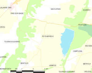
Puydarrieux
- commune in Hautes-Pyrénées, France
- Country:
- Postal Code: 65220
- Coordinates: 43° 17' 8" N, 0° 23' 8" E
- GPS tracks (wikiloc): [Link]
- Area: 13.99 sq km
- Population: 217