Servins (Servins)

- commune in Pas-de-Calais, France
- Country:

- Postal Code: 62530
- Coordinates: 50° 24' 31" N, 2° 38' 16" E


- GPS tracks (wikiloc): [Link]
- Area: 6.36 sq km
- Population: 1095
- Wikipedia en: wiki(en)
- Wikipedia: wiki(fr)
- Wikidata storage: Wikidata: Q1023294
- Wikipedia Commons Category: [Link]
- Freebase ID: [/m/02z9934]
- GeoNames ID: Alt: [6618316]
- SIREN number: [216207936]
- BnF ID: [15269234g]
- INSEE municipality code: 62793
Shares border with regions:


Villers-au-Bois
- commune in Pas-de-Calais, France
- Country:
- Postal Code: 62144
- Coordinates: 50° 22' 23" N, 2° 40' 17" E
- GPS tracks (wikiloc): [Link]
- Area: 5.2 sq km
- Population: 558


Bouvigny-Boyeffles
- commune in Pas-de-Calais, France
- Country:
- Postal Code: 62172
- Coordinates: 50° 25' 17" N, 2° 40' 20" E
- GPS tracks (wikiloc): [Link]
- Area: 9.07 sq km
- Population: 2447
- Web site: [Link]


Gouy-Servins
- commune in Pas-de-Calais, France
- Country:
- Postal Code: 62530
- Coordinates: 50° 24' 11" N, 2° 38' 59" E
- GPS tracks (wikiloc): [Link]
- Area: 3.32 sq km
- Population: 344

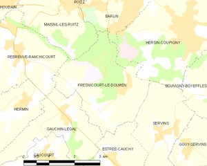
Fresnicourt-le-Dolmen
- commune in Pas-de-Calais, France
- Country:
- Postal Code: 62150
- Coordinates: 50° 25' 5" N, 2° 35' 59" E
- GPS tracks (wikiloc): [Link]
- Area: 7.95 sq km
- Population: 758


Hersin-Coupigny
- commune in Pas-de-Calais, France
- Country:
- Postal Code: 62530
- Coordinates: 50° 26' 46" N, 2° 38' 52" E
- GPS tracks (wikiloc): [Link]
- Area: 12.02 sq km
- Population: 6182
- Web site: [Link]


Camblain-l'Abbé
- commune in Pas-de-Calais, France
- Country:
- Postal Code: 62690
- Coordinates: 50° 22' 23" N, 2° 38' 13" E
- GPS tracks (wikiloc): [Link]
- Area: 5.61 sq km
- Population: 645
- Web site: [Link]


Estrée-Cauchy
- commune in Pas-de-Calais, France
- Country:
- Postal Code: 62690
- Coordinates: 50° 23' 52" N, 2° 36' 34" E
- GPS tracks (wikiloc): [Link]
- Area: 3.89 sq km
- Population: 376