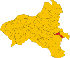
Simbario (Simbario)
.svg)
- Italian comune
 Hiking in Simbario
Simbario, located in the Calabria region of southern Italy, offers a unique hiking experience characterized by its rugged terrain, natural beauty, and rich cultural heritage. Here are some highlights to consider when hiking in Simbario:
Trails and Terrain
- Diverse Landscapes: The area features a mix of mountainous terrains, forests, olive groves, and stunning views of the surrounding valleys and the Tyrrhenian Sea.
- Difficulty Levels: There are trails suitable for all levels, from easy walks to more challenging hikes for experienced trekkers. Look for marked paths that provide a good sense of direction.
Key Hiking Routes
- Local Nature Trails: Explore paths that wind through lush vegetation, providing opportunities to see local flora and fauna.
- Historical Routes: Some trails may take you past ancient ruins or historical sites, integrating cultural exploration with your outdoor activity.
Best Time to Hike
- Spring and Fall: These seasons tend to offer the best weather for hiking, with mild temperatures and fewer crowds. Summers can be hot, and winters may bring snow in higher elevations.
Precautions and Tips
- Guided Hikes: Consider joining a guided hike, especially if you’re unfamiliar with the area. Local guides can provide insight into the geography, ecology, and history of Simbario.
- Preparation: Always wear appropriate hiking gear, including sturdy shoes, and carry sufficient water and snacks. Be mindful of the weather and pack accordingly.
- Leave No Trace: Respect the natural environment by following the Leave No Trace principles, ensuring your impact on the area is minimal.
Nearby Attractions
- Cultural Sites: After your hike, take time to explore the charming village of Simbario and enjoy local cuisine, particularly Calabrian dishes.
- Other Outdoor Activities: If you have time, consider other activities in the area, such as mountain biking or visiting nearby parks.
In summary, hiking in Simbario can be a rewarding experience that combines outdoor adventure with the exploration of the natural and cultural beauty of Calabria. Whether you’re looking for a leisurely walk or a more strenuous trek, you’ll find plenty of options to enjoy.
- Country:

- Postal Code: 89822
- Local Dialing Code: 0963
- Licence Plate Code: VV
- Coordinates: 38° 37' 0" N, 16° 20' 0" E


- GPS tracks (wikiloc): [Link]
- AboveSeaLevel: 766 м m
- Area: 20.83 sq km
- Population: 957
- Web site: http://www.comune.simbario.vv.it
- Wikipedia en: wiki(en)
- Wikipedia: wiki(it)
- Wikidata storage: Wikidata: Q54740
- Wikipedia Commons Category: [Link]
- Freebase ID: [/m/0gr7h0]
- GeoNames ID: Alt: [6538029]
- VIAF ID: Alt: [238452031]
- OSM relation ID: [39668]
- GND ID: Alt: [4244020-8]
- ISTAT ID: 102038
- Italian cadastre code: I744
Shares border with regions:
Cardinale
- Italian comune
Hiking in Cardinale
Cardinale, a town nestled in the Calabria region of southern Italy, is surrounded by stunning natural scenery that offers a variety of hiking opportunities. The area is characterized by its mountainous terrain, lush forests, and beautiful coastline along the Tyrrhenian Sea....
- Country:
- Postal Code: 88062
- Local Dialing Code: 0967
- Licence Plate Code: CZ
- Coordinates: 38° 39' 0" N, 16° 23' 0" E
- GPS tracks (wikiloc): [Link]
- AboveSeaLevel: 560 м m
- Area: 30.12 sq km
- Population: 2068
- Web site: [Link]
Torre di Ruggiero
- Italian comune
Hiking in Torre di Ruggiero
Torre di Ruggiero is a charming town located in the Calabria region of southern Italy, known for its natural beauty and picturesque landscapes. Hiking in this area can provide an opportunity to explore stunning terrains and rich biodiversity....
- Country:
- Postal Code: 88060
- Local Dialing Code: 0967
- Licence Plate Code: CZ
- Coordinates: 38° 38' 0" N, 16° 22' 0" E
- GPS tracks (wikiloc): [Link]
- AboveSeaLevel: 590 м m
- Area: 25.37 sq km
- Population: 995
- Web site: [Link]


Brognaturo
- Italian comune
Hiking in Brognaturo
Brognaturo is a charming village located in the Calabria region of southern Italy, nestled in the Serre Mountains. The area is characterized by its stunning natural scenery, rich biodiversity, and numerous hiking opportunities. Here are some key aspects to consider when hiking in Brognaturo:...
- Country:
- Postal Code: 89822
- Local Dialing Code: 0963
- Licence Plate Code: VV
- Coordinates: 38° 36' 0" N, 16° 20' 0" E
- GPS tracks (wikiloc): [Link]
- AboveSeaLevel: 760 м m
- Area: 25.69 sq km
- Population: 720
- Web site: [Link]


Pizzoni
- Italian comune
Hiking in Pizzoni
Pizzoni, a small village in the Calabria region of southern Italy, offers a variety of hiking opportunities amid its stunning landscapes. The area is characterized by rugged mountains, lush forests, and scenic views, making it ideal for outdoor enthusiasts....
- Country:
- Postal Code: 89834
- Local Dialing Code: 0963
- Licence Plate Code: VV
- Coordinates: 38° 37' 22" N, 16° 14' 56" E
- GPS tracks (wikiloc): [Link]
- AboveSeaLevel: 250 м m
- Area: 21.7 sq km
- Population: 1094
- Web site: [Link]


Serra San Bruno
- Italian comune
Hiking in Serra San Bruno
Serra San Bruno, located in the Calabria region of southern Italy, is a beautiful area known for its stunning natural landscapes, rich history, and peaceful atmosphere. It's an excellent destination for hiking enthusiasts of all levels. Here are some key points to consider when hiking in the Serra San Bruno area:...
- Country:
- Postal Code: 89822
- Local Dialing Code: 0963
- Licence Plate Code: VV
- Coordinates: 38° 35' 0" N, 16° 20' 0" E
- GPS tracks (wikiloc): [Link]
- AboveSeaLevel: 870 м m
- Area: 40.57 sq km
- Population: 6604
- Web site: [Link]


Sorianello
- Italian comune
Hiking in Sorianello
Sorianello is a charming village located in the Calabria region of southern Italy, nestled in the Serre Calabresi mountains. This area is known for its stunning landscapes, rich biodiversity, and cultural heritage, making it an excellent destination for hiking enthusiasts....
- Country:
- Postal Code: 89831
- Local Dialing Code: 0963
- Licence Plate Code: VV
- Coordinates: 38° 36' 0" N, 16° 14' 0" E
- GPS tracks (wikiloc): [Link]
- AboveSeaLevel: 420 м m
- Area: 9.59 sq km
- Population: 1181
- Web site: [Link]

Spadola
- Italian comune
Hiking in Spadola
Spadola is a charming small village located in the Calabria region of southern Italy, known for its stunning natural landscapes and mountainous terrain. Hiking in Spadola can provide an enriching experience, blending beautiful scenic views with cultural and historical elements....
- Country:
- Postal Code: 89822
- Local Dialing Code: 0963
- Licence Plate Code: VV
- Coordinates: 38° 36' 0" N, 16° 20' 0" E
- GPS tracks (wikiloc): [Link]
- AboveSeaLevel: 754 м m
- Area: 9.65 sq km
- Population: 811
- Web site: [Link]


Vallelonga
- Italian comune
Hiking in Vallelonga
Vallelonga, located in the heart of the Apennine Mountains in Italy, offers a range of hiking opportunities that cater to various levels of experience and fitness. Here are some highlights:...
- Country:
- Postal Code: 89821
- Local Dialing Code: 0963
- Licence Plate Code: VV
- Coordinates: 38° 39' 0" N, 16° 17' 0" E
- GPS tracks (wikiloc): [Link]
- AboveSeaLevel: 646 м m
- Area: 17.64 sq km
- Population: 719
- Web site: [Link]
Vazzano
- Italian comune
Hiking in Vazzano
Vazzano is a charming municipality located in the Calabria region of southern Italy. It's nestled in the foothills of the Aspromonte National Park, which makes it an appealing destination for hiking enthusiasts. Here are some highlights and tips for hiking in and around Vazzano:...
- Country:
- Postal Code: 89834
- Local Dialing Code: 0963
- Licence Plate Code: VV
- Coordinates: 38° 38' 0" N, 16° 15' 0" E
- GPS tracks (wikiloc): [Link]
- AboveSeaLevel: 357 м m
- Area: 20.2 sq km
- Population: 1029
- Web site: [Link]