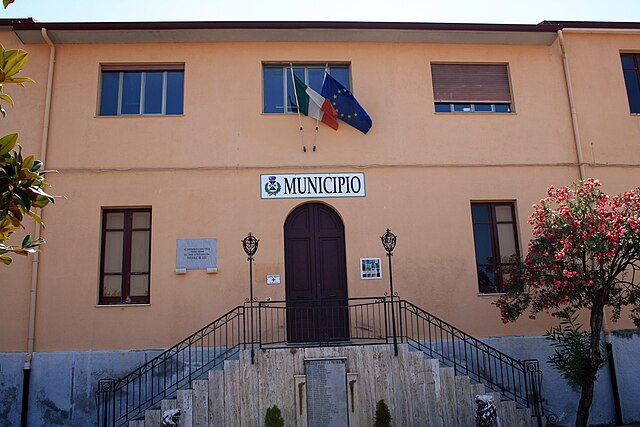
Sinopoli (Sinopoli)
.svg)
- Italian comune
 Hiking in Sinopoli
Sinopoli is a charming town located in the Calabria region of southern Italy. Known for its rich history and beautiful landscapes, it offers several opportunities for hiking and outdoor activities. Here are some highlights you might consider:
Nature and Scenery
- Mount Poro: This area features hills and mountains with stunning views of the surrounding countryside. Hiking here allows you to enjoy both the natural beauty and the panoramic vistas of the Tyrrhenian Sea.
- Forests and Trails: The surrounding area has various hiking trails that wind through lush forests and diverse ecosystems. The flora and fauna can be quite rich, and you might encounter local wildlife along the way.
Historical Hiking
- Cultural Routes: Some trails in and around Sinopoli might pass by historical sites, offering a combined experience of nature and history. These routes can lead you to ancient ruins or traditional villages, giving insight into the local culture.
Hiking Recommendations
- Choosing Trails: It’s essential to choose trails that match your skill level. There are easier paths suitable for beginners and more challenging routes for experienced hikers.
- Local Guides: Consider hiring a local guide or joining a hiking group. They can provide valuable information about the trails, local flora and fauna, and historical context.
Gear and Preparation
- Appropriate Gear: Wear sturdy hiking boots, and dress in layers suitable for the varied weather. Don’t forget to pack water, snacks, a map, or a GPS device.
- Safety: Always let someone know your hiking plans and check the weather beforehand. Start your hikes early in the day to allow for ample time to return before dark.
Best Time to Hike
- Spring and Fall: The best times to hike in Sinopoli are typically in spring (April to June) and fall (September to November) when the weather is mild, and the scenery is most vibrant.
Sinopoli is an excellent destination for hikers looking for a mix of natural beauty, cultural experiences, and historical exploration. Whether you are a novice or an experienced hiker, you can find the right trails to enjoy.
- Country:

- Postal Code: 89020
- Local Dialing Code: 0966
- Licence Plate Code: RC
- Coordinates: 38° 15' 57" N, 15° 52' 44" E


- GPS tracks (wikiloc): [Link]
- AboveSeaLevel: 510 м m
- Area: 25.22 sq km
- Population: 2042
- Web site: http://www.comune.sinopoli.rc.it
- Wikipedia en: wiki(en)
- Wikipedia: wiki(it)
- Wikidata storage: Wikidata: Q54673
- Wikipedia Commons Category: [Link]
- Freebase ID: [/m/0gnzh8]
- GeoNames ID: Alt: [6539108]
- BnF ID: [12246611c]
- VIAF ID: Alt: [151407235]
- OSM relation ID: [39561]
- GND ID: Alt: [4271439-4]
- Library of Congress authority ID: Alt: [n91043213]
- MusicBrainz area ID: [52790e1c-23ec-4eb8-b0ad-00af79a27ebc]
- ISTAT ID: 080089
- Italian cadastre code: I753
Shares border with regions:


Cosoleto
- Italian comune
Hiking in Cosoleto
Cosoleto is a charming town in the Calabria region of southern Italy, known for its natural beauty and mountainous terrain. Hiking in and around Cosoleto offers a unique opportunity to explore the picturesque landscapes, rich biodiversity, and historical sites of the area....
- Country:
- Postal Code: 89050
- Local Dialing Code: 0966
- Licence Plate Code: RC
- Coordinates: 38° 16' 0" N, 15° 56' 0" E
- GPS tracks (wikiloc): [Link]
- AboveSeaLevel: 442 м m
- Area: 34.37 sq km
- Population: 847
- Web site: [Link]


Oppido Mamertina
- Italian comune
Hiking in Oppido Mamertina
Oppido Mamertina, located in the Calabria region of southern Italy, is surrounded by stunning natural scenery that includes mountains, forests, and the Tyrrhenian Sea. Its location within the Aspromonte National Park offers a variety of hiking opportunities for adventurers of all levels. Here are some aspects to consider when planning a hiking trip in Oppido Mamertina:...
- Country:
- Postal Code: 89014
- Local Dialing Code: 0966
- Licence Plate Code: RC
- Coordinates: 38° 18' 0" N, 15° 59' 0" E
- GPS tracks (wikiloc): [Link]
- AboveSeaLevel: 342 м m
- Area: 58.88 sq km
- Population: 5290
- Web site: [Link]


Roccaforte del Greco
- Italian comune
Hiking in Roccaforte del Greco
Roccaforte del Greco, located in the Calabria region of southern Italy, offers a unique hiking experience with its stunning natural landscapes and rich cultural heritage. Nestled in the Aspromonte National Park, this area is characterized by rugged mountains, lush forests, and breathtaking views of the surrounding valleys and the Ionian Sea....
- Country:
- Postal Code: 89060
- Local Dialing Code: 0965
- Licence Plate Code: RC
- Coordinates: 38° 3' 0" N, 15° 54' 0" E
- GPS tracks (wikiloc): [Link]
- AboveSeaLevel: 983 м m
- Area: 43.86 sq km
- Population: 445
- Web site: [Link]


Roghudi
- Italian comune
Hiking in Roghudi
Roghudi, a small village in Calabria, Italy, is surrounded by stunning landscapes and offers various hiking opportunities. The area is characterized by its rugged terrain, ancient forest paths, and historic sites, making it an appealing destination for outdoor enthusiasts....
- Country:
- Postal Code: 89060
- Local Dialing Code: 0965
- Licence Plate Code: RC
- Coordinates: 38° 2' 56" N, 15° 54' 57" E
- GPS tracks (wikiloc): [Link]
- AboveSeaLevel: 55 м m
- Area: 46.92 sq km
- Population: 1036
- Web site: [Link]

San Procopio
- Italian comune
Hiking in San Procopio
San Procopio is not a widely recognized hiking destination, so it might not have an extensive amount of resources or established trails like more popular areas. However, if you are referring to a specific region or park, it's crucial to gather more particulars about its location....
- Country:
- Postal Code: 89020
- Local Dialing Code: 0966
- Licence Plate Code: RC
- Coordinates: 38° 17' 0" N, 15° 54' 0" E
- GPS tracks (wikiloc): [Link]
- AboveSeaLevel: 352 м m
- Area: 11.36 sq km
- Population: 537
- Web site: [Link]
Sant'Eufemia d'Aspromonte
- Italian comune
Hiking in Sant'Eufemia d'Aspromonte
Sant'Eufemia d'Aspromonte is a beautiful village located in the Aspromonte National Park in southern Italy, specifically in Calabria. The area is known for its stunning landscapes, rugged terrain, and diverse flora and fauna, making it an excellent destination for hiking enthusiasts....
- Country:
- Postal Code: 89027
- Local Dialing Code: 0966
- Licence Plate Code: RC
- Coordinates: 38° 16' 0" N, 15° 52' 0" E
- GPS tracks (wikiloc): [Link]
- AboveSeaLevel: 420 м m
- Area: 32.88 sq km
- Population: 4079
- Web site: [Link]
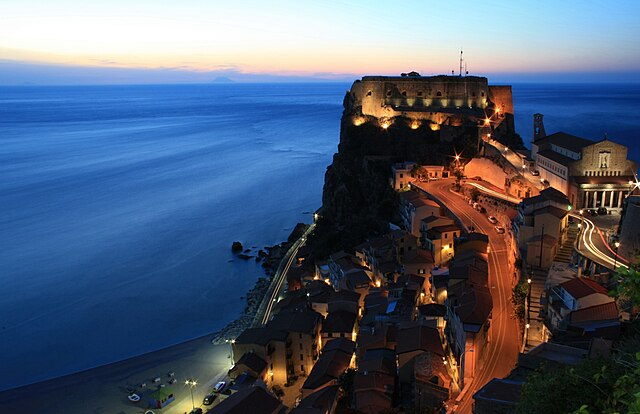

Scilla
- Italian comune
Hiking in Scilla
Scilla, a picturesque coastal village in Calabria, Italy, offers stunning landscapes and a unique blend of mountain and sea hiking experiences. Nestled along the Tyrrhenian coast, Scilla is known for its crystal-clear waters, sandy beaches, and dramatic cliffs, providing a beautiful backdrop for hikers....
- Country:
- Postal Code: 89058
- Local Dialing Code: 0965
- Licence Plate Code: RC
- Coordinates: 38° 15' 0" N, 15° 43' 0" E
- GPS tracks (wikiloc): [Link]
- AboveSeaLevel: 91 м m
- Area: 44.13 sq km
- Population: 4885
- Web site: [Link]